Estimated Value: $557,000 - $592,450
3
Beds
2
Baths
2,300
Sq Ft
$247/Sq Ft
Est. Value
About This Home
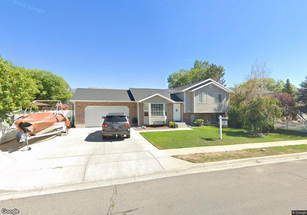
This home is located at 1466 N 250 W Unit 31, Lehi, UT 84043 and is currently estimated at $569,113, approximately $247 per square foot. 1466 N 250 W Unit 31 is a home located in Utah County with nearby schools including Sego Lily Elementary School, Lehi Junior High School, and Skyridge High School.
Ownership History
Date
Name
Owned For
Owner Type
Purchase Details
Closed on
Oct 4, 2022
Sold by
Orme Justin D
Bought by
Orme Justin D and Orme Carissa
Current Estimated Value
Home Financials for this Owner
Home Financials are based on the most recent Mortgage that was taken out on this home.
Original Mortgage
$392,000
Outstanding Balance
$374,681
Interest Rate
5.13%
Mortgage Type
New Conventional
Estimated Equity
$194,432
Purchase Details
Closed on
Sep 30, 2022
Sold by
Green Jared D
Bought by
Orme Justin D
Home Financials for this Owner
Home Financials are based on the most recent Mortgage that was taken out on this home.
Original Mortgage
$392,000
Outstanding Balance
$374,681
Interest Rate
5.13%
Mortgage Type
New Conventional
Estimated Equity
$194,432
Purchase Details
Closed on
Jun 1, 2018
Sold by
Lemmon Michael D and Lemmon Susan
Bought by
Green Jared D and Green Cathy A
Home Financials for this Owner
Home Financials are based on the most recent Mortgage that was taken out on this home.
Original Mortgage
$304,385
Interest Rate
5.25%
Mortgage Type
FHA
Purchase Details
Closed on
Apr 7, 2008
Sold by
Lemmon Michael D
Bought by
Lemmon Michael D and Lemmon Susan
Purchase Details
Closed on
Dec 12, 2003
Sold by
Baker Edwenia
Bought by
Lemmon Michael D
Home Financials for this Owner
Home Financials are based on the most recent Mortgage that was taken out on this home.
Original Mortgage
$151,200
Interest Rate
6.37%
Mortgage Type
Purchase Money Mortgage
Purchase Details
Closed on
Nov 17, 2000
Sold by
Wilson Brad W and Wilson Leslie
Bought by
Baker Edwenia
Home Financials for this Owner
Home Financials are based on the most recent Mortgage that was taken out on this home.
Original Mortgage
$165,850
Interest Rate
7.82%
Purchase Details
Closed on
May 6, 1999
Sold by
Csr Enterprises Llc
Bought by
Hi Valley Development Corp
Purchase Details
Closed on
Feb 22, 1999
Sold by
Hi Valley Development Corp
Bought by
Peck Construction Company Inc
Create a Home Valuation Report for This Property
The Home Valuation Report is an in-depth analysis detailing your home's value as well as a comparison with similar homes in the area
Home Values in the Area
Average Home Value in this Area
Purchase History
| Date | Buyer | Sale Price | Title Company |
|---|---|---|---|
| Orme Justin D | -- | Highland Title | |
| Orme Justin D | -- | First American Title | |
| Green Jared D | -- | Cottonwood Title Ins Agency | |
| Lemmon Michael D | -- | Morgan Title & Escrow Inc | |
| Lemmon Michael D | -- | Equity Title Agency Inc | |
| Baker Edwenia | -- | First American Title Co | |
| Hi Valley Development Corp | -- | Mountain West Title Co | |
| Peck Construction Company Inc | -- | Mountain West Title Co |
Source: Public Records
Mortgage History
| Date | Status | Borrower | Loan Amount |
|---|---|---|---|
| Open | Orme Justin D | $392,000 | |
| Previous Owner | Green Jared D | $304,385 | |
| Previous Owner | Lemmon Michael D | $151,200 | |
| Previous Owner | Baker Edwenia | $165,850 |
Source: Public Records
Tax History Compared to Growth
Tax History
| Year | Tax Paid | Tax Assessment Tax Assessment Total Assessment is a certain percentage of the fair market value that is determined by local assessors to be the total taxable value of land and additions on the property. | Land | Improvement |
|---|---|---|---|---|
| 2025 | $2,284 | $300,630 | $216,200 | $330,400 |
| 2024 | $2,284 | $267,300 | $0 | $0 |
| 2023 | $2,117 | $268,950 | $0 | $0 |
| 2022 | $2,192 | $270,050 | $0 | $0 |
| 2021 | $1,944 | $362,100 | $125,100 | $237,000 |
| 2020 | $1,832 | $337,300 | $115,800 | $221,500 |
| 2019 | $1,655 | $316,700 | $115,800 | $200,900 |
| 2018 | $1,549 | $280,300 | $101,300 | $179,000 |
| 2017 | $1,512 | $145,420 | $0 | $0 |
| 2016 | $1,519 | $135,520 | $0 | $0 |
| 2015 | $1,462 | $123,860 | $0 | $0 |
| 2014 | $1,408 | $118,580 | $0 | $0 |
Source: Public Records
Map
Nearby Homes
- 1755 N 250 W
- 1329 N 100 E Unit 21
- 1150 N 200 W Unit 6
- 1295 N 190 E
- 4333 N Baiken Ridge Dr Unit 1020
- 996 N 200 W
- 155 W State St Unit TRLR 3
- 1817 W Bad Rock Cir
- 68 W State St
- 902 W 1500 N
- 1301 N 900 W Unit 12
- 497 W 2200 N
- 7 E State St
- 595 W 2200 N
- 443 W 820 N
- 1011 W Mountain Way Unit 316
- 497 W 2280 N
- 1094 W 1425 N
- 1610 N 1125 W
- 192 E 2200 N
- 1466 N 250 W
- 1457 N 250 W
- 1448 N 250 W
- 1448 N 250 W Unit 32
- 1484 N 250 W
- 1484 N 250 W Unit 30
- 1459 N 180 W
- 1481 N 180 W
- 1437 N 180 W
- 1430 N 250 W
- 1430 N 250 W Unit 33
- 1465 N 250 W
- 1465 N 250 W Unit 42
- 1447 N 250 W
- 1447 N 250 W Unit 41
- 1483 N 250 W
- 1483 N 250 W Unit 43
- 1512 N 250 W
- 1415 N 180 W
- 1515 N 180 W