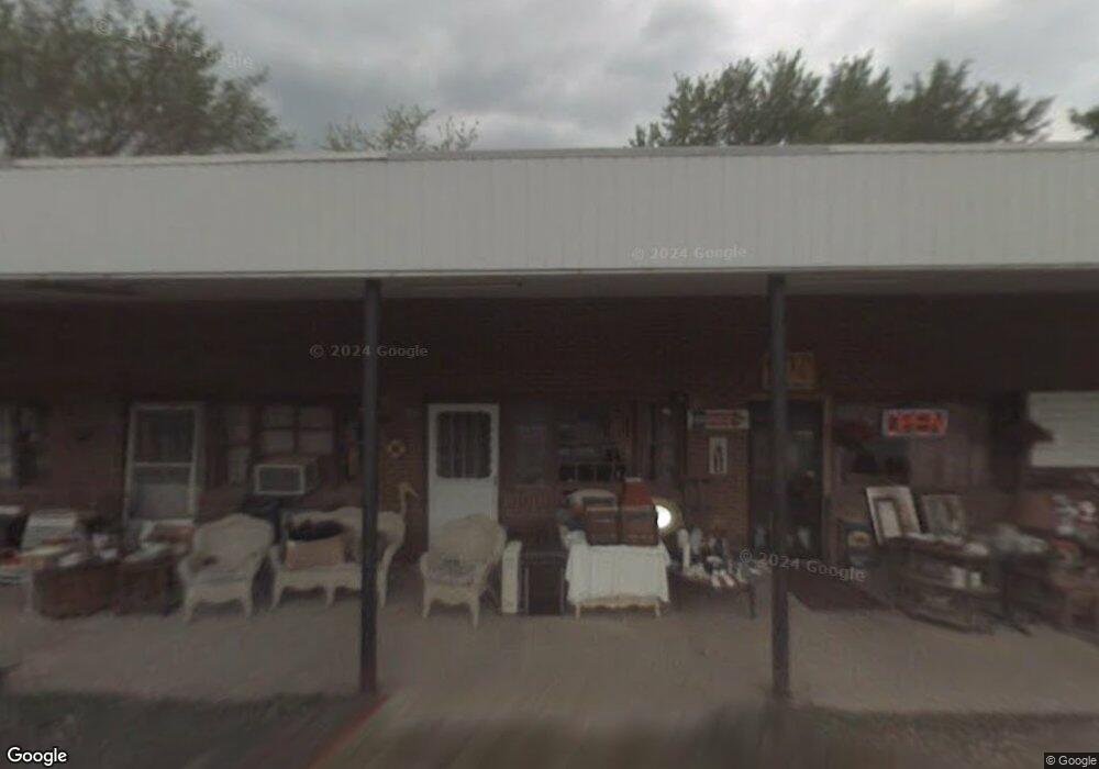
1466 Snug Harbor Rd Shady Side, MD 20764
Estimated Value: $598,582
--
Bed
--
Bath
2,990
Sq Ft
$200/Sq Ft
Est. Value
About This Home
This home is located at 1466 Snug Harbor Rd, Shady Side, MD 20764 and is currently estimated at $598,582, approximately $200 per square foot. 1466 Snug Harbor Rd is a home located in Anne Arundel County with nearby schools including Shady Side Elementary School, Southern Middle School, and Southern High School.
Ownership History
Date
Name
Owned For
Owner Type
Purchase Details
Closed on
Apr 24, 2013
Sold by
Holt William B and Lowe Rebecca H
Bought by
Jackson Roy E and Jackson Deborah L
Current Estimated Value
Home Financials for this Owner
Home Financials are based on the most recent Mortgage that was taken out on this home.
Original Mortgage
$350,000
Outstanding Balance
$248,502
Interest Rate
3.6%
Mortgage Type
Commercial
Estimated Equity
$350,080
Purchase Details
Closed on
Oct 22, 1999
Sold by
Brobst Va L
Bought by
Holt William B and Lowe Hubert O
Create a Home Valuation Report for This Property
The Home Valuation Report is an in-depth analysis detailing your home's value as well as a comparison with similar homes in the area
Home Values in the Area
Average Home Value in this Area
Purchase History
| Date | Buyer | Sale Price | Title Company |
|---|---|---|---|
| Jackson Roy E | $350,000 | Fidelity Natl Title Ins Co | |
| Holt William B | $165,000 | -- |
Source: Public Records
Mortgage History
| Date | Status | Borrower | Loan Amount |
|---|---|---|---|
| Open | Jackson Roy E | $350,000 |
Source: Public Records
Tax History Compared to Growth
Tax History
| Year | Tax Paid | Tax Assessment Tax Assessment Total Assessment is a certain percentage of the fair market value that is determined by local assessors to be the total taxable value of land and additions on the property. | Land | Improvement |
|---|---|---|---|---|
| 2025 | $4,214 | $367,600 | $304,000 | $63,600 |
| 2024 | $4,214 | $367,600 | $304,000 | $63,600 |
| 2023 | $4,214 | $369,400 | $304,000 | $65,400 |
| 2022 | $4,031 | $369,400 | $304,000 | $65,400 |
| 2021 | $4,255 | $369,400 | $304,000 | $65,400 |
| 2020 | $4,255 | $390,900 | $235,900 | $155,000 |
| 2019 | $3,241 | $382,567 | $0 | $0 |
| 2018 | $3,795 | $374,233 | $0 | $0 |
| 2017 | $3,882 | $365,900 | $0 | $0 |
| 2016 | $763 | $327,333 | $0 | $0 |
| 2015 | $763 | $288,767 | $0 | $0 |
| 2014 | -- | $250,200 | $0 | $0 |
Source: Public Records
Map
Nearby Homes
- 4846 Woods Wharf Rd
- 1419 Shady Rest Rd
- 4949 Idlewilde Rd
- 1302 Spruce St
- 4913 Chestnut St
- 4912 Beech St
- 4908 Aspen St
- 6508 Shady Side Rd
- 4900 Thomas Dr
- 6512 Shady Side Rd
- 4950 W End Ave
- 4992 Lerch Dr
- 0 Shady Side Rd Unit MDAA2113156
- 0 Shady Side Rd Unit MDAA2113166
- 4738 Washington Ave
- 1650 Cedar Ln
- 6152 Shady Side Rd
- 4738 Idlewilde Rd
- 1461 Cedarhurst Rd
- 6118 Shady Side Rd
- 1462 Snug Harbor Rd
- 1474 Snug Harbor Rd
- 4853 Woods Wharf Rd
- 1467 Snug Harbor Rd
- 1464 Snug Harbor Rd
- 1475 Snug Harbor Rd
- 1264 Woods Road A
- 1264 Woods Rd
- 1264 A Woods Wharf Rd
- 1479 Snug Harbor Rd
- 1484 Snug Harbor Rd
- 1463 Snug Harbor Rd
- 1486 Snug Harbor Rd
- 1459 Snug Harbor Rd
- 1478 Gross Cir
- 1490 Snug Harbor Rd
- 1449 Snug Harbor Rd
- 1450 Snug Harbor Rd
- 4819 Woods Wharf Rd
- 1493 Snug Harbor Rd