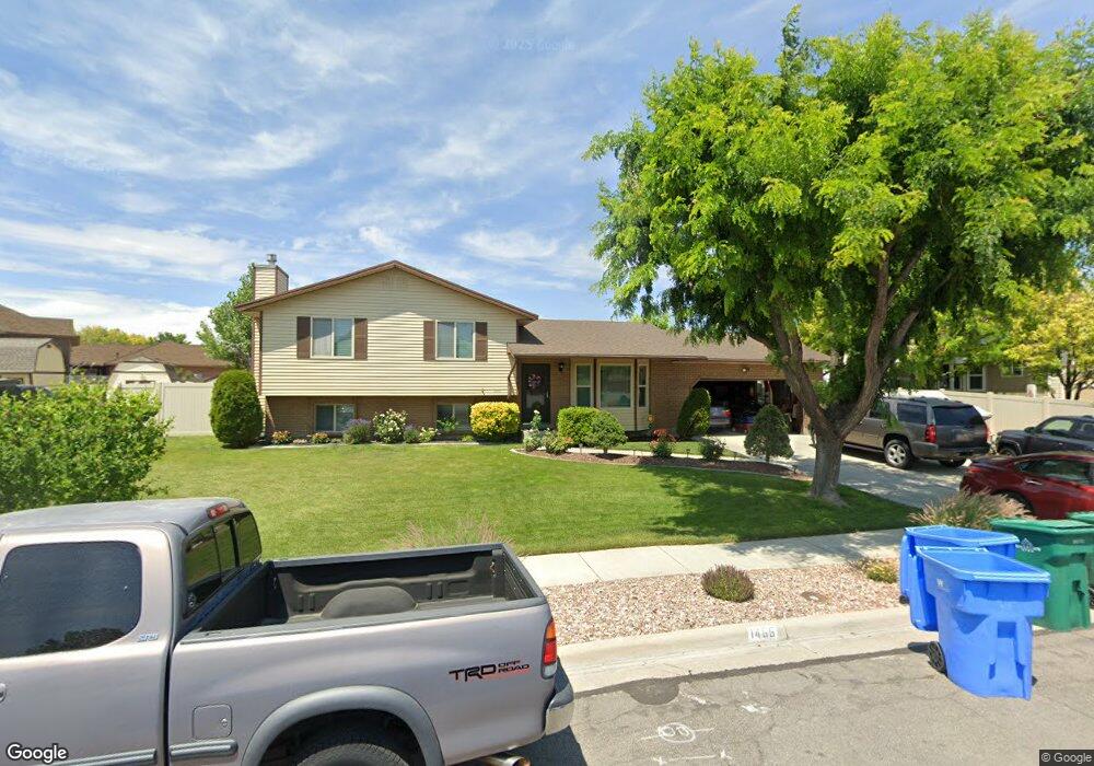
1466 W 12230 S Riverton, UT 84065
Estimated Value: $514,000 - $550,000
4
Beds
2
Baths
1,796
Sq Ft
$297/Sq Ft
Est. Value
About This Home
This home is located at 1466 W 12230 S, Riverton, UT 84065 and is currently estimated at $534,037, approximately $297 per square foot. 1466 W 12230 S is a home located in Salt Lake County with nearby schools including Rosamond Elementary School, Oquirrh Hills Middle School, and Riverton High School.
Ownership History
Date
Name
Owned For
Owner Type
Purchase Details
Closed on
Apr 8, 2024
Sold by
Adams Darrel D
Bought by
Darrel And Azucena Adams Family Trust and Adams
Current Estimated Value
Purchase Details
Closed on
Apr 21, 2009
Sold by
Adams Darrel D and Adams Azucena
Bought by
Adams Darrel D and Azucena Adams W
Home Financials for this Owner
Home Financials are based on the most recent Mortgage that was taken out on this home.
Original Mortgage
$121,600
Interest Rate
4.64%
Mortgage Type
New Conventional
Purchase Details
Closed on
Nov 26, 2001
Sold by
Adams Darrel D
Bought by
Adams Darrel D and Adams Azucena
Home Financials for this Owner
Home Financials are based on the most recent Mortgage that was taken out on this home.
Original Mortgage
$112,500
Interest Rate
6.63%
Purchase Details
Closed on
Apr 27, 2000
Sold by
Derby Scott W and Derby Tracy
Bought by
Adams Darrel D
Home Financials for this Owner
Home Financials are based on the most recent Mortgage that was taken out on this home.
Original Mortgage
$111,600
Interest Rate
8.24%
Create a Home Valuation Report for This Property
The Home Valuation Report is an in-depth analysis detailing your home's value as well as a comparison with similar homes in the area
Home Values in the Area
Average Home Value in this Area
Purchase History
| Date | Buyer | Sale Price | Title Company |
|---|---|---|---|
| Darrel And Azucena Adams Family Trust | -- | None Listed On Document | |
| Adams Darrel D | -- | Equity Title | |
| Adams Darrel D | -- | Equity Title | |
| Adams Darrel D | -- | Sutherland Title |
Source: Public Records
Mortgage History
| Date | Status | Borrower | Loan Amount |
|---|---|---|---|
| Previous Owner | Adams Darrel D | $121,600 | |
| Previous Owner | Adams Darrel D | $112,500 | |
| Previous Owner | Adams Darrel D | $111,600 |
Source: Public Records
Tax History Compared to Growth
Tax History
| Year | Tax Paid | Tax Assessment Tax Assessment Total Assessment is a certain percentage of the fair market value that is determined by local assessors to be the total taxable value of land and additions on the property. | Land | Improvement |
|---|---|---|---|---|
| 2025 | $2,846 | $500,800 | $205,800 | $295,000 |
| 2024 | $2,846 | $492,500 | $202,100 | $290,400 |
| 2023 | $2,846 | $451,000 | $187,100 | $263,900 |
| 2022 | $2,887 | $462,100 | $183,400 | $278,700 |
| 2021 | $2,492 | $355,200 | $137,600 | $217,600 |
| 2020 | $2,201 | $292,500 | $123,300 | $169,200 |
| 2019 | $2,203 | $287,800 | $112,100 | $175,700 |
| 2018 | $2,073 | $266,600 | $112,100 | $154,500 |
| 2017 | $1,974 | $247,400 | $112,100 | $135,300 |
| 2016 | $1,848 | $222,300 | $103,000 | $119,300 |
| 2015 | $1,765 | $205,800 | $104,800 | $101,000 |
| 2014 | $1,698 | $194,100 | $99,900 | $94,200 |
Source: Public Records
Map
Nearby Homes
- 12294 S 1490 W
- 1410 W 12115 S
- 12216 S 1300 W
- 12392 S 1300 W
- 1661 W Madison View Dr
- 12317 S Redwood Rd
- 12325 S Redwood Rd
- 1056 W Kate Springs Ln S Unit 10
- 12345 S Redwood Rd
- 1373 W Stewart Falls Dr
- 1371 W Stewart Falls Dr
- 1184 W Margaret Rose Dr
- 1233 W 12500 S
- 1337 Natasha Cir
- 12566 S Tithing Hill Dr
- 12091 S Lampton View Dr
- 11860 S Alysum Cir
- 1182 River Hills Dr
- 11784 Stone Ridge Ct
- 1721 W Hollow Cedar Ln Unit 1
- 12214 S 1440 W
- 1467 W Summit Hollow Cir
- 1478 W 12230 S
- 1467 Summit Hollow Cir
- 1453 Summit Hollow Cir
- 12245 S 1490 W
- 12228 S 1490 W
- 1483 Summit Hollow Cir
- 12258 Paulson Cir
- 12242 S 1490 W
- 12257 S 1490 W
- 12219 S 1440 W
- 12187 Summit Hollow Cir
- 12196 Summit Hollow Cir
- 12262 Paulson Cir
- 12266 S 1490 W
- 12196 S 1430 W
- 12205 S 1440 W
- 12271 S 1490 W
- 12241 Paulson Cir