1467 Glenside Dr Unit 3A Bolingbrook, IL 60490
Sunset Park-Old Plank NeighborhoodEstimated Value: $407,649 - $463,000
--
Bed
1
Bath
1,981
Sq Ft
$223/Sq Ft
Est. Value
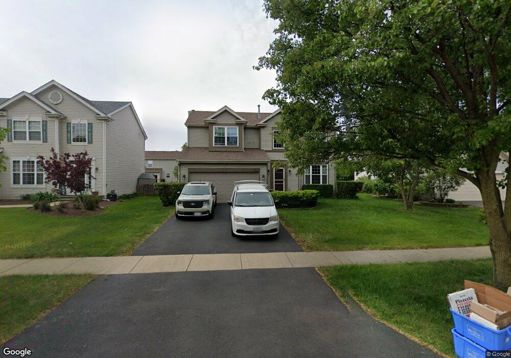
About This Home
This home is located at 1467 Glenside Dr Unit 3A, Bolingbrook, IL 60490 and is currently estimated at $441,412, approximately $222 per square foot. 1467 Glenside Dr Unit 3A is a home located in Will County with nearby schools including Liberty Elementary School, John F Kennedy Middle School, and Plainfield East High School.
Ownership History
Date
Name
Owned For
Owner Type
Purchase Details
Closed on
Aug 15, 2024
Sold by
Morfoot Michael K and Morfoot Dawn M
Bought by
Morfoot Family Trust and Morfoot
Current Estimated Value
Purchase Details
Closed on
May 15, 2001
Sold by
The Ryland Group Inc
Bought by
Morfoot Michael K and Morfoot Dawn M
Home Financials for this Owner
Home Financials are based on the most recent Mortgage that was taken out on this home.
Original Mortgage
$147,486
Interest Rate
7.18%
Create a Home Valuation Report for This Property
The Home Valuation Report is an in-depth analysis detailing your home's value as well as a comparison with similar homes in the area
Home Values in the Area
Average Home Value in this Area
Purchase History
| Date | Buyer | Sale Price | Title Company |
|---|---|---|---|
| Morfoot Family Trust | -- | None Listed On Document | |
| Morfoot Michael K | $230,500 | Ticor Title |
Source: Public Records
Mortgage History
| Date | Status | Borrower | Loan Amount |
|---|---|---|---|
| Previous Owner | Morfoot Michael K | $147,486 |
Source: Public Records
Tax History Compared to Growth
Tax History
| Year | Tax Paid | Tax Assessment Tax Assessment Total Assessment is a certain percentage of the fair market value that is determined by local assessors to be the total taxable value of land and additions on the property. | Land | Improvement |
|---|---|---|---|---|
| 2024 | $9,662 | $138,401 | $20,056 | $118,345 |
| 2023 | $9,662 | $124,529 | $18,046 | $106,483 |
| 2022 | $8,617 | $112,269 | $16,269 | $96,000 |
| 2021 | $8,132 | $104,974 | $15,212 | $89,762 |
| 2020 | $7,952 | $101,522 | $14,712 | $86,810 |
| 2019 | $7,742 | $96,687 | $14,011 | $82,676 |
| 2018 | $7,492 | $92,541 | $13,410 | $79,131 |
| 2017 | $7,311 | $87,717 | $12,711 | $75,006 |
| 2016 | $7,214 | $83,500 | $12,100 | $71,400 |
| 2015 | $6,413 | $80,100 | $11,600 | $68,500 |
| 2014 | $6,413 | $75,500 | $10,900 | $64,600 |
| 2013 | $6,413 | $72,600 | $10,500 | $62,100 |
Source: Public Records
Map
Nearby Homes
- 1488 Schoenherr Ave
- 725 Delacourte Ave
- 1437 Sage Dr
- 652 Timberline Dr
- 664 Birchwood Dr
- 1424 Sage Dr
- 1616 Sutton Place Unit 1
- 1536 Trails End Ln Unit 5A
- 812 Metropolitan Ave Unit 1
- 558 Pinebrook Dr
- 1544 Suncrest Ln
- 545 Pinebrook Dr
- 856 Fieldcrest Dr
- 402 Marshall Ash St Unit 3
- 584 Lakewood Farms Dr
- 1692 Trails End Ln Unit 6
- 402 S Palmer Dr Unit 2B
- 1409 Aster Ln
- 342 Sweet Gum St Unit 3
- 1499 Raven Dr Unit 4
- 1463 Glenside Dr
- 1471 Glenside Dr Unit 3A
- 775 Glenside Cir
- 1459 Glenside Dr Unit 3A
- 779 Glenside Cir
- 771 Glenside Cir Unit 3A
- 767 Glenside Cir
- 1466 Glenside Dr
- 1470 Glenside Dr Unit 3A
- 1462 Glenside Dr
- 1455 Glenside Dr Unit 3A
- 1474 Glenside Dr Unit 3A
- 808 Glenside Cir
- 804 Glenside Cir
- 1458 Glenside Dr Unit 3A
- 763 Glenside Cir
- 800 Glenside Cir Unit 3A
- 1478 Glenside Dr Unit 3A
- 796 Glenside Cir
- 1454 Glenside Dr