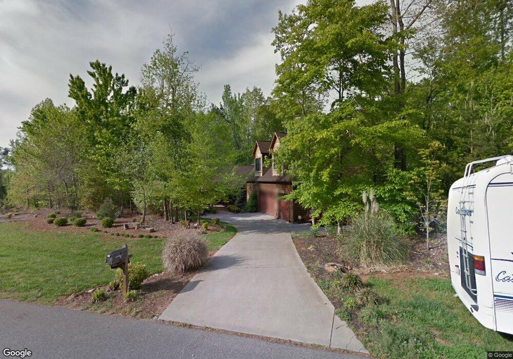
1467 Morningside Dr Iron Station, NC 28080
Estimated Value: $642,000 - $917,000
3
Beds
4
Baths
2,949
Sq Ft
$277/Sq Ft
Est. Value
About This Home
This home is located at 1467 Morningside Dr, Iron Station, NC 28080 and is currently estimated at $815,980, approximately $276 per square foot. 1467 Morningside Dr is a home located in Lincoln County with nearby schools including Iron Station Elementary School, East Lincoln Middle School, and East Lincoln High School.
Ownership History
Date
Name
Owned For
Owner Type
Purchase Details
Closed on
Aug 14, 2015
Sold by
Lyon James W and Lyon Deana G
Bought by
Smith David L and Smith Madison Taylor
Current Estimated Value
Home Financials for this Owner
Home Financials are based on the most recent Mortgage that was taken out on this home.
Original Mortgage
$314,450
Outstanding Balance
$247,984
Interest Rate
4.11%
Mortgage Type
New Conventional
Estimated Equity
$567,996
Purchase Details
Closed on
Jun 11, 2004
Bought by
Lyon James W and Lyon Deana G
Create a Home Valuation Report for This Property
The Home Valuation Report is an in-depth analysis detailing your home's value as well as a comparison with similar homes in the area
Home Values in the Area
Average Home Value in this Area
Purchase History
| Date | Buyer | Sale Price | Title Company |
|---|---|---|---|
| Smith David L | $331,000 | None Available | |
| Lyon James W | $34,000 | -- |
Source: Public Records
Mortgage History
| Date | Status | Borrower | Loan Amount |
|---|---|---|---|
| Open | Smith David L | $314,450 |
Source: Public Records
Tax History Compared to Growth
Tax History
| Year | Tax Paid | Tax Assessment Tax Assessment Total Assessment is a certain percentage of the fair market value that is determined by local assessors to be the total taxable value of land and additions on the property. | Land | Improvement |
|---|---|---|---|---|
| 2025 | $4,818 | $755,792 | $71,005 | $684,787 |
| 2024 | $4,798 | $755,792 | $71,005 | $684,787 |
| 2023 | $4,691 | $755,792 | $71,005 | $684,787 |
| 2022 | $3,181 | $416,819 | $37,242 | $379,577 |
| 2021 | $3,181 | $416,819 | $37,242 | $379,577 |
| 2020 | $2,982 | $416,819 | $37,242 | $379,577 |
| 2019 | $2,982 | $416,819 | $37,242 | $379,577 |
| 2018 | $2,709 | $358,500 | $36,089 | $322,411 |
| 2017 | $2,608 | $358,500 | $36,089 | $322,411 |
| 2016 | $2,608 | $358,500 | $36,089 | $322,411 |
| 2015 | $2,642 | $358,500 | $36,089 | $322,411 |
| 2014 | $2,185 | $296,966 | $47,571 | $249,395 |
Source: Public Records
Map
Nearby Homes
- Lot #42 Sardis Ct
- 1485 Adkin Dr
- 5038 Arden Gate Dr
- 5039 Penn Rd
- 0 Wolf Rd Unit 8
- 1615 Oak Park Ct
- Lot 156 Cocker Spaniel Ct
- 0 Great Dane Ave Unit CAR4157929
- 0 Lhasa Apso Ln Unit CAR4157960
- 0 Lhasa Apso Ln Unit CAR4157956
- 375 Timber Rd
- 601 Lhasa Apso Ln
- 00 Timber Rd
- 5748 Dalmatian St
- 5756 Dalmatian St
- 0 Dalmatian St Unit CAR4157812
- 5716 Dalmatian St
- 1785 Doe Ct
- 1789 Doe Ct
- 1279 Craig Dr
- #2 Morningside Dr Unit 2
- 1473 Morningside Dr
- #9 Lot Morningside Dr
- Lot 11 Morningside Dr
- #11 Morningside Dr Unit 11
- 11 Morningside Dr Unit 11
- 1447 Morningside Dr
- 1489 Morningside Dr
- 1466 Morningside Dr
- 1448 Morningside Dr
- 1476 Morningside Dr
- 41 Arden Gate Dr Unit 41
- 5071 Arden Gate Dr
- Lot 42 Sardis Ct
- Lot 44 Sardis Ct
- Lot 42 Sardis Ct Unit 42
- 5061 Arden Gate Dr
- 42 Sardis Ct
- 5110 Arden Gate Dr
- 0 Sardis Ct Unit 44 3429609