Estimated Value: $485,413 - $500,000
3
Beds
2
Baths
1,405
Sq Ft
$351/Sq Ft
Est. Value
About This Home
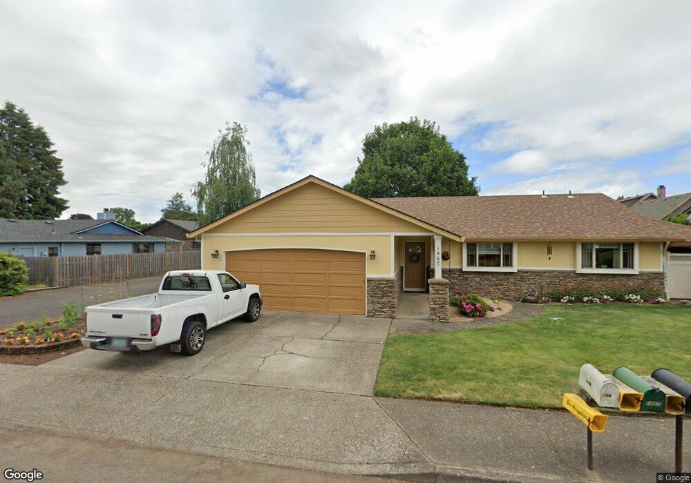
This home is located at 1467 N Locust St, Canby, OR 97013 and is currently estimated at $493,103, approximately $350 per square foot. 1467 N Locust St is a home located in Clackamas County with nearby schools including Howard Eccles Elementary School, Baker Prairie Middle School, and Canby High School.
Ownership History
Date
Name
Owned For
Owner Type
Purchase Details
Closed on
Apr 3, 2003
Sold by
Young Andrew A
Bought by
Young Andrew A and Young Colleen A
Current Estimated Value
Purchase Details
Closed on
Aug 7, 2000
Sold by
Ellis Marjorie A
Bought by
Young Andrew A
Home Financials for this Owner
Home Financials are based on the most recent Mortgage that was taken out on this home.
Original Mortgage
$139,500
Outstanding Balance
$50,474
Interest Rate
8.19%
Estimated Equity
$442,629
Create a Home Valuation Report for This Property
The Home Valuation Report is an in-depth analysis detailing your home's value as well as a comparison with similar homes in the area
Home Values in the Area
Average Home Value in this Area
Purchase History
| Date | Buyer | Sale Price | Title Company |
|---|---|---|---|
| Young Andrew A | -- | Ticor Title Insurance Compan | |
| Young Andrew A | $155,000 | Fidelity National Title Co |
Source: Public Records
Mortgage History
| Date | Status | Borrower | Loan Amount |
|---|---|---|---|
| Open | Young Andrew A | $139,500 |
Source: Public Records
Tax History Compared to Growth
Tax History
| Year | Tax Paid | Tax Assessment Tax Assessment Total Assessment is a certain percentage of the fair market value that is determined by local assessors to be the total taxable value of land and additions on the property. | Land | Improvement |
|---|---|---|---|---|
| 2024 | $4,599 | $259,300 | -- | -- |
| 2023 | $4,599 | $251,748 | $0 | $0 |
| 2022 | $4,230 | $244,416 | $0 | $0 |
| 2021 | $4,073 | $237,298 | $0 | $0 |
| 2020 | $4,001 | $230,387 | $0 | $0 |
| 2019 | $3,810 | $223,677 | $0 | $0 |
| 2018 | $3,725 | $217,162 | $0 | $0 |
| 2017 | $3,630 | $210,837 | $0 | $0 |
| 2016 | $3,509 | $204,696 | $0 | $0 |
| 2015 | $3,389 | $198,734 | $0 | $0 |
| 2014 | $3,291 | $192,946 | $0 | $0 |
Source: Public Records
Map
Nearby Homes
- 312 NE 14th Ave
- 187 NE 14th Ave
- 1240 N Juniper St
- 142 NE 11th Ave
- 1721 N Hyssop St
- 184 NE 10th Ave
- 860 NE 14th Ave
- 832 NE 17th Ave
- 853 NE 17th Ave
- 838 NE 17th Ave
- 844 NE 17th Ave
- 947 NE 17th Ave
- 2152 N Laurelwood St
- 952 NE 17th Ave
- 878 NE 17th Ave
- 1762 N Oak St
- 1009 NE 17th Ave
- 0 NW 10th Ave
- 1258 NE 17th Ave
- 1200 NE Territorial Rd Unit 93
- 1473 N Locust St
- 1449 N Locust St
- 1421 N Locust St
- 1485 N Locust St
- 1435 N Locust St
- 306 NE 14th Ave
- 1490 N Locust St
- 1478 N Locust St
- 1456 N Juniper St
- 1505 N Locust St
- 1474 N Juniper St Unit 1
- 1474 N Juniper St
- 1517 N Locust St
- 1415 N Locust St
- 1409 N Locust St
- 1510 N Locust St
- 1434 N Juniper St
- 1488 N Juniper St
- 1420 N Locust St
- 1535 N Locust St