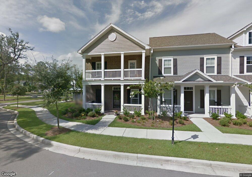
1467 Nautical Chart Dr Charleston, SC 29414
West Ashley NeighborhoodEstimated Value: $411,308 - $526,000
3
Beds
3
Baths
1,622
Sq Ft
$279/Sq Ft
Est. Value
About This Home
This home is located at 1467 Nautical Chart Dr, Charleston, SC 29414 and is currently estimated at $451,827, approximately $278 per square foot. 1467 Nautical Chart Dr is a home located in Charleston County with nearby schools including Oakland Elementary School, West Ashley High School, and Evangel Christian School.
Ownership History
Date
Name
Owned For
Owner Type
Purchase Details
Closed on
Jan 13, 2011
Sold by
Jasmine Row Homeowners Association Inc
Bought by
Fearon Roberta H
Current Estimated Value
Home Financials for this Owner
Home Financials are based on the most recent Mortgage that was taken out on this home.
Original Mortgage
$107,831
Outstanding Balance
$3,123
Interest Rate
3.8%
Mortgage Type
Future Advance Clause Open End Mortgage
Estimated Equity
$448,704
Purchase Details
Closed on
Dec 29, 2010
Sold by
The Ryland Group Inc
Bought by
Fearon Roberta H
Home Financials for this Owner
Home Financials are based on the most recent Mortgage that was taken out on this home.
Original Mortgage
$107,831
Outstanding Balance
$3,123
Interest Rate
3.8%
Mortgage Type
Future Advance Clause Open End Mortgage
Estimated Equity
$448,704
Purchase Details
Closed on
Nov 28, 2007
Sold by
The Ryland Group Inc
Bought by
The City Of Charleston South Carolina
Create a Home Valuation Report for This Property
The Home Valuation Report is an in-depth analysis detailing your home's value as well as a comparison with similar homes in the area
Home Values in the Area
Average Home Value in this Area
Purchase History
| Date | Buyer | Sale Price | Title Company |
|---|---|---|---|
| Fearon Roberta H | -- | -- | |
| Fearon Roberta H | $202,831 | -- | |
| The City Of Charleston South Carolina | -- | -- |
Source: Public Records
Mortgage History
| Date | Status | Borrower | Loan Amount |
|---|---|---|---|
| Open | Fearon Roberta H | $107,831 |
Source: Public Records
Tax History Compared to Growth
Tax History
| Year | Tax Paid | Tax Assessment Tax Assessment Total Assessment is a certain percentage of the fair market value that is determined by local assessors to be the total taxable value of land and additions on the property. | Land | Improvement |
|---|---|---|---|---|
| 2024 | $967 | $6,620 | $0 | $0 |
| 2023 | $967 | $6,620 | $0 | $0 |
| 2022 | $875 | $6,620 | $0 | $0 |
| 2021 | $914 | $6,620 | $0 | $0 |
| 2020 | $946 | $6,620 | $0 | $0 |
| 2019 | $815 | $5,500 | $0 | $0 |
| 2017 | $789 | $7,500 | $0 | $0 |
| 2016 | $759 | $7,500 | $0 | $0 |
| 2015 | $782 | $7,500 | $0 | $0 |
| 2014 | $673 | $0 | $0 | $0 |
| 2011 | -- | $0 | $0 | $0 |
Source: Public Records
Map
Nearby Homes
- 1410 Roustabout Way
- 3030 Scuba Dr
- 1615 Seabago Dr
- 1585 Seabago Dr
- 1607 Roustabout Way
- 1576 Nautical Chart Dr
- 3201 Moonlight Dr
- 3221 Moonlight Dr
- 2864 Conservancy Ln
- 2823 Conservancy Ln
- 1615 Evening Star Place
- 1507 Dawn Mist Way
- 775 Hitching Post Rd
- 212 Twinleaf Ct
- Addison Plan at Ashley Walk Townes
- Maxwell Plan at Ashley Walk Townes
- 207 Twinleaf Ct
- 709 Pepperbush St
- 1624 Shady Pine Rd
- 423 Queenview Ln
- 1465 Nautical Chart Dr
- 1463 Nautical Chart Dr
- 1461 Nautical Chart Dr
- 1457 Nautical Chart Dr
- 3086 Moonlight Dr
- 1466 Nautical Chart Dr
- 1468 Nautical Chart Dr
- 1455 Nautical Chart Dr
- 3090 Moonlight Dr
- 1464 Nautical Chart Dr
- 1475 Nautical Chart Dr
- 1462 Nautical Chart Dr
- 3082 Moonlight Dr
- 3094 Moonlight Dr
- 1453 Nautical Chart Dr
- 1477 Nautical Chart Dr
- 3078 Moonlight Dr
- 1451 Nautical Chart Dr
- 3098 Moonlight Dr
- 1479 Nautical Chart Dr