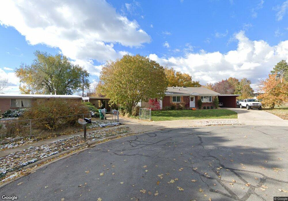
1467 Scott Cir Layton, UT 84041
Estimated Value: $401,000 - $411,000
4
Beds
1
Bath
1,454
Sq Ft
$280/Sq Ft
Est. Value
About This Home
This home is located at 1467 Scott Cir, Layton, UT 84041 and is currently estimated at $406,976, approximately $279 per square foot. 1467 Scott Cir is a home located in Davis County with nearby schools including Vae View Elementary School, Central Davis Junior High School, and Layton High School.
Ownership History
Date
Name
Owned For
Owner Type
Purchase Details
Closed on
Jul 15, 2025
Sold by
Mackey Jacob and Mackey Alyssa
Bought by
Wines Brandon and Wines Sydney
Current Estimated Value
Home Financials for this Owner
Home Financials are based on the most recent Mortgage that was taken out on this home.
Original Mortgage
$24,448
Outstanding Balance
$24,322
Interest Rate
6.85%
Estimated Equity
$382,654
Purchase Details
Closed on
Jul 20, 2016
Sold by
Gentry Mark S and Gentry Savanna K
Bought by
Mackey Jacob and Mackey Alyssa
Purchase Details
Closed on
Feb 28, 2014
Sold by
Klein Alice M
Bought by
Gentry Mark S and Gentry Savanna K
Home Financials for this Owner
Home Financials are based on the most recent Mortgage that was taken out on this home.
Original Mortgage
$106,400
Interest Rate
4.38%
Mortgage Type
New Conventional
Create a Home Valuation Report for This Property
The Home Valuation Report is an in-depth analysis detailing your home's value as well as a comparison with similar homes in the area
Home Values in the Area
Average Home Value in this Area
Purchase History
| Date | Buyer | Sale Price | Title Company |
|---|---|---|---|
| Wines Brandon | -- | Fidelity National Title | |
| Mackey Jacob | -- | Backman Title | |
| Gentry Mark S | -- | First American Title |
Source: Public Records
Mortgage History
| Date | Status | Borrower | Loan Amount |
|---|---|---|---|
| Open | Wines Brandon | $24,448 | |
| Open | Wines Brandon | $407,483 | |
| Previous Owner | Gentry Mark S | $106,400 |
Source: Public Records
Tax History
| Year | Tax Paid | Tax Assessment Tax Assessment Total Assessment is a certain percentage of the fair market value that is determined by local assessors to be the total taxable value of land and additions on the property. | Land | Improvement |
|---|---|---|---|---|
| 2025 | $1,996 | $209,550 | $114,459 | $95,091 |
| 2024 | $1,940 | $205,150 | $136,544 | $68,606 |
| 2023 | $1,883 | $351,000 | $174,246 | $176,754 |
| 2022 | $2,000 | $202,400 | $82,579 | $119,821 |
| 2021 | $1,809 | $273,000 | $118,732 | $154,268 |
| 2020 | $1,609 | $233,000 | $88,116 | $144,884 |
| 2019 | $1,495 | $212,000 | $84,729 | $127,271 |
| 2018 | $1,299 | $185,000 | $78,453 | $106,547 |
| 2016 | $1,000 | $73,481 | $22,215 | $51,266 |
| 2015 | $951 | $66,331 | $22,215 | $44,116 |
| 2014 | $1,002 | $73,385 | $22,215 | $51,170 |
| 2013 | -- | $69,183 | $20,680 | $48,503 |
Source: Public Records
Map
Nearby Homes
- 1591 N Marilyn Dr
- 1652 N 1600 St W
- 1658 N 1600 St W Unit 130
- 1664 N 1600 W
- Highbridge 3 Plan at Layton Towns on Main - Townhomes
- Highbridge 1 Plan at Layton Towns on Main - Townhomes
- Midtown Plan at Layton Towns on Main - Townhomes
- Cityline 1 Plan at Layton Towns on Main - Townhomes
- Cityline 2 Plan at Layton Towns on Main - Townhomes
- 1682 N 1600 W
- 1358 Marilyn Dr
- 1688 N 1600 W
- 1696 N 1600 W Unit 123
- 1650 N Main St Unit 126
- 1707 N 1625 W
- 1713 N 1625 W
- 1717 N 1625 W
- 1740 N 1600 W Unit 116
- 1748 N 1600 W
- 2600 N Hill Rd Unit 19
- 1472 Scott Cir
- 1506 Marilyn Dr
- 1498 Marilyn Dr
- 1461 Scott Cir
- 1516 Marilyn Dr
- 1458 Scott Cir
- 1494 Marilyn Dr
- 1457 Scott Cir
- 1484 Marilyn Dr
- 1482 Marilyn Dr
- 1451 Scott Cir
- 1478 Marilyn Dr
- 1535 Davis Dr
- 1452 Scott Cir
- 1476 N Marilyn Dr
- 1476 Marilyn Dr
- 1497 Marilyn Dr
- 1476 Marilyn Dr
- 1493 N Marilyn Dr
- 1493 Marilyn Dr
Your Personal Tour Guide
Ask me questions while you tour the home.