Estimated Value: $413,000 - $579,000
--
Bed
--
Bath
--
Sq Ft
6,011
Sq Ft Lot
About This Home
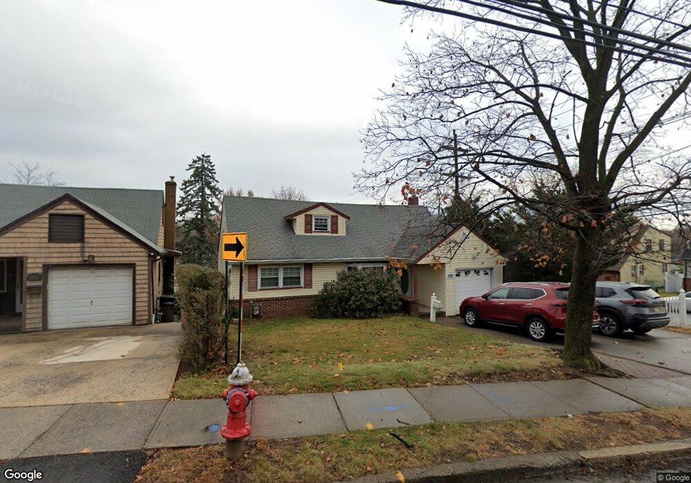
This home is located at 1467 Vauxhall Rd, Union, NJ 07083 and is currently estimated at $505,399. 1467 Vauxhall Rd is a home located in Union County with nearby schools including Livingston Elementary School, Union High School, and St Michael Parish School.
Ownership History
Date
Name
Owned For
Owner Type
Purchase Details
Closed on
Mar 5, 2004
Sold by
Bissoondal Anthony
Bought by
Alcius Yiogene
Current Estimated Value
Home Financials for this Owner
Home Financials are based on the most recent Mortgage that was taken out on this home.
Original Mortgage
$272,844
Outstanding Balance
$127,515
Interest Rate
5.67%
Estimated Equity
$377,884
Purchase Details
Closed on
Jan 12, 1995
Sold by
Pagano Jerry
Bought by
Bissoondal Iris and Bissoondal Anthony
Create a Home Valuation Report for This Property
The Home Valuation Report is an in-depth analysis detailing your home's value as well as a comparison with similar homes in the area
Home Values in the Area
Average Home Value in this Area
Purchase History
| Date | Buyer | Sale Price | Title Company |
|---|---|---|---|
| Alcius Yiogene | $275,000 | -- | |
| Bissoondal Iris | $135,000 | -- |
Source: Public Records
Mortgage History
| Date | Status | Borrower | Loan Amount |
|---|---|---|---|
| Open | Alcius Yiogene | $272,844 |
Source: Public Records
Tax History Compared to Growth
Tax History
| Year | Tax Paid | Tax Assessment Tax Assessment Total Assessment is a certain percentage of the fair market value that is determined by local assessors to be the total taxable value of land and additions on the property. | Land | Improvement |
|---|---|---|---|---|
| 2025 | $10,460 | $46,800 | $20,800 | $26,000 |
| 2024 | $10,141 | $46,800 | $20,800 | $26,000 |
| 2023 | $10,141 | $46,800 | $20,800 | $26,000 |
| 2022 | $9,789 | $46,800 | $20,800 | $26,000 |
| 2021 | $9,551 | $46,800 | $20,800 | $26,000 |
| 2020 | $9,361 | $46,800 | $20,800 | $26,000 |
| 2019 | $9,235 | $46,800 | $20,800 | $26,000 |
| 2018 | $9,078 | $46,800 | $20,800 | $26,000 |
| 2017 | $8,943 | $46,800 | $20,800 | $26,000 |
| 2016 | $8,725 | $46,800 | $20,800 | $26,000 |
| 2015 | $8,581 | $46,800 | $20,800 | $26,000 |
| 2014 | $8,388 | $46,800 | $20,800 | $26,000 |
Source: Public Records
Map
Nearby Homes
- 1267 Erhardt St
- 142 Eastern Pkwy
- 286 Mclean Place
- 1040 Cranbrook Rd
- 1393 Cornell Place
- 617 Tillman St
- 1322 Marcella Dr
- 553 Harvard Ave
- 112 Apple Tree Ln
- 557 Yale Ave
- 35 Eastern Pkwy
- 542 Leo St
- 537 Us Highway 22
- 1764 Colgate Place
- 525 Us Highway 22
- 1848 Portsmouth Way
- 507 Locust Ave
- 393 Harvard Ave
- 1370 Beverly Rd
- 152 Glenwood Ct
- 1471 Vauxhall Rd
- 1475 Vauxhall Rd
- 1211 Robert St
- 1270 Robert St
- 1203 Erhardt St
- 1207 Robert St
- 1190 Harmony Rd
- 1213 Robert St
- 1572 Vauxhall Rd
- 1472 Vauxhall Rd
- 1209 Erhardt St
- 1215 Erhardt St
- 1219 Robert St
- 1219 Robert St Unit 2
- 1480 Vauxhall Rd
- 1186 Harmony Rd
- 1476 Vauxhall Rd
- 1549 Vauxhall Rd
- 1221 Erhardt St
- 1486 Vauxhall Rd