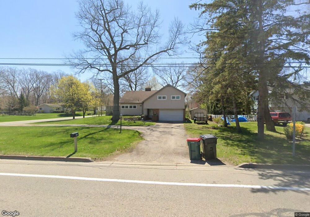
1467 W Norton Ave Norton Shores, MI 49441
Roosevelt Park NeighborhoodEstimated Value: $280,000 - $312,000
3
Beds
3
Baths
1,800
Sq Ft
$165/Sq Ft
Est. Value
About This Home
This home is located at 1467 W Norton Ave, Norton Shores, MI 49441 and is currently estimated at $297,558, approximately $165 per square foot. 1467 W Norton Ave is a home located in Muskegon County with nearby schools including Mona Shores High School, Dr. Martin Luther King Academy, and West Shore Lutheran School.
Ownership History
Date
Name
Owned For
Owner Type
Purchase Details
Closed on
Sep 15, 2009
Sold by
Borns David R and Borns Laura
Bought by
Vette Jedidiah T
Current Estimated Value
Home Financials for this Owner
Home Financials are based on the most recent Mortgage that was taken out on this home.
Original Mortgage
$70,100
Interest Rate
5.07%
Mortgage Type
New Conventional
Create a Home Valuation Report for This Property
The Home Valuation Report is an in-depth analysis detailing your home's value as well as a comparison with similar homes in the area
Home Values in the Area
Average Home Value in this Area
Purchase History
| Date | Buyer | Sale Price | Title Company |
|---|---|---|---|
| Vette Jedidiah T | $94,250 | Safe Title Inc |
Source: Public Records
Mortgage History
| Date | Status | Borrower | Loan Amount |
|---|---|---|---|
| Previous Owner | Vette Jedidiah T | $70,100 |
Source: Public Records
Tax History Compared to Growth
Tax History
| Year | Tax Paid | Tax Assessment Tax Assessment Total Assessment is a certain percentage of the fair market value that is determined by local assessors to be the total taxable value of land and additions on the property. | Land | Improvement |
|---|---|---|---|---|
| 2025 | $2,611 | $141,500 | $0 | $0 |
| 2024 | $2,047 | $129,400 | $0 | $0 |
| 2023 | $1,955 | $112,500 | $0 | $0 |
| 2022 | $2,383 | $92,500 | $0 | $0 |
| 2021 | $2,315 | $84,700 | $0 | $0 |
| 2020 | $2,289 | $80,100 | $0 | $0 |
| 2019 | $2,247 | $72,200 | $0 | $0 |
| 2018 | $2,194 | $65,800 | $0 | $0 |
| 2017 | $2,143 | $63,500 | $0 | $0 |
| 2016 | $1,660 | $58,800 | $0 | $0 |
| 2015 | -- | $56,100 | $0 | $0 |
| 2014 | $1,992 | $55,800 | $0 | $0 |
| 2013 | -- | $51,900 | $0 | $0 |
Source: Public Records
Map
Nearby Homes
- 3246 Royal Oak Rd
- 1243 Crandall Ave
- 1480 Marlboro Rd
- 1448 Marlboro Rd
- 3684 Harris Dr
- 1744 W Norton Ave
- 3320 Davis Rd
- 1733 Woodside Rd
- 1582 Haverhill Rd
- 3658 Lake Harbor Rd
- 1045 Le Roux Rd Unit 178
- 1377 Princeton Rd
- 1936 Lawnel Ave
- 1012 Beechtree Ct
- 1689 Bonneville Dr
- 1650 Bonneville Dr
- 3920 Braeburn Dr
- 3891 Wickham Dr
- 2881 Cornell Ct
- 1752 Bonneville Dr
- 1481 W Norton Ave
- 3433 Brentwood St
- 1441 W Norton Ave
- 1495 W Norton Ave
- 3447 Brentwood St
- 3432 Brentwood St
- 1511 W Norton Ave
- 3434 Seminole Woods Dr
- 3446 Brentwood St
- 3463 Brentwood St
- 3462 Brentwood St
- 3487 Brentwood St
- 3486 Brentwood St
- 1539 W Norton Ave
- 3415 Rood Rd
- 3465 Rood Rd
- 3431 Rood Rd
- 3501 Brentwood St
- 3502 Brentwood St
- 3465 Seminole Woods Dr