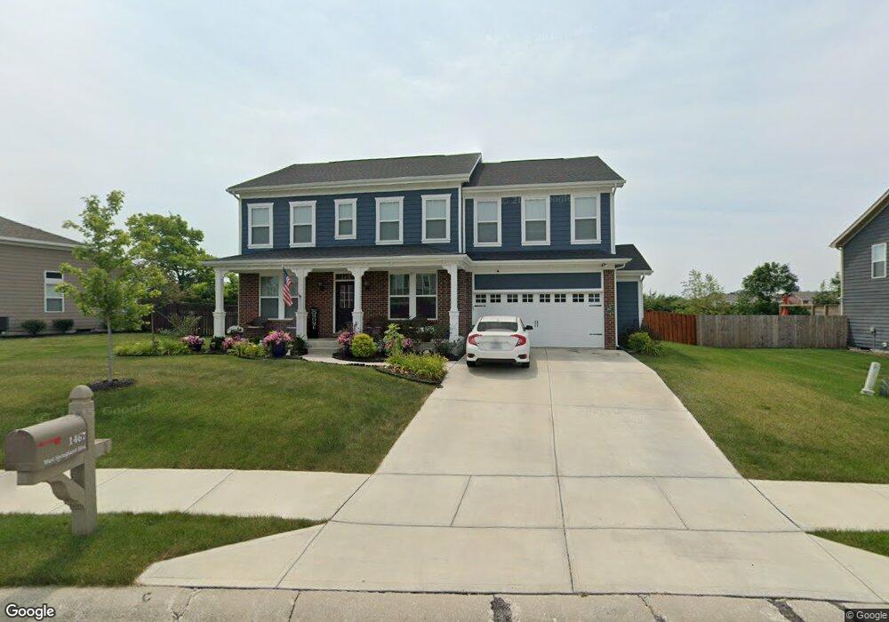
1467 W Springhurst Blvd Greenfield, IN 46140
Estimated Value: $465,000 - $551,000
5
Beds
4
Baths
3,194
Sq Ft
$164/Sq Ft
Est. Value
About This Home
This home is located at 1467 W Springhurst Blvd, Greenfield, IN 46140 and is currently estimated at $522,429, approximately $163 per square foot. 1467 W Springhurst Blvd is a home located in Hancock County with nearby schools including Weston Elementary School, Greenfield Intermediate School, and Greenfield Central Junior High School.
Ownership History
Date
Name
Owned For
Owner Type
Purchase Details
Closed on
Jul 18, 2019
Sold by
Fischer Homes Indianapolis Ii Llc
Bought by
Wilburn Rex A and Wilburn Mary A
Current Estimated Value
Home Financials for this Owner
Home Financials are based on the most recent Mortgage that was taken out on this home.
Original Mortgage
$320,000
Outstanding Balance
$280,233
Interest Rate
3.8%
Mortgage Type
New Conventional
Estimated Equity
$242,196
Purchase Details
Closed on
Jan 5, 2016
Sold by
First Merchants Bank Na
Bought by
Landman Properties Llc
Create a Home Valuation Report for This Property
The Home Valuation Report is an in-depth analysis detailing your home's value as well as a comparison with similar homes in the area
Home Values in the Area
Average Home Value in this Area
Purchase History
| Date | Buyer | Sale Price | Title Company |
|---|---|---|---|
| Wilburn Rex A | $424,326 | Homestead Title Agency Ltd | |
| Landman Properties Llc | -- | First American Title |
Source: Public Records
Mortgage History
| Date | Status | Borrower | Loan Amount |
|---|---|---|---|
| Open | Wilburn Rex A | $320,000 |
Source: Public Records
Tax History Compared to Growth
Tax History
| Year | Tax Paid | Tax Assessment Tax Assessment Total Assessment is a certain percentage of the fair market value that is determined by local assessors to be the total taxable value of land and additions on the property. | Land | Improvement |
|---|---|---|---|---|
| 2024 | $5,193 | $519,300 | $85,000 | $434,300 |
| 2023 | $5,193 | $473,500 | $85,000 | $388,500 |
| 2022 | $4,767 | $476,700 | $58,800 | $417,900 |
| 2021 | $4,318 | $430,300 | $48,000 | $382,300 |
| 2020 | $4,219 | $420,400 | $48,000 | $372,400 |
| 2019 | $21 | $500 | $500 | $0 |
| 2018 | $26 | $500 | $500 | $0 |
| 2017 | $27 | $500 | $500 | $0 |
| 2016 | $27 | $500 | $500 | $0 |
| 2014 | $12 | $500 | $500 | $0 |
| 2013 | $12 | $500 | $500 | $0 |
Source: Public Records
Map
Nearby Homes
- 1079 Salisbury Dr
- 1400 W Springhurst Blvd
- 1443 Byron St
- 1020 Arthur Ct
- 1112 Arthur Ct
- 1862 Downey Ln
- 1500 W Mckenzie Rd
- 1145 Phillips Dr
- 1215 Simms Ln
- 1946 Meridian Springs Ln
- 1237 Simms Ln
- 1207 Mcbride St
- 1691 Roosevelt Dr
- 1307 Fleming Dr
- 468 Ashby Dr
- 757 Carson Ln
- Chatham Plan at Brunson's Landing
- Freeport Plan at Brunson's Landing
- Bellamy Plan at Brunson's Landing
- Stamford Plan at Brunson's Landing
- 1467 W Springhurst Blvd
- 1457 W Springhurst Blvd
- 1475 W Springhurst Blvd
- 1473 W Springhurst Blvd
- 1438 W Springhurst Blvd
- 1480 W Springhurst Blvd
- 1462 W Springhurst Blvd
- 1445 W Springhurst Blvd
- 0 W Springhurst Blvd
- 0 W Springhurst Blvd
- 0 W Springhurst Blvd
- 1447 W Springhurst Blvd
- 1436 Byron St
- 1384 Byron St
- 1418 Byron St
- 1452 Byron St
- 1495 W Springhurst Blvd
- 2982 Red Spruce Dr
- 1796 Gunnison Dr
- 1470 Byron St