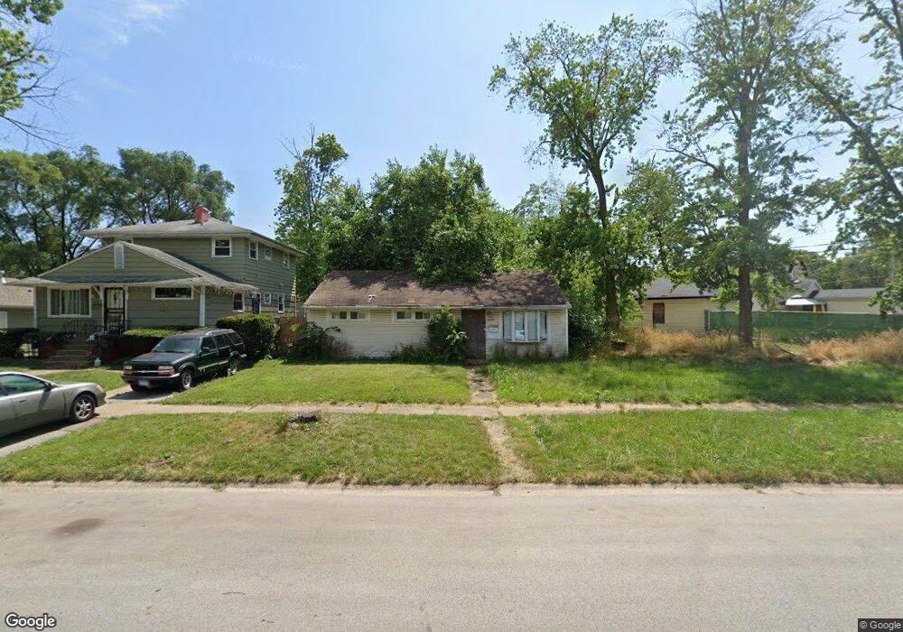
14670 Shepard Dr Dolton, IL 60419
Estimated Value: $136,000 - $153,000
3
Beds
1
Bath
1,000
Sq Ft
$142/Sq Ft
Est. Value
About This Home
This home is located at 14670 Shepard Dr, Dolton, IL 60419 and is currently estimated at $141,950, approximately $141 per square foot. 14670 Shepard Dr is a home located in Cook County with nearby schools including Berger-Vandenberg Elementary School, School Of Fine Arts Academy, and Creative Communications Academy.
Ownership History
Date
Name
Owned For
Owner Type
Purchase Details
Closed on
Apr 14, 1998
Sold by
South Holland Trust & Svgs Bank
Bought by
Caldwell Olivia D
Current Estimated Value
Home Financials for this Owner
Home Financials are based on the most recent Mortgage that was taken out on this home.
Original Mortgage
$55,920
Outstanding Balance
$10,773
Interest Rate
7.27%
Estimated Equity
$131,177
Create a Home Valuation Report for This Property
The Home Valuation Report is an in-depth analysis detailing your home's value as well as a comparison with similar homes in the area
Home Values in the Area
Average Home Value in this Area
Purchase History
| Date | Buyer | Sale Price | Title Company |
|---|---|---|---|
| Caldwell Olivia D | $70,000 | -- |
Source: Public Records
Mortgage History
| Date | Status | Borrower | Loan Amount |
|---|---|---|---|
| Open | Caldwell Olivia D | $55,920 |
Source: Public Records
Tax History Compared to Growth
Tax History
| Year | Tax Paid | Tax Assessment Tax Assessment Total Assessment is a certain percentage of the fair market value that is determined by local assessors to be the total taxable value of land and additions on the property. | Land | Improvement |
|---|---|---|---|---|
| 2024 | $3,207 | $9,000 | $2,715 | $6,285 |
| 2023 | $998 | $9,000 | $2,715 | $6,285 |
| 2022 | $998 | $4,800 | $2,396 | $2,404 |
| 2021 | $1,012 | $4,799 | $2,395 | $2,404 |
| 2020 | $1,092 | $4,799 | $2,395 | $2,404 |
| 2019 | $1,449 | $5,416 | $2,235 | $3,181 |
| 2018 | $1,438 | $5,416 | $2,235 | $3,181 |
| 2017 | $1,402 | $5,416 | $2,235 | $3,181 |
| 2016 | $1,953 | $5,560 | $2,076 | $3,484 |
| 2015 | $1,808 | $5,560 | $2,076 | $3,484 |
| 2014 | $1,819 | $5,560 | $2,076 | $3,484 |
| 2013 | $2,081 | $6,279 | $2,076 | $4,203 |
Source: Public Records
Map
Nearby Homes
- 14708 Shepard Dr
- 14619 Minerva Ave
- 14720 Shepard Dr
- 14761 Lincoln Ave
- 14635 Woodlawn Ave
- 14700 Avalon Ave
- 14644 Ellis Ave
- 14814 Woodlawn Ave
- 14534 Woodlawn Ave
- 14640 Ingleside Ave
- 14737 Kimbark Ave
- 14447 University Ave
- 14634 Kenwood Ave
- 14622 Kenwood Ave
- 14728 Kenwood Ave
- 14429 Minerva Ave
- 14911 Woodlawn Ave
- 14637 Kenwood Ave
- 14508 Ingleside Ave
- 14808 Dorchester Ave
- 14700 Shepard Dr
- 14649 Minerva Ave
- 14645 Minerva Ave
- 14702 Shepard Dr
- 14665 Shepard Dr
- 14703 Minerva Ave
- 14721 Lincoln Ave
- 14721 Lincoln Ave
- 14704 Shepard Dr
- 14634 University Ave
- 14641 Minerva Ave
- 14725 Lincoln Ave
- 14725 Lincoln Ave
- 14632 University Ave
- 14729 Lincoln Ave
- 14649 University Ave
- 14645 University Ave
- 14641 University Ave
- 14679 Shepard Dr