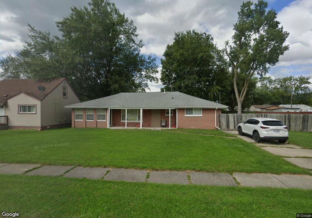
14674 Marvin St Unit Bldg-Unit Taylor, MI 48180
Estimated Value: $183,000 - $207,000
3
Beds
1
Bath
1,585
Sq Ft
$122/Sq Ft
Est. Value
About This Home
This home is located at 14674 Marvin St Unit Bldg-Unit, Taylor, MI 48180 and is currently estimated at $193,086, approximately $121 per square foot. 14674 Marvin St Unit Bldg-Unit is a home located in Wayne County with nearby schools including Eureka Heights Elementary School, Hoover Middle School, and Taylor High School.
Ownership History
Date
Name
Owned For
Owner Type
Purchase Details
Closed on
Mar 22, 2018
Sold by
Wenden Properties Llc
Bought by
Krueger Timothy
Current Estimated Value
Purchase Details
Closed on
Jan 23, 2015
Sold by
Wenden Properties
Bought by
Hunter Linda Lee
Purchase Details
Closed on
Apr 6, 2010
Sold by
Danville Dennis R and Danville Wendy L
Bought by
Wenden Properties Llc
Purchase Details
Closed on
Apr 23, 2009
Sold by
Molnar William Kenneth and Molnar Grace T
Bought by
Wells Fargo Financial America Inc
Create a Home Valuation Report for This Property
The Home Valuation Report is an in-depth analysis detailing your home's value as well as a comparison with similar homes in the area
Home Values in the Area
Average Home Value in this Area
Purchase History
| Date | Buyer | Sale Price | Title Company |
|---|---|---|---|
| Krueger Timothy | $113,500 | Minnesota Title Box | |
| Hunter Linda Lee | -- | Minnesota Title Agency | |
| Wenden Properties Llc | -- | Minnesota Title Agency | |
| Wells Fargo Financial America Inc | $50,000 | None Available |
Source: Public Records
Tax History Compared to Growth
Tax History
| Year | Tax Paid | Tax Assessment Tax Assessment Total Assessment is a certain percentage of the fair market value that is determined by local assessors to be the total taxable value of land and additions on the property. | Land | Improvement |
|---|---|---|---|---|
| 2025 | $1,082 | $89,600 | $0 | $0 |
| 2024 | $1,082 | $80,300 | $0 | $0 |
| 2023 | $1,221 | $68,600 | $0 | $0 |
| 2022 | $1,018 | $59,400 | $0 | $0 |
| 2021 | $1,092 | $18,600 | $0 | $0 |
| 2020 | $857 | $17,500 | $0 | $0 |
| 2019 | $84,906 | $15,000 | $0 | $0 |
| 2018 | $497 | $11,600 | $0 | $0 |
| 2017 | $280 | $11,600 | $0 | $0 |
| 2016 | $841 | $11,400 | $0 | $0 |
| 2015 | $1,800 | $0 | $0 | $0 |
| 2013 | $1,800 | $18,200 | $0 | $0 |
| 2012 | $2,202 | $32,500 | $13,300 | $19,200 |
Source: Public Records
Map
Nearby Homes
- 14712 Marvin St
- 14634 Mcguire St
- 14611 Mcguire St
- 26531 Eureka Rd
- 15354 Oldham St
- 13744 Mcguire St
- 15350 Gulley St
- 13753 Mcguire St
- 13717 Fellrath St
- 15684 Mcguire St
- 15387 Michael St
- 13529 Fellrath St
- 15679 Gulley St
- 13504 Fellrath St
- 15910 Hampden St
- 15425 Leader St
- 15143 Siebert St
- 13161 Golf Pointe Dr
- 16031 Beech Daly Rd Unit 174
- 16031 Beech Daly Rd Unit 4
- 14674 Marvin St
- 14644 Marvin St
- 14704 Marvin St
- 14640 Marvin St
- 14640 Marvin St
- 235 Vinewood Marvin St
- 14721 Fellrath St
- 14711 Fellrath St
- 14731 Fellrath St
- 14671 Fellrath St
- 14663 Marvin St
- 14651 Marvin St
- 14705 Marvin St Unit Bldg-Unit
- 14705 Marvin St
- 14645 Marvin St
- 14728 Marvin St
- 14713 Marvin St
- 14659 Fellrath St
- 14801 Fellrath St
- 14721 Marvin St