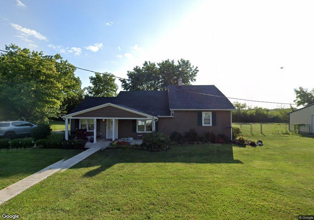
14675 East St Mount Sterling, OH 43143
Estimated Value: $203,343 - $302,000
3
Beds
2
Baths
1,500
Sq Ft
$175/Sq Ft
Est. Value
About This Home
This home is located at 14675 East St, Mount Sterling, OH 43143 and is currently estimated at $262,336, approximately $174 per square foot. 14675 East St is a home located in Madison County with nearby schools including Madison-Plains Elementary School, Madison-Plains Intermediate School, and Madison-Plains Junior High School.
Ownership History
Date
Name
Owned For
Owner Type
Purchase Details
Closed on
Aug 11, 2004
Sold by
Fletcher Steven L and Fletcher Heidi L
Bought by
Sines Brady M
Current Estimated Value
Home Financials for this Owner
Home Financials are based on the most recent Mortgage that was taken out on this home.
Original Mortgage
$86,000
Outstanding Balance
$42,873
Interest Rate
6.08%
Mortgage Type
Purchase Money Mortgage
Estimated Equity
$219,463
Purchase Details
Closed on
Oct 5, 2002
Sold by
Fletcher Steven L
Bought by
Sines Brady M
Create a Home Valuation Report for This Property
The Home Valuation Report is an in-depth analysis detailing your home's value as well as a comparison with similar homes in the area
Home Values in the Area
Average Home Value in this Area
Purchase History
| Date | Buyer | Sale Price | Title Company |
|---|---|---|---|
| Sines Brady M | $86,000 | Chicago Title | |
| Sines Brady M | $96,500 | -- |
Source: Public Records
Mortgage History
| Date | Status | Borrower | Loan Amount |
|---|---|---|---|
| Open | Sines Brady M | $86,000 | |
| Closed | Sines Brady M | $0 |
Source: Public Records
Tax History Compared to Growth
Tax History
| Year | Tax Paid | Tax Assessment Tax Assessment Total Assessment is a certain percentage of the fair market value that is determined by local assessors to be the total taxable value of land and additions on the property. | Land | Improvement |
|---|---|---|---|---|
| 2024 | $1,617 | $47,110 | $7,390 | $39,720 |
| 2023 | $1,617 | $47,110 | $7,390 | $39,720 |
| 2022 | $1,454 | $39,950 | $6,140 | $33,810 |
| 2021 | $1,417 | $39,950 | $6,140 | $33,810 |
| 2020 | $1,419 | $39,950 | $6,140 | $33,810 |
| 2019 | $1,192 | $34,570 | $5,420 | $29,150 |
| 2018 | $1,193 | $34,570 | $5,420 | $29,150 |
| 2017 | $932 | $34,570 | $5,420 | $29,150 |
| 2016 | $932 | $28,720 | $5,420 | $23,300 |
| 2015 | $932 | $28,720 | $5,420 | $23,300 |
| 2014 | $914 | $28,720 | $5,420 | $23,300 |
| 2013 | -- | $29,400 | $4,310 | $25,090 |
Source: Public Records
Map
Nearby Homes
- 94 Jefferson St
- 60 N London St
- 67 W Columbus St
- 110 Mountview Ct
- 230 W Columbus St
- 10741 2nd St
- 500 Wingate Place N
- 16185 State Route 207
- 15561 Blain Rd
- 10495 Anderson Antioch Rd
- 12265 Woods Opossum Run
- 8713 State Route 207
- 0 Renick Rd
- 10586 Baldwin Rd
- 14008 1st St
- 16270 Cook Yankeetown Rd NE
- 13810 Yankeetown Chenoweth Rd
- 19763 Clarks Run Rd
- 0 Rockwell Rd Unit 225016734
- 11444 Kellough Rd
- 14661 East St
- 14660 East St
- 14625 East St
- 14625 East St
- 10938 South St
- 10938 South St
- 10930 South St
- 14669 High St
- 14669 High St
- 10915 Cemetery Rd
- 14670 High St
- 10920 South St
- 10901 South St
- 10910 South St
- 10869 Cemetery Rd
- 10861 Cemetery Rd
- 10890 South St
- 10869 McClimansville Cemetery Rd
- 14695 West St
- 10857 Cemetery Rd