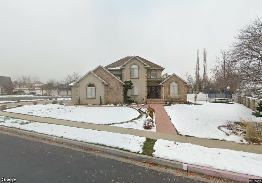
1468 N 1020 E American Fork, UT 84003
Estimated Value: $815,349 - $884,000
5
Beds
5
Baths
3,893
Sq Ft
$221/Sq Ft
Est. Value
About This Home
This home is located at 1468 N 1020 E, American Fork, UT 84003 and is currently estimated at $860,450, approximately $221 per square foot. 1468 N 1020 E is a home located in Utah County with nearby schools including Deerfield Elementary School, Mountain Ridge Junior High School, and American Fork High School.
Ownership History
Date
Name
Owned For
Owner Type
Purchase Details
Closed on
Oct 22, 2020
Sold by
Jordan Roger F and Jordan Carene C
Bought by
Nadroj Llc
Current Estimated Value
Purchase Details
Closed on
Jun 25, 2009
Sold by
Holman Kirk L and Holman Denece E
Bought by
Jordan Roger F and Jordan Carene C
Home Financials for this Owner
Home Financials are based on the most recent Mortgage that was taken out on this home.
Original Mortgage
$145,000
Interest Rate
4.83%
Mortgage Type
Purchase Money Mortgage
Purchase Details
Closed on
Aug 22, 1996
Sold by
Carlisle Robert Jay and Carlisle Diane
Bought by
Holman Kirk L and Holman Denece E
Home Financials for this Owner
Home Financials are based on the most recent Mortgage that was taken out on this home.
Original Mortgage
$205,430
Interest Rate
8.42%
Mortgage Type
Construction
Create a Home Valuation Report for This Property
The Home Valuation Report is an in-depth analysis detailing your home's value as well as a comparison with similar homes in the area
Home Values in the Area
Average Home Value in this Area
Purchase History
| Date | Buyer | Sale Price | Title Company |
|---|---|---|---|
| Nadroj Llc | -- | Backman Title Services Ltd | |
| Jordan Roger F | -- | Affiliated First Title Comp | |
| Holman Kirk L | -- | -- |
Source: Public Records
Mortgage History
| Date | Status | Borrower | Loan Amount |
|---|---|---|---|
| Previous Owner | Jordan Roger F | $145,000 | |
| Previous Owner | Holman Kirk L | $205,430 |
Source: Public Records
Tax History
| Year | Tax Paid | Tax Assessment Tax Assessment Total Assessment is a certain percentage of the fair market value that is determined by local assessors to be the total taxable value of land and additions on the property. | Land | Improvement |
|---|---|---|---|---|
| 2025 | $3,457 | $425,810 | -- | -- |
| 2024 | $3,457 | $384,065 | $0 | $0 |
| 2023 | $3,265 | $384,670 | $0 | $0 |
| 2022 | $3,273 | $380,490 | $0 | $0 |
| 2021 | $2,871 | $521,400 | $173,600 | $347,800 |
| 2020 | $2,793 | $491,900 | $160,700 | $331,200 |
| 2019 | $2,639 | $480,700 | $149,500 | $331,200 |
| 2018 | $2,717 | $473,200 | $142,000 | $331,200 |
| 2017 | $2,725 | $256,135 | $0 | $0 |
| 2016 | $2,888 | $252,175 | $0 | $0 |
| 2015 | $2,849 | $236,115 | $0 | $0 |
| 2014 | $2,601 | $212,630 | $0 | $0 |
Source: Public Records
Map
Nearby Homes
- 9587 N 4500 W
- 4675 W Ferguson Way
- 4552 W Windsor Cir
- 4531 W Cambridge Dr
- 9752 N Dorchester Dr
- 1125 N 1270 E
- 3518 N 1450 W
- 4979 W Willowbank Dr
- 1077 N 950 E
- 4968 W Evergreen Ln
- 1045 N 930 E Unit 58
- 5032 W Northwood Ln
- 5061 W Evergreen Ln
- 4814 W Washoe Ct
- 4956 W Gallatin Way
- 5034 W Green Ash Ln
- 5042 W Green Ash Ln
- 5056 W Green Ash Ln
- 4998 W Green Ash Ln
- 6552 N Bald Knoll
- 1062 Murdock Dr
- 1446 N 1020 E
- 1446 N 1020 E Unit 8
- 1451 N 1020 E
- 1479 N 1020 E
- 1479 N 1020 E Unit 1
- 1041 E 1420 N
- 1035 Murdock Dr
- 1083 Murdock Dr
- 1108 Murdock Dr
- 1108 Murdock Dr Unit 11
- 1433 N 1020 E
- 1008 Murdock Dr
- 1384 N 1100 E
- 1017 Murdock Dr
- 1456 N 1000 E
- 1036 E 1420 N
- 1111 Murdock Dr Unit 9
- 1111 Murdock Dr
- 1415 N 1020 E
Your Personal Tour Guide
Ask me questions while you tour the home.