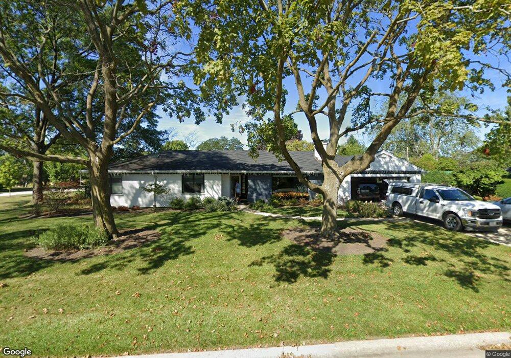
1468 Parkside Dr Park Ridge, IL 60068
Estimated Value: $662,000 - $841,000
4
Beds
3
Baths
2,176
Sq Ft
$343/Sq Ft
Est. Value
About This Home
This home is located at 1468 Parkside Dr, Park Ridge, IL 60068 and is currently estimated at $745,428, approximately $342 per square foot. 1468 Parkside Dr is a home located in Cook County with nearby schools including Franklin Elementary School, Emerson Middle School, and Maine East High School.
Ownership History
Date
Name
Owned For
Owner Type
Purchase Details
Closed on
Aug 25, 2017
Sold by
Williams Sandra L
Bought by
Lomasney Edmund J and Lomasney Terese M
Current Estimated Value
Home Financials for this Owner
Home Financials are based on the most recent Mortgage that was taken out on this home.
Original Mortgage
$614,000
Outstanding Balance
$501,616
Interest Rate
3.12%
Mortgage Type
Adjustable Rate Mortgage/ARM
Estimated Equity
$243,812
Purchase Details
Closed on
Dec 31, 1998
Sold by
Williams Sandra L
Bought by
Williams Sandra L and Williams Scott R
Purchase Details
Closed on
Jul 13, 1995
Sold by
Strunk Norman W
Bought by
Williams Sandra L
Home Financials for this Owner
Home Financials are based on the most recent Mortgage that was taken out on this home.
Original Mortgage
$175,000
Interest Rate
7.5%
Create a Home Valuation Report for This Property
The Home Valuation Report is an in-depth analysis detailing your home's value as well as a comparison with similar homes in the area
Home Values in the Area
Average Home Value in this Area
Purchase History
| Date | Buyer | Sale Price | Title Company |
|---|---|---|---|
| Lomasney Edmund J | $614,000 | None Available | |
| Williams Sandra L | -- | -- | |
| Williams Sandra L | $325,000 | -- |
Source: Public Records
Mortgage History
| Date | Status | Borrower | Loan Amount |
|---|---|---|---|
| Open | Lomasney Edmund J | $614,000 | |
| Previous Owner | Williams Sandra L | $175,000 |
Source: Public Records
Tax History Compared to Growth
Tax History
| Year | Tax Paid | Tax Assessment Tax Assessment Total Assessment is a certain percentage of the fair market value that is determined by local assessors to be the total taxable value of land and additions on the property. | Land | Improvement |
|---|---|---|---|---|
| 2024 | $14,385 | $53,000 | $14,293 | $38,707 |
| 2023 | $13,783 | $53,000 | $14,293 | $38,707 |
| 2022 | $13,783 | $53,000 | $14,293 | $38,707 |
| 2021 | $16,364 | $53,803 | $11,434 | $42,369 |
| 2020 | $15,714 | $53,803 | $11,434 | $42,369 |
| 2019 | $15,756 | $60,453 | $11,434 | $49,019 |
| 2018 | $12,702 | $44,386 | $10,005 | $34,381 |
| 2017 | $11,686 | $44,386 | $10,005 | $34,381 |
| 2016 | $11,493 | $44,386 | $10,005 | $34,381 |
| 2015 | $11,860 | $41,076 | $8,218 | $32,858 |
| 2014 | $11,642 | $41,076 | $8,218 | $32,858 |
| 2013 | $11,011 | $41,076 | $8,218 | $32,858 |
Source: Public Records
Map
Nearby Homes
- 1580 Habberton Ave
- 8253 N Western Ave
- 8619 W Park Ln
- 8554 W Bruce Dr
- 1819 Glenview Ave
- 1712 Woodland Ave
- 1710 Dempster St Unit C
- 1144 N Greenwood Ave
- 1720 Greendale Ave
- 1044 N Knight Ave
- 8517 W Madison Dr
- 1025 N Knight Ave
- 8426 W Betty Terrace
- 1041 Vernon Ave
- 1420 Oakton St
- 1039 N Northwest Hwy Unit A5
- 1717 Oakton St
- 1815 Oakton St Unit 2A
- 8974 N Western Ave Unit D409
- 8808 Briar Ct Unit 88082A
- 1842 De Cook Ave
- 1488 Parkside Dr
- 1852 De Cook Ave
- 1833 Burton Ln
- 1435 Parkside Dr Unit 2
- 1425 Parkside Dr
- 1445 Parkside Dr
- 1415 Parkside Dr
- 1843 Burton Ln
- 1448 Parkside Dr
- 1862 De Cook Ave
- 1841 De Cook Ave
- 1455 Parkside Dr
- 1405 Parkside Dr
- 1851 De Cook Ave
- 1853 Burton Ln
- 1872 De Cook Ave
- 1395 Parkside Dr
- 1465 Parkside Dr
- 1861 De Cook Ave