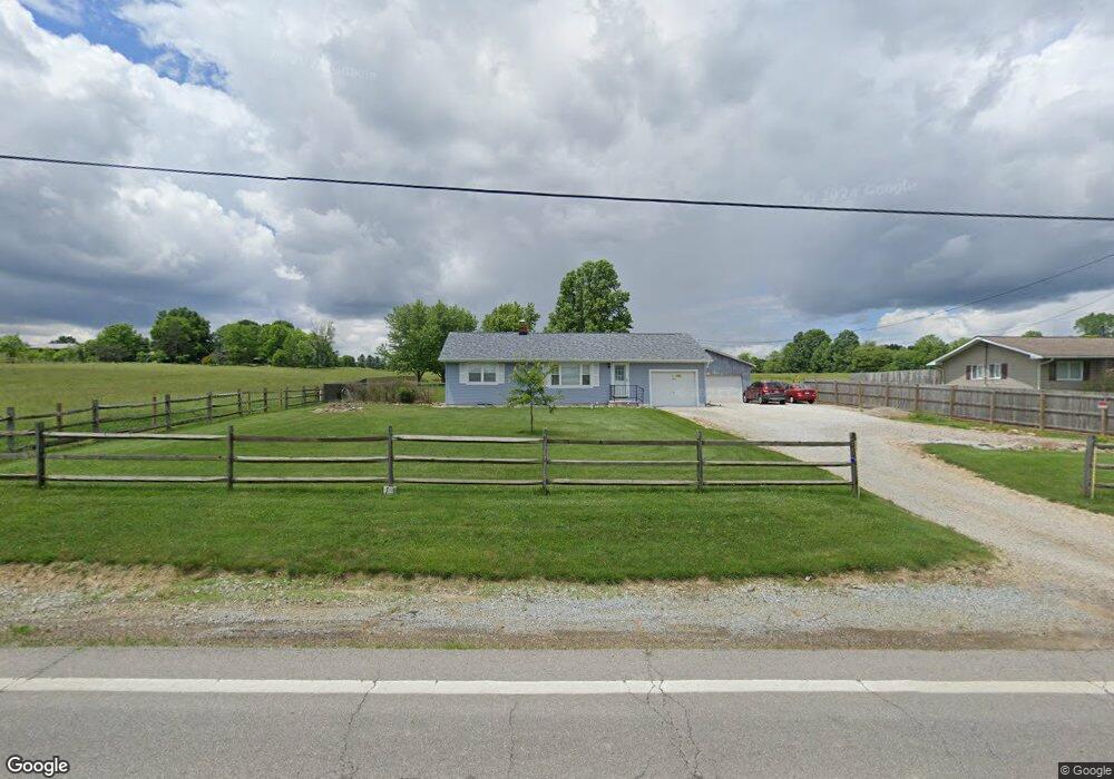
14680 Mount Eaton Rd N Rittman, OH 44270
Estimated Value: $231,137 - $245,000
2
Beds
1
Bath
972
Sq Ft
$245/Sq Ft
Est. Value
About This Home
This home is located at 14680 Mount Eaton Rd N, Rittman, OH 44270 and is currently estimated at $238,534, approximately $245 per square foot. 14680 Mount Eaton Rd N is a home located in Wayne County with nearby schools including Hazel Harvey Elementary School, Chippewa Intermediate School, and Chippewa Jr./Sr. High School.
Ownership History
Date
Name
Owned For
Owner Type
Purchase Details
Closed on
Feb 20, 2018
Sold by
Drake Robert D
Bought by
Drake Roger D and Drake Shelia S
Current Estimated Value
Purchase Details
Closed on
Jan 29, 2003
Sold by
Tooley Clinton A and Tooley Sherry L
Bought by
Drake Robert D and Drake Shelia
Home Financials for this Owner
Home Financials are based on the most recent Mortgage that was taken out on this home.
Original Mortgage
$113,900
Interest Rate
5.91%
Mortgage Type
Unknown
Purchase Details
Closed on
Jul 31, 1997
Sold by
Lapaglia Louis F
Bought by
Tooley Clinton A and Tooley Sherry L
Home Financials for this Owner
Home Financials are based on the most recent Mortgage that was taken out on this home.
Original Mortgage
$84,000
Interest Rate
7.71%
Mortgage Type
New Conventional
Create a Home Valuation Report for This Property
The Home Valuation Report is an in-depth analysis detailing your home's value as well as a comparison with similar homes in the area
Home Values in the Area
Average Home Value in this Area
Purchase History
| Date | Buyer | Sale Price | Title Company |
|---|---|---|---|
| Drake Roger D | -- | -- | |
| Drake Robert D | $119,900 | -- | |
| Tooley Clinton A | $105,000 | -- |
Source: Public Records
Mortgage History
| Date | Status | Borrower | Loan Amount |
|---|---|---|---|
| Previous Owner | Drake Robert D | $113,900 | |
| Previous Owner | Tooley Clinton A | $84,000 |
Source: Public Records
Tax History Compared to Growth
Tax History
| Year | Tax Paid | Tax Assessment Tax Assessment Total Assessment is a certain percentage of the fair market value that is determined by local assessors to be the total taxable value of land and additions on the property. | Land | Improvement |
|---|---|---|---|---|
| 2024 | $2,241 | $64,490 | $17,400 | $47,090 |
| 2023 | $2,217 | $63,480 | $17,400 | $46,080 |
| 2022 | $1,645 | $43,480 | $11,910 | $31,570 |
| 2021 | $1,655 | $43,480 | $11,910 | $31,570 |
| 2020 | $1,667 | $43,480 | $11,910 | $31,570 |
| 2019 | $1,461 | $36,770 | $10,620 | $26,150 |
| 2018 | $1,475 | $36,770 | $10,620 | $26,150 |
| 2017 | $1,441 | $36,770 | $10,620 | $26,150 |
| 2016 | $1,426 | $35,360 | $10,210 | $25,150 |
| 2015 | $1,420 | $35,360 | $10,210 | $25,150 |
| 2014 | $1,246 | $35,360 | $10,210 | $25,150 |
| 2013 | $1,264 | $34,770 | $9,870 | $24,900 |
Source: Public Records
Map
Nearby Homes
- 970 Eastern Rd
- 877 Chardoney Dr
- 243 Chelley Ln
- 1014 Marissa Dr
- 1008 Barn Swallow Cir
- 15500 Freedom Dr
- 500 W Clinton St
- Amberwood Plan at Mount Eaton Estates - Mount Eaton Estates
- Newberry Plan at Mount Eaton Estates - Mount Eaton Estates
- Ascend Plan at Mount Eaton Estates - Mount Eaton Estates
- Aspire Plan at Mount Eaton Estates - Mount Eaton Estates
- Fairview Plan at Mount Eaton Estates - Mount Eaton Estates
- Mercer Plan at Mount Eaton Estates - Mount Eaton Estates
- Continental Plan at Mount Eaton Estates - Mount Eaton Estates
- Boardwalk Plan at Mount Eaton Estates - Mount Eaton Estates
- 0 Akron Rd Unit 5123781
- 10091 Dale Dr
- 220 Country Meadow Ln
- 0 E Ohio Ave Unit 5118655
- 678 Wall Rd
- 14680 Mount Eaton Rd
- 14728 Mount Eaton Rd
- 14667 Mount Eaton Rd
- 14748 Mt Eaton Rd
- 14748 Mount Eaton Rd
- 14751 Mount Eaton Rd
- 14590 Mount Eaton Rd
- 14589 Mount Eaton Rd
- 14780 Mount Eaton Rd
- 14802 Mount Eaton Rd
- 14802 Mount Eaton Rd
- 14835 Mount Eaton Rd
- 14892 Mount Eaton Rd
- 14470 Mount Eaton Rd
- 14582 Mount Eaton Rd
- 14899 Mount Eaton Rd
- 14689 Hatfield Rd
- 14934 Mount Eaton Rd
- 14934 Mount Eaton Rd N
- 14397 Mount Eaton Rd