Estimated Value: $630,000 - $849,000
4
Beds
3
Baths
2,793
Sq Ft
$267/Sq Ft
Est. Value
About This Home
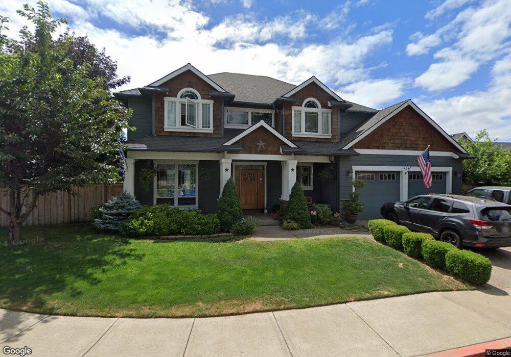
This home is located at 1469 N Fir St, Canby, OR 97013 and is currently estimated at $744,775, approximately $266 per square foot. 1469 N Fir St is a home located in Clackamas County with nearby schools including Josefa L. Sambrano Elementary School, Baker Prairie Middle School, and Canby High School.
Ownership History
Date
Name
Owned For
Owner Type
Purchase Details
Closed on
Nov 30, 2015
Sold by
Block Bret and Block Mechelle
Bought by
Mchenry William A
Current Estimated Value
Home Financials for this Owner
Home Financials are based on the most recent Mortgage that was taken out on this home.
Original Mortgage
$408,405
Outstanding Balance
$320,574
Interest Rate
3.73%
Mortgage Type
New Conventional
Estimated Equity
$424,201
Purchase Details
Closed on
Jun 18, 2007
Sold by
2Krmt Inc
Bought by
Block Bret and Block Mechelle
Home Financials for this Owner
Home Financials are based on the most recent Mortgage that was taken out on this home.
Original Mortgage
$390,000
Interest Rate
6.51%
Mortgage Type
Construction
Create a Home Valuation Report for This Property
The Home Valuation Report is an in-depth analysis detailing your home's value as well as a comparison with similar homes in the area
Home Values in the Area
Average Home Value in this Area
Purchase History
| Date | Buyer | Sale Price | Title Company |
|---|---|---|---|
| Mchenry William A | $429,900 | Fidelity Natl Title Co Of Or | |
| Block Bret | $157,727 | Chicago Title Co |
Source: Public Records
Mortgage History
| Date | Status | Borrower | Loan Amount |
|---|---|---|---|
| Open | Mchenry William A | $408,405 | |
| Previous Owner | Block Bret | $390,000 |
Source: Public Records
Tax History Compared to Growth
Tax History
| Year | Tax Paid | Tax Assessment Tax Assessment Total Assessment is a certain percentage of the fair market value that is determined by local assessors to be the total taxable value of land and additions on the property. | Land | Improvement |
|---|---|---|---|---|
| 2025 | $7,958 | $449,162 | -- | -- |
| 2024 | $7,735 | $436,080 | -- | -- |
| 2023 | $7,735 | $423,379 | $0 | $0 |
| 2022 | $7,114 | $411,048 | $0 | $0 |
| 2021 | $6,851 | $399,076 | $0 | $0 |
| 2020 | $6,728 | $387,453 | $0 | $0 |
| 2019 | $6,407 | $376,168 | $0 | $0 |
| 2018 | $6,264 | $365,212 | $0 | $0 |
| 2017 | $6,105 | $354,575 | $0 | $0 |
| 2016 | $5,902 | $344,248 | $0 | $0 |
| 2015 | $5,699 | $334,221 | $0 | $0 |
| 2014 | $5,535 | $324,486 | $0 | $0 |
Source: Public Records
Map
Nearby Homes
- 1614 NW 16th Ave
- 1721 N Hyssop St
- 0 NW 10th Ave
- 187 NE 14th Ave
- 960 N Aspen Ct
- 184 NE 10th Ave
- 312 NE 14th Ave
- 1751 N Laurelwood Loop
- 318 NE 9th Ave
- 580 N Grant St
- 2152 N Laurelwood St
- 1165 NW 22nd Ave
- 1199 NW 22nd Ave
- 1151 NW 22nd Ave
- 660 NE 20th Ave
- 442 NW 4th Ave
- 832 NE 17th Ave
- 860 NE 14th Ave
- 853 NE 17th Ave
- 838 NE 17th Ave
- 512 NW 14th Ave
- 1475 N Fir St
- 1464 N Fir St
- 1412 N Fir St
- 1412 N Fir St Unit 27
- 1478 N Fir St
- 1407 N Fir St
- 1434 N Fir St
- 522 NW 14th Ave
- 1481 N Fir St
- 1452 N Fir St
- 1495 N Fir St
- 536 NW 14th Ave
- 1371 N Fir St
- 1390 N Fir St
- 407 NW Territorial Rd
- 1468 N Elm St
- 1482 N Elm St
- 0 Terretorial Unit 16412930
- 540 NW Territorial Rd