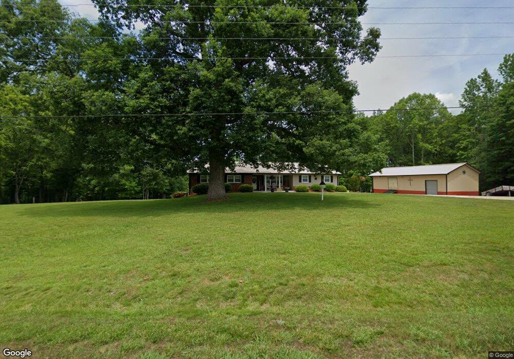
1469 Noahtown Rd Thomasville, NC 27360
Estimated Value: $188,000 - $418,000
3
Beds
1
Bath
4,630
Sq Ft
$65/Sq Ft
Est. Value
About This Home
This home is located at 1469 Noahtown Rd, Thomasville, NC 27360 and is currently estimated at $301,906, approximately $65 per square foot. 1469 Noahtown Rd is a home located in Davidson County with nearby schools including Brier Creek Elementary School, E. Lawson Brown Middle School, and East Davidson High School.
Ownership History
Date
Name
Owned For
Owner Type
Purchase Details
Closed on
Jul 18, 2007
Sold by
Bodenheimer Nancy R and Bodenheimer Johnny D
Bought by
Noah Ronald and Noah Belinda
Current Estimated Value
Home Financials for this Owner
Home Financials are based on the most recent Mortgage that was taken out on this home.
Original Mortgage
$65,000
Outstanding Balance
$40,944
Interest Rate
6.65%
Mortgage Type
Purchase Money Mortgage
Estimated Equity
$260,962
Purchase Details
Closed on
Jul 1, 1995
Purchase Details
Closed on
Aug 1, 1987
Create a Home Valuation Report for This Property
The Home Valuation Report is an in-depth analysis detailing your home's value as well as a comparison with similar homes in the area
Home Values in the Area
Average Home Value in this Area
Purchase History
| Date | Buyer | Sale Price | Title Company |
|---|---|---|---|
| Noah Ronald | $129,635 | None Available | |
| -- | $95,000 | -- | |
| -- | -- | -- |
Source: Public Records
Mortgage History
| Date | Status | Borrower | Loan Amount |
|---|---|---|---|
| Open | Noah Ronald | $65,000 |
Source: Public Records
Tax History Compared to Growth
Tax History
| Year | Tax Paid | Tax Assessment Tax Assessment Total Assessment is a certain percentage of the fair market value that is determined by local assessors to be the total taxable value of land and additions on the property. | Land | Improvement |
|---|---|---|---|---|
| 2025 | $1,339 | $211,820 | $0 | $0 |
| 2024 | $1,339 | $211,820 | $0 | $0 |
| 2023 | $1,360 | $211,820 | $0 | $0 |
| 2022 | $1,339 | $211,820 | $0 | $0 |
| 2021 | $1,339 | $211,820 | $0 | $0 |
| 2020 | $1,072 | $169,440 | $0 | $0 |
| 2019 | $1,089 | $169,440 | $0 | $0 |
| 2018 | $1,089 | $169,440 | $0 | $0 |
| 2017 | $1,089 | $169,440 | $0 | $0 |
| 2016 | $1,055 | $169,440 | $0 | $0 |
| 2015 | $1,055 | $169,440 | $0 | $0 |
| 2014 | $1,010 | $162,350 | $0 | $0 |
Source: Public Records
Map
Nearby Homes
- 731 Pauls Airport Rd
- 855 Blackberry Rd
- 298 Haven Hill Ln
- 3339 Kennedy Rd
- Lot 13/14 Hickory Trail
- 215 Fairfield Ct
- 8581 Us Highway 64 Hwy
- 1973 Old Mountain Rd
- 104 Max Moore Rd
- 00 Chipper Trail
- 4599 Red Oak Dr
- 344 Blythe Dr
- 2788 Fuller Mill Rd N
- 9272 & 9274 Us Highway 64 W
- 1759 Finch Farm Rd Unit 4
- 1761 Finch Farm Rd
- 6406 Calvary Way
- 808 John Black Rd
- 337 Glendale Ave
- 240 Glendale Ave
- 1480 Noahtown Rd
- 167 Buie Bodenheimer Rd
- 1533 Noahtown Rd
- 54B Jeanette Ln
- 54C Jeanette Ln
- Lot 54C Jeanette Ln
- Lot 54B Jeanette Ln
- 201 Jeanette Ln
- 1624 Noahtown Rd
- 231 Buie Bodenheimer Rd
- 176 Laurel Dr
- 1259 Noahtown Rd
- 156 Laurel Dr
- 180 Laurel Dr
- 1209 Noahtown Rd
- 1703 Noahtown Rd
- 363 Buie Bodenheimer Rd
- 1183 Noahtown Rd
- 296 Buie Bodenheimer Rd
- 296 Buie Bodenheimer Rd