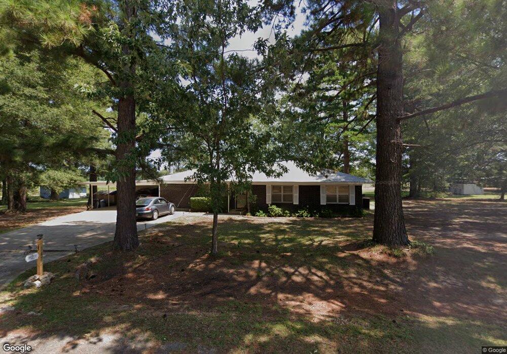
147 Airport Loop Springhill, LA 71075
Estimated Value: $139,000 - $148,000
3
Beds
2
Baths
1,580
Sq Ft
$90/Sq Ft
Est. Value
About This Home
This home is located at 147 Airport Loop, Springhill, LA 71075 and is currently estimated at $141,752, approximately $89 per square foot. 147 Airport Loop is a home located in Webster Parish with nearby schools including Browning Elementary School, Brown Upper Elementary School, and North Webster High School.
Ownership History
Date
Name
Owned For
Owner Type
Purchase Details
Closed on
Jul 20, 2023
Sold by
Callender Malone Sharon
Bought by
Malone Paul Thomas and Malone Melanie Brooke
Current Estimated Value
Home Financials for this Owner
Home Financials are based on the most recent Mortgage that was taken out on this home.
Original Mortgage
$131,312
Outstanding Balance
$127,601
Interest Rate
6.71%
Mortgage Type
New Conventional
Estimated Equity
$14,151
Purchase Details
Closed on
Nov 6, 2020
Sold by
Malone Larry R and Malone-Ambrose Lisa
Bought by
Malone Paul T
Create a Home Valuation Report for This Property
The Home Valuation Report is an in-depth analysis detailing your home's value as well as a comparison with similar homes in the area
Purchase History
| Date | Buyer | Sale Price | Title Company |
|---|---|---|---|
| Malone Paul Thomas | $129,999 | None Listed On Document | |
| Malone Paul T | -- | None Available | |
| Malone Larry R | $29,000 | None Available |
Source: Public Records
Mortgage History
| Date | Status | Borrower | Loan Amount |
|---|---|---|---|
| Open | Malone Paul Thomas | $131,312 |
Source: Public Records
Tax History
| Year | Tax Paid | Tax Assessment Tax Assessment Total Assessment is a certain percentage of the fair market value that is determined by local assessors to be the total taxable value of land and additions on the property. | Land | Improvement |
|---|---|---|---|---|
| 2025 | $240 | $9,420 | $550 | $8,870 |
| 2024 | $235 | $9,420 | $550 | $8,870 |
| 2023 | $118 | $8,560 | $500 | $8,060 |
| 2022 | $955 | $8,560 | $500 | $8,060 |
| 2021 | $954 | $8,560 | $500 | $8,060 |
| 2020 | $329 | $2,900 | $250 | $2,650 |
| 2019 | $324 | $2,900 | $250 | $2,650 |
| 2018 | $334 | $2,900 | $250 | $2,650 |
| 2017 | $331 | $2,900 | $250 | $2,650 |
| 2016 | $352 | $2,900 | $250 | $2,650 |
| 2010 | $327 | $2,900 | $250 | $2,650 |
Source: Public Records
Map
Nearby Homes
- 203 Airport Loop
- 894 Percy Burns Rd
- 511 King Orchard Rd
- 0 Elm St
- 900 MacHen Dr
- 405 8th St SE
- 423 11th St NE
- 304 8th St SE
- 107 6th St NE
- 407 S Park Dr
- 403 N Park Dr
- 404 4th St SE
- 212 1st Street Pinehill
- 0 Spring Branch Rd
- 2020 S Arkansas St
- 0 SW 1st St Unit 21062350
- 607 5th St NE
- 206 North St
- 0 June Anthony Dr
- 204 3rd St NW
- 135 Springhill Airport Rd
- 132 Springhill Airport Rd
- 166 Springhill Airport Rd
- 166 Springhill Airport Rd
- 105 Airport Loop
- 100 Springhill Airport Rd
- 265 Springhill Airport Rd
- 214 Springhill Airport Rd
- 193 Airport Loop
- 230 Airport Loop
- 260 Airport Loop
- 197 Springhill Airport Rd
- 266 Springhill Airport Rd
- 221 Airport Loop
- 201 Airport Loop
- 314 Springhill Airport Rd
- 240 Springhill Airport Rd
- 179 Springhill Airport Rd
- 184 Springhill Airport Rd
- 367 Springhill Airport Rd
Your Personal Tour Guide
Ask me questions while you tour the home.