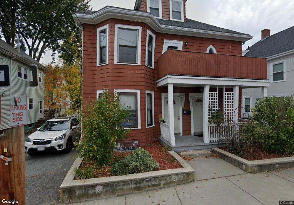
147 Charlesbank Rd Unit 1 Newton, MA 02458
Newton Corner NeighborhoodEstimated Value: $1,192,000 - $1,370,000
2
Beds
1
Bath
99,999
Sq Ft
$13/Sq Ft
Est. Value
About This Home
This home is located at 147 Charlesbank Rd Unit 1, Newton, MA 02458 and is currently estimated at $1,273,330, approximately $12 per square foot. 147 Charlesbank Rd Unit 1 is a home located in Middlesex County with nearby schools including Underwood Elementary School, Bigelow Middle School, and Newton North High School.
Ownership History
Date
Name
Owned For
Owner Type
Purchase Details
Closed on
Feb 28, 2001
Sold by
Jim Charles W and Ker Cynthia Y
Bought by
Ker Shu-Ming L
Current Estimated Value
Home Financials for this Owner
Home Financials are based on the most recent Mortgage that was taken out on this home.
Original Mortgage
$368,800
Outstanding Balance
$134,090
Interest Rate
7%
Mortgage Type
Purchase Money Mortgage
Estimated Equity
$1,139,240
Create a Home Valuation Report for This Property
The Home Valuation Report is an in-depth analysis detailing your home's value as well as a comparison with similar homes in the area
Home Values in the Area
Average Home Value in this Area
Purchase History
| Date | Buyer | Sale Price | Title Company |
|---|---|---|---|
| Ker Shu-Ming L | $461,000 | -- |
Source: Public Records
Mortgage History
| Date | Status | Borrower | Loan Amount |
|---|---|---|---|
| Open | Ker Shu-Ming L | $368,800 |
Source: Public Records
Tax History Compared to Growth
Tax History
| Year | Tax Paid | Tax Assessment Tax Assessment Total Assessment is a certain percentage of the fair market value that is determined by local assessors to be the total taxable value of land and additions on the property. | Land | Improvement |
|---|---|---|---|---|
| 2025 | $8,799 | $897,900 | $636,500 | $261,400 |
| 2024 | $8,508 | $871,700 | $618,000 | $253,700 |
| 2023 | $7,999 | $785,800 | $477,900 | $307,900 |
| 2022 | $7,654 | $727,600 | $442,500 | $285,100 |
| 2021 | $7,182 | $667,500 | $406,000 | $261,500 |
| 2020 | $6,969 | $667,500 | $406,000 | $261,500 |
| 2019 | $6,519 | $623,800 | $379,400 | $244,400 |
| 2018 | $6,371 | $588,800 | $353,700 | $235,100 |
| 2017 | $6,007 | $540,200 | $324,500 | $215,700 |
| 2016 | $5,640 | $495,600 | $297,700 | $197,900 |
| 2015 | $5,378 | $463,200 | $278,200 | $185,000 |
Source: Public Records
Map
Nearby Homes
- 65-67 Saint James Cir
- 10 Williams St Unit 39
- 10 Williams St Unit 56
- 159 Washington St Unit 4
- 164 Galen St Unit 88
- 164 Galen St Unit 65
- 4 Remick Terrace
- 4 Remick Terrace Unit 4
- 180 Hunnewell Ave Unit 180
- 9 Baldwin St Unit 15C
- 34 Channing St Unit 1
- 34 Channing St Unit 2
- 68 Vernon St
- 65 Pearl St Unit 1
- 1 Channing St
- 12 Richardson St Unit 14
- 33 Capitol St
- 25 Ladd St Unit 25
- 25 Ladd St
- 27 Ladd St Unit 27
- 147 Charlesbank Rd
- 147 Charlesbank Rd Unit 2
- 147 Charlesbank Rd
- 149 Charlesbank Rd Unit 2
- 149 Charlesbank Rd
- 143 Charlesbank Rd
- 151 Charlesbank Rd Unit 1
- 151 Charlesbank Rd
- 151 Charlesbank Rd Unit 2
- 151 Charlesbank Rd Unit 151
- 18 Nonantum Place Unit 2
- 18 Nonantum Place
- 18 Nonantum Place Unit 1
- 155 Charlesbank Rd Unit 157
- 157 Charlesbank Rd Unit 1
- 137 Charlesbank Rd
- 137 Charlesbank Rd Unit A
- 137 Charlesbank Rd Unit B
- 152 Charlesbank Rd
- 8 Nonantum Place