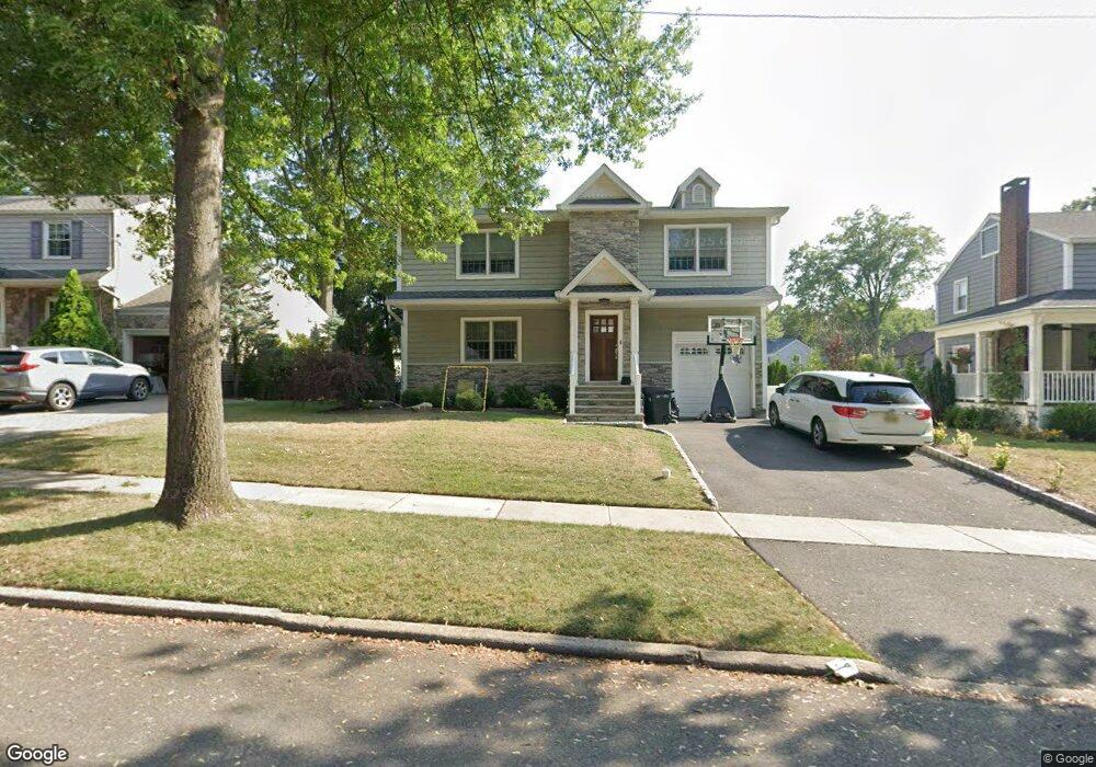
147 Concord Dr River Edge, NJ 07661
Estimated Value: $762,000 - $1,179,000
Studio
--
Bath
2,625
Sq Ft
$378/Sq Ft
Est. Value
About This Home
This home is located at 147 Concord Dr, River Edge, NJ 07661 and is currently estimated at $993,386, approximately $378 per square foot. 147 Concord Dr is a home located in Bergen County with nearby schools including Roosevelt Elementary School, River Dell Middle School, and River Dell Regional High School.
Ownership History
Date
Name
Owned For
Owner Type
Purchase Details
Closed on
Jan 26, 2017
Sold by
Talty Michael and Talty Ann
Bought by
Talty Derick and Talty Cynthia
Current Estimated Value
Home Financials for this Owner
Home Financials are based on the most recent Mortgage that was taken out on this home.
Original Mortgage
$300,000
Outstanding Balance
$249,217
Interest Rate
4.32%
Mortgage Type
New Conventional
Estimated Equity
$744,169
Purchase Details
Closed on
Mar 2, 2016
Sold by
Talty Barbara and Miert Velma Van
Bought by
Talty Michael and Talty Ann
Create a Home Valuation Report for This Property
The Home Valuation Report is an in-depth analysis detailing your home's value as well as a comparison with similar homes in the area
Home Values in the Area
Average Home Value in this Area
Purchase History
| Date | Buyer | Sale Price | Title Company |
|---|---|---|---|
| Talty Derick | $400,000 | Old Republic National Title | |
| Talty Michael | $330,000 | None Avilable |
Source: Public Records
Mortgage History
| Date | Status | Borrower | Loan Amount |
|---|---|---|---|
| Open | Talty Derick | $300,000 |
Source: Public Records
Tax History
| Year | Tax Paid | Tax Assessment Tax Assessment Total Assessment is a certain percentage of the fair market value that is determined by local assessors to be the total taxable value of land and additions on the property. | Land | Improvement |
|---|---|---|---|---|
| 2025 | $15,804 | $757,100 | $346,200 | $410,900 |
| 2024 | $15,410 | $398,600 | $204,200 | $194,400 |
| 2023 | $14,748 | $398,600 | $204,200 | $194,400 |
| 2022 | $14,748 | $398,600 | $204,200 | $194,400 |
| 2021 | $14,457 | $398,600 | $204,200 | $194,400 |
| 2020 | $14,230 | $398,600 | $204,200 | $194,400 |
| 2019 | $13,823 | $398,600 | $204,200 | $194,400 |
| 2018 | $13,532 | $398,600 | $204,200 | $194,400 |
| 2017 | $11,347 | $337,500 | $204,200 | $133,300 |
| 2016 | $11,090 | $337,500 | $204,200 | $133,300 |
| 2015 | $10,357 | $337,500 | $204,200 | $133,300 |
| 2014 | $10,378 | $337,500 | $204,200 | $133,300 |
Source: Public Records
Map
Nearby Homes
- 117 Monroe Ave
- 212 Monroe Ave
- 239 Greenway Terrace
- 378 Windsor Rd
- 457 the Fenway
- 409 Windsor Rd
- 3 Elm Place
- 406 Kinderkamack Rd
- 284 Continental Ave
- 784 Kinderkamack Rd Unit 101
- 405 Valley Rd
- 374 Valley Rd
- 652 Harvard St
- 33 Lincoln Ave
- 12 Gainesborough Terrace Unit 1B
- 668 River Rd
- 302 Howland Ave
- 42 Howland Ave
- 766 7th Ave
- 765 7th Ave
- 149 Concord Dr
- 151 Concord Dr
- 141 Concord Dr
- 144 Manning Ave
- 148 Manning Ave
- 142 Manning Ave
- 150 Manning Ave
- 137 Concord Dr
- 146 Concord Dr
- 140 Manning Ave
- 144 Concord Dr
- 148 Concord Dr
- 150 Concord Dr
- 140 Concord Dr
- 138 Manning Ave
- 136 Concord Dr
- 159 Concord Dr
- 135 Concord Dr
- 581 Bogert Rd
- 136 Manning Ave
Your Personal Tour Guide
Ask me questions while you tour the home.