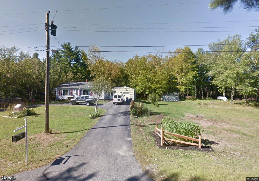
147 Country Club #2 Rd Sanford, ME 04073
South Sanford NeighborhoodEstimated Value: $301,000 - $457,000
3
Beds
1
Bath
1,189
Sq Ft
$318/Sq Ft
Est. Value
About This Home
This home is located at 147 Country Club #2 Rd, Sanford, ME 04073 and is currently estimated at $378,063, approximately $317 per square foot. 147 Country Club #2 Rd is a home located in York County.
Ownership History
Date
Name
Owned For
Owner Type
Purchase Details
Closed on
Jul 20, 2009
Sold by
Bourque Patrick V and Bourque Alberta M
Bought by
Hokinson Paul R and Howard Jennifer R
Current Estimated Value
Home Financials for this Owner
Home Financials are based on the most recent Mortgage that was taken out on this home.
Original Mortgage
$147,181
Outstanding Balance
$95,272
Interest Rate
5.31%
Mortgage Type
FHA
Estimated Equity
$282,791
Create a Home Valuation Report for This Property
The Home Valuation Report is an in-depth analysis detailing your home's value as well as a comparison with similar homes in the area
Home Values in the Area
Average Home Value in this Area
Purchase History
| Date | Buyer | Sale Price | Title Company |
|---|---|---|---|
| Hokinson Paul R | -- | -- |
Source: Public Records
Mortgage History
| Date | Status | Borrower | Loan Amount |
|---|---|---|---|
| Open | Hokinson Paul R | $147,181 |
Source: Public Records
Tax History Compared to Growth
Tax History
| Year | Tax Paid | Tax Assessment Tax Assessment Total Assessment is a certain percentage of the fair market value that is determined by local assessors to be the total taxable value of land and additions on the property. | Land | Improvement |
|---|---|---|---|---|
| 2025 | $3,880 | $226,900 | $44,800 | $182,100 |
| 2024 | $3,662 | $226,900 | $44,800 | $182,100 |
| 2023 | $3,407 | $225,000 | $44,800 | $180,200 |
| 2022 | $3,330 | $225,000 | $44,800 | $180,200 |
| 2021 | $3,281 | $180,500 | $44,800 | $135,700 |
| 2020 | $3,211 | $159,300 | $44,800 | $114,500 |
| 2019 | $3,091 | $149,300 | $44,800 | $104,500 |
| 2018 | $2,936 | $143,200 | $40,100 | $103,100 |
| 2017 | $2,827 | $136,300 | $40,100 | $96,200 |
| 2016 | $2,868 | $126,100 | $40,200 | $85,900 |
| 2015 | $2,649 | $130,200 | $45,400 | $84,800 |
| 2014 | $2,767 | $131,900 | $47,100 | $84,800 |
| 2013 | -- | $138,000 | $53,200 | $84,800 |
Source: Public Records
Map
Nearby Homes
- Lot 8E Country Club Rd
- TBD Ridge Terrace Unit Lot 7
- TBD Ridge Terrace Unit Lot 6
- Lot 1 Ridge Terrace
- 102 Country Club 1 Rd Unit 15A
- 102 Country Club 1 Rd Unit 11B
- 17 Airport Rd
- TBD Pheasant Ln
- 0 Pheasant Ln Unit 1633461
- 0 Pheasant Ln Unit 1611370
- 0 Airport Rd Unit 1634997
- 0 Airport Rd Unit 1624305
- 99 Channel Ln
- Lot 3 Gatehouse Rd
- Lot 1 Gatehouse Rd
- Lot 4 Gatehouse Rd
- Lot 2 Gatehouse Rd
- 8 Rock Pond Rd Unit 8
- 2 Bedrock Dr Unit 2
- 5 Bedrock Dr Unit 5
- 147 Country Club 2 Rd
- 155 Country Club 2 Rd
- 142 Country Club 2 Rd
- 142 Country Club Rd
- 158 Country Club 2 Rd
- 166 Country Club 2 Rd
- 134 Country Club 2 Rd
- 129 Country Club 2 Rd
- 170 Country Club 2 Rd
- 120 Country Way
- 111 Country Way Unit Lot 37
- 108 Country Way Unit Lot 16
- 132 Country Way Unit 23
- 115 Country Way Unit lot 38
- 130 Country Way Unit Lot 22
- 104 Country Way Unit Lot 15
- 125 Country Way Unit Lot 25
- 124 Country Way Unit 20
- 128 Country Way Unit Lot 21
- 107 Country Way Unit Lot 36