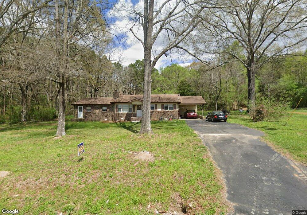
147 E Rogers Rd La Fayette, GA 30728
Estimated Value: $193,521 - $348,000
--
Bed
2
Baths
1,512
Sq Ft
$181/Sq Ft
Est. Value
About This Home
This home is located at 147 E Rogers Rd, La Fayette, GA 30728 and is currently estimated at $273,130, approximately $180 per square foot. 147 E Rogers Rd is a home located in Walker County with nearby schools including Naomi Elementary School, Lafayette Middle School, and Lafayette High School.
Ownership History
Date
Name
Owned For
Owner Type
Purchase Details
Closed on
May 11, 2001
Sold by
Bryson John Mark and Bryson Susan M
Bought by
Bryson Susan Mischel
Current Estimated Value
Purchase Details
Closed on
Sep 28, 1994
Sold by
Gilreath William D and Gilreath Wf
Bought by
Bryson John Mark and Bryson Susan M
Purchase Details
Closed on
Jul 28, 1967
Bought by
Gilreath William D and Gilreath Wf
Create a Home Valuation Report for This Property
The Home Valuation Report is an in-depth analysis detailing your home's value as well as a comparison with similar homes in the area
Home Values in the Area
Average Home Value in this Area
Purchase History
| Date | Buyer | Sale Price | Title Company |
|---|---|---|---|
| Bryson Susan Mischel | -- | -- | |
| Bryson John Mark | $60,000 | -- | |
| Gilreath William D | -- | -- |
Source: Public Records
Tax History Compared to Growth
Tax History
| Year | Tax Paid | Tax Assessment Tax Assessment Total Assessment is a certain percentage of the fair market value that is determined by local assessors to be the total taxable value of land and additions on the property. | Land | Improvement |
|---|---|---|---|---|
| 2024 | $1,284 | $54,789 | $18,599 | $36,190 |
| 2023 | $1,187 | $49,053 | $14,761 | $34,292 |
| 2022 | $940 | $35,963 | $6,505 | $29,458 |
| 2021 | $872 | $30,026 | $6,505 | $23,521 |
| 2020 | $818 | $26,977 | $6,505 | $20,472 |
| 2019 | $831 | $26,977 | $6,505 | $20,472 |
| 2018 | $714 | $26,977 | $6,505 | $20,472 |
| 2017 | $1,007 | $30,361 | $6,505 | $23,856 |
| 2016 | $631 | $22,494 | $6,505 | $15,989 |
| 2015 | $912 | $32,022 | $6,236 | $25,786 |
| 2014 | $822 | $32,022 | $6,236 | $25,786 |
| 2013 | -- | $32,021 | $6,236 | $25,785 |
Source: Public Records
Map
Nearby Homes
- 15 Old Lee School Rd
- 67 Old Warren School Rd
- 97 Old Warren School Rd
- 161 Old Warren School Rd
- 224 Old Warren School Rd
- 236 Old Warren School Rd
- 254 Old Warren School Rd
- 1511 Monroe Green Rd
- 2280 Highway S 27
- 2280 S Highway S 27
- 86 Beard Dr
- 9744 Highway 151
- 9744 Georgia 151
- 0 Martindale Rd Unit 10608820
- 0 Martindale Rd Unit 1520834
- 1299 Trion Hwy
- 91 Lee Edwards Dr
- 91 Lee Edwards Dr
- 626 Greenbush Rd
- 0 Ga Hwy 337 Unit LotWP001
- 197 E Rogers Rd
- 148 E Rogers Rd
- 228 E Rogers Rd
- 69 E Rogers Rd
- 189 E Rogers Rd
- E E Rogers Rd
- 0 W Rogers Rd Unit RTC2722941
- 0 W Rogers Rd Unit 1323561
- 0 W Rogers Rd Unit 1275060
- 0 W Rogers Rd Unit 1244171
- 0 W Rogers Rd Unit 115725
- 0 W Rogers Rd Unit 115740
- 0 W Rogers Rd Unit 1354421
- 0 W Rogers Rd Unit 10043809
- 0 W Rogers Rd Unit RTC2341452
- 0 W Rogers Rd Unit 113349
- 0 W Rogers Rd Unit 8528915
- 329 E Rogers Rd
- 76 E Rogers Rd
- 76 E Rogers Rd
