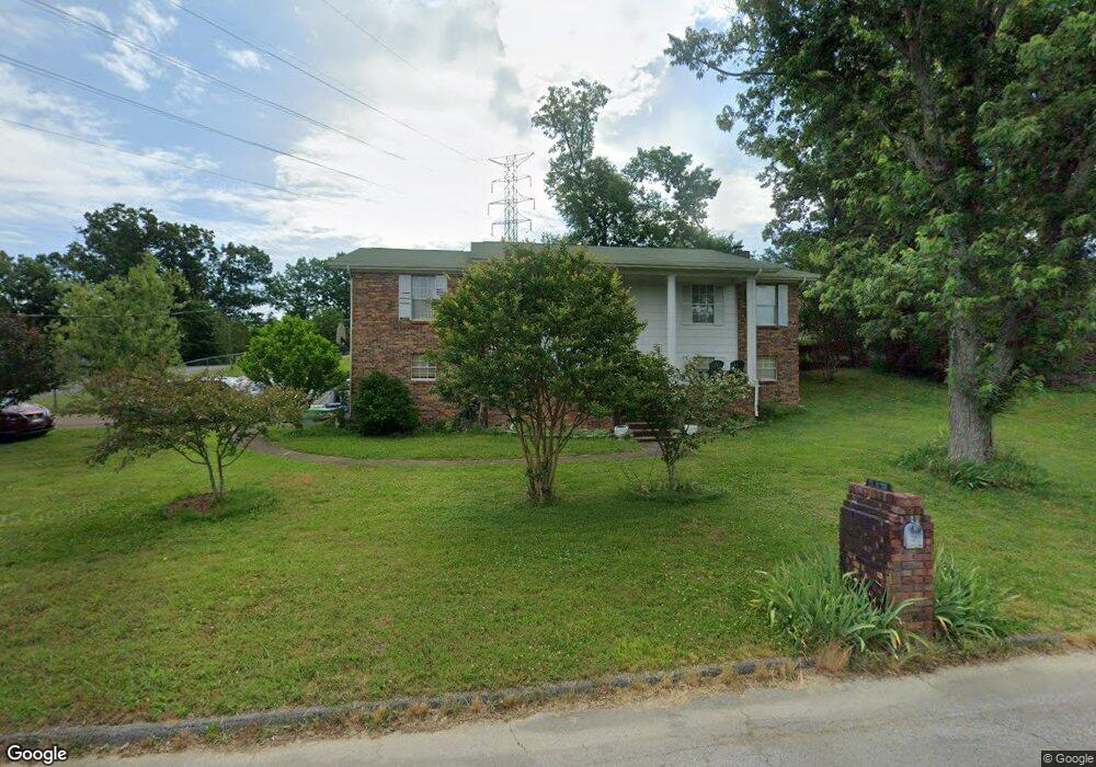
147 General Hays Rd Fort Oglethorpe, GA 30742
Estimated Value: $286,786 - $363,000
3
Beds
2
Baths
2,016
Sq Ft
$156/Sq Ft
Est. Value
About This Home
This home is located at 147 General Hays Rd, Fort Oglethorpe, GA 30742 and is currently estimated at $313,697, approximately $155 per square foot. 147 General Hays Rd is a home located in Catoosa County with nearby schools including Battlefield Primary School, Battlefield Elementary School, and Lakeview Middle School.
Ownership History
Date
Name
Owned For
Owner Type
Purchase Details
Closed on
Dec 21, 2006
Sold by
Jp Morgan Chase Bank
Bought by
Degraff Peter D
Current Estimated Value
Home Financials for this Owner
Home Financials are based on the most recent Mortgage that was taken out on this home.
Original Mortgage
$93,600
Outstanding Balance
$54,154
Interest Rate
6.1%
Mortgage Type
New Conventional
Estimated Equity
$259,543
Purchase Details
Closed on
Aug 1, 2006
Sold by
Mcbryar Douglas
Bought by
Jp Morgan Chase Bank
Create a Home Valuation Report for This Property
The Home Valuation Report is an in-depth analysis detailing your home's value as well as a comparison with similar homes in the area
Home Values in the Area
Average Home Value in this Area
Purchase History
| Date | Buyer | Sale Price | Title Company |
|---|---|---|---|
| Degraff Peter D | $117,000 | -- | |
| Jp Morgan Chase Bank | $123,250 | -- |
Source: Public Records
Mortgage History
| Date | Status | Borrower | Loan Amount |
|---|---|---|---|
| Open | Degraff Peter D | $93,600 |
Source: Public Records
Tax History
| Year | Tax Paid | Tax Assessment Tax Assessment Total Assessment is a certain percentage of the fair market value that is determined by local assessors to be the total taxable value of land and additions on the property. | Land | Improvement |
|---|---|---|---|---|
| 2025 | $2,064 | $103,480 | $10,000 | $93,480 |
| 2024 | $2,386 | $101,041 | $11,491 | $89,550 |
| 2023 | $1,902 | $78,481 | $11,491 | $66,990 |
| 2022 | $1,482 | $63,541 | $11,491 | $52,050 |
| 2021 | $1,392 | $63,541 | $11,491 | $52,050 |
| 2020 | $1,657 | $56,131 | $11,491 | $44,640 |
| 2019 | $1,336 | $56,131 | $11,491 | $44,640 |
| 2018 | $1,723 | $54,982 | $10,342 | $44,640 |
| 2017 | $1,595 | $54,592 | $10,342 | $44,250 |
| 2016 | $1,530 | $50,379 | $10,342 | $40,037 |
| 2015 | -- | $50,379 | $10,342 | $40,037 |
| 2014 | -- | $50,379 | $10,342 | $40,037 |
| 2013 | -- | $50,378 | $10,342 | $40,036 |
Source: Public Records
Map
Nearby Homes
- 1305 Park Forrest Dr
- 99 Battlewood Dr
- 124 Colony Cir
- 183 McDonald Dr
- 1708 Cannon Dr
- 351 Franklin Cir
- 12 Maple Ln
- 47 Spring Place Dr
- 425 Franklin Cir
- 52 S Glade Rd
- 71 Elaine Cir
- 699 Colony Cir
- 422 Linda Ln
- 792 Colony Cir
- 38 Phillips Dr
- 182 Evergreen Cir
- 875 Colony Cir
- 325 Mockingbird Ln
- 183 Evergreen Cir
- 178 Evergreen Cir
- 147 General Hayes Rd
- 143 General Hays Rd
- 0 General Hayes Rd Unit 1318420
- 0 General Hayes Rd Unit RTC2340696
- 142 Stuart Rd
- 146 General Hays Rd
- 150 General Hayes Rd
- 139 General Hays Rd
- 139 General Hayes Rd
- 138 Stuart Rd
- 142 General Hays Rd
- 50 General Davis Rd
- 138 General Hays Rd
- 239 Battlewood Dr
- 00 General Hays Rd
- 136 Stuart Rd
- 235 Battlewood Dr
- 135 General Hays Rd
- 135 General Hayes Rd
- 0 General Hays Rd