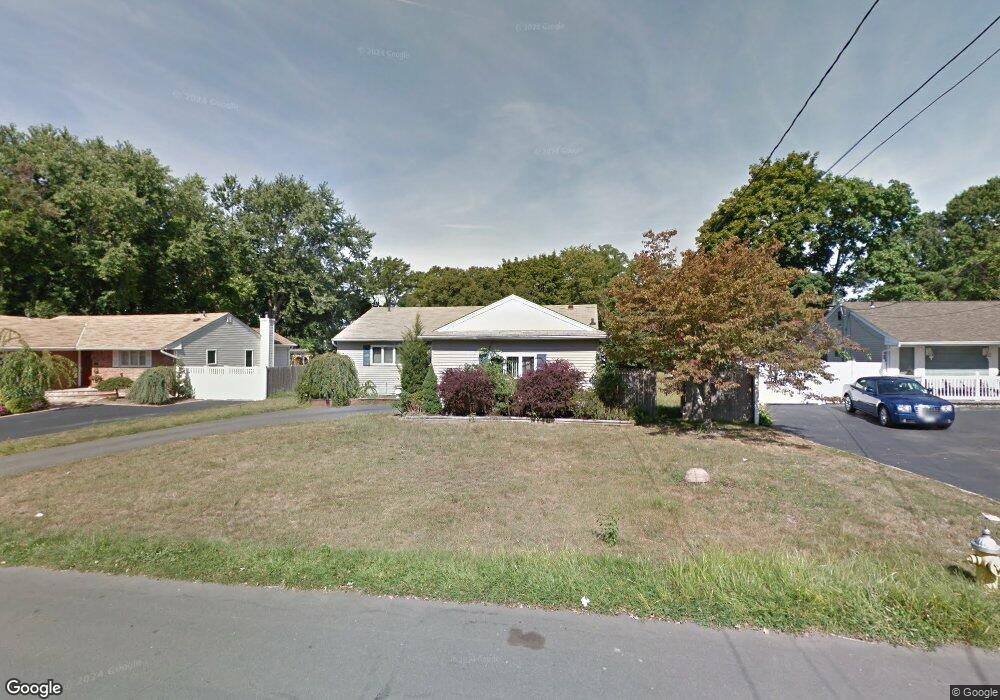
147 Liberty St Deer Park, NY 11729
Deer Park NeighborhoodEstimated Value: $617,000 - $723,000
--
Bed
--
Bath
1,127
Sq Ft
$607/Sq Ft
Est. Value
About This Home
This home is located at 147 Liberty St, Deer Park, NY 11729 and is currently estimated at $683,920, approximately $606 per square foot. 147 Liberty St is a home located in Suffolk County with nearby schools including Robert Frost Middle School, Deer Park High School, and Upper Room Christian School.
Ownership History
Date
Name
Owned For
Owner Type
Purchase Details
Closed on
Apr 27, 2018
Sold by
Capital Group Funding Llc
Bought by
Zhindon Wilson and Zhindon Elizabeth
Current Estimated Value
Home Financials for this Owner
Home Financials are based on the most recent Mortgage that was taken out on this home.
Original Mortgage
$414,277
Interest Rate
4.44%
Mortgage Type
New Conventional
Purchase Details
Closed on
Sep 29, 2017
Sold by
Angelo Robert A
Bought by
Capital Group Funding Llc
Home Financials for this Owner
Home Financials are based on the most recent Mortgage that was taken out on this home.
Original Mortgage
$288,000
Interest Rate
3.82%
Mortgage Type
New Conventional
Purchase Details
Closed on
Sep 24, 2001
Sold by
Heitmann Ann Marie and Deblasio Ann Marie
Bought by
Angelo Robert A
Home Financials for this Owner
Home Financials are based on the most recent Mortgage that was taken out on this home.
Original Mortgage
$200,000
Interest Rate
6.92%
Mortgage Type
Purchase Money Mortgage
Create a Home Valuation Report for This Property
The Home Valuation Report is an in-depth analysis detailing your home's value as well as a comparison with similar homes in the area
Home Values in the Area
Average Home Value in this Area
Purchase History
| Date | Buyer | Sale Price | Title Company |
|---|---|---|---|
| Zhindon Wilson | $422,000 | -- | |
| Capital Group Funding Llc | $270,000 | -- | |
| Angelo Robert A | $244,000 | Commonwealth Land Title Ins |
Source: Public Records
Mortgage History
| Date | Status | Borrower | Loan Amount |
|---|---|---|---|
| Previous Owner | Zhindon Wilson | $414,277 | |
| Previous Owner | Capital Group Funding Llc | $288,000 | |
| Previous Owner | Angelo Robert A | $200,000 |
Source: Public Records
Tax History Compared to Growth
Tax History
| Year | Tax Paid | Tax Assessment Tax Assessment Total Assessment is a certain percentage of the fair market value that is determined by local assessors to be the total taxable value of land and additions on the property. | Land | Improvement |
|---|---|---|---|---|
| 2024 | $11,434 | $3,340 | $270 | $3,070 |
| 2023 | $11,434 | $3,340 | $270 | $3,070 |
| 2022 | $7,568 | $3,340 | $270 | $3,070 |
| 2021 | $7,568 | $3,340 | $270 | $3,070 |
| 2020 | $10,498 | $3,340 | $270 | $3,070 |
| 2019 | $10,498 | $0 | $0 | $0 |
| 2018 | $7,643 | $3,340 | $270 | $3,070 |
| 2017 | $7,643 | $3,340 | $270 | $3,070 |
| 2016 | $7,605 | $3,340 | $270 | $3,070 |
| 2015 | -- | $3,340 | $270 | $3,070 |
| 2014 | -- | $3,340 | $270 | $3,070 |
Source: Public Records
Map
Nearby Homes
- 11 Susan Ct
- 118 Wright Ave
- 123 Claremont St
- 207 Eastwood Ave
- 215 Eastwood Ave
- 27 Leo Ln
- 78 Jefferson Ave
- 39 Wellington Ave
- 28 Glenda Dr
- 286 Old Country Rd
- 19 Madison Ave
- 109 Westwood Ave
- 27 Taca Blvd
- 640 Carlls Path
- 71 Irving Ave
- 467 Carlls Path
- 21 Pine Edge Place
- 61 Andover Dr
- 11 Cayuga Ave
- 123 Cayuga Ave
- 141 Liberty St
- 151 Liberty St
- 135 Liberty St
- 153 Liberty St
- 62 Pearsall Place
- 131 Liberty St
- 68 Pearsall Place
- 52 Pearsall Place
- 161 Liberty St
- 74 Pearsall Place
- 48 Pearsall Place
- 146 Liberty St
- 150 Liberty St
- 156 Liberty St
- 140 Liberty St
- 163 Liberty St
- 134 Liberty St
- 80 Pearsall Place
- 125 Liberty St
- 162 Liberty St