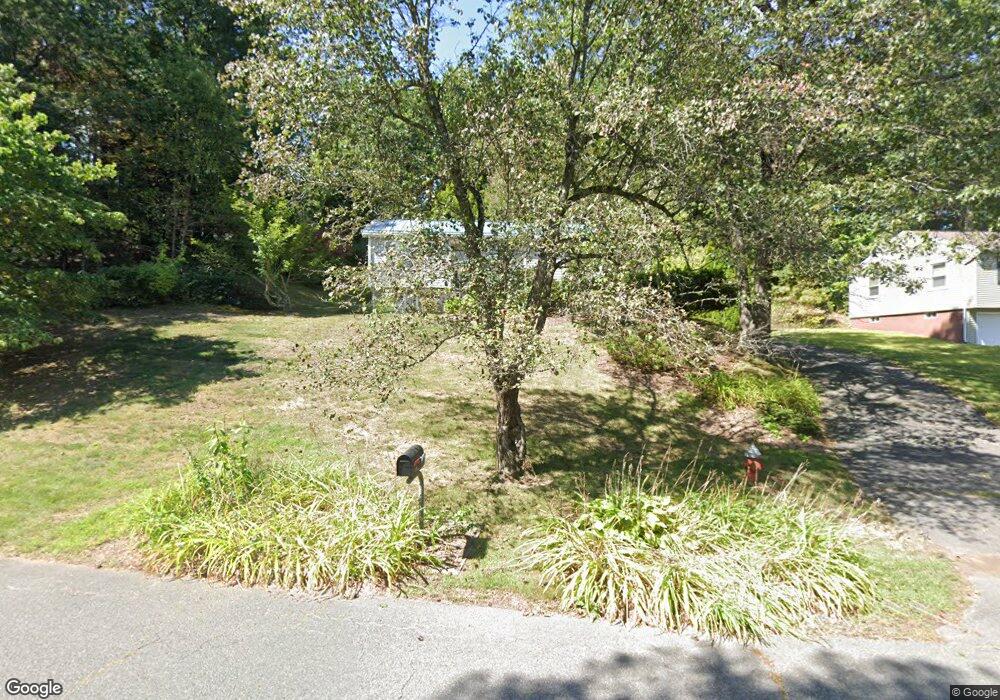
147 Logtown Rd Amherst, MA 01002
Estimated Value: $430,121 - $512,000
4
Beds
2
Baths
1,212
Sq Ft
$398/Sq Ft
Est. Value
About This Home
This home is located at 147 Logtown Rd, Amherst, MA 01002 and is currently estimated at $481,780, approximately $397 per square foot. 147 Logtown Rd is a home located in Hampshire County with nearby schools including Fort River Elementary School, Amherst Regional Middle School, and Amherst Regional High School.
Ownership History
Date
Name
Owned For
Owner Type
Purchase Details
Closed on
Aug 28, 2006
Sold by
Casteneda Parades Maribel
Bought by
Krupczynski Joseph B and Castaneda Maribel
Current Estimated Value
Home Financials for this Owner
Home Financials are based on the most recent Mortgage that was taken out on this home.
Original Mortgage
$210,000
Interest Rate
6.83%
Mortgage Type
Purchase Money Mortgage
Purchase Details
Closed on
May 18, 2005
Sold by
Paredes Maribel Castene and Paredes Miguel
Bought by
Paredes Maribel Castene
Purchase Details
Closed on
Aug 15, 2001
Sold by
Reyes Janet
Bought by
Paredes Maribel C and Paredes Miguel
Purchase Details
Closed on
May 31, 1996
Sold by
Roberts Mildred R
Bought by
Reyes Janet
Purchase Details
Closed on
Oct 13, 1989
Sold by
Langley James M
Bought by
Roberts Mildred R
Create a Home Valuation Report for This Property
The Home Valuation Report is an in-depth analysis detailing your home's value as well as a comparison with similar homes in the area
Home Values in the Area
Average Home Value in this Area
Purchase History
| Date | Buyer | Sale Price | Title Company |
|---|---|---|---|
| Krupczynski Joseph B | -- | -- | |
| Paredes Maribel Castene | -- | -- | |
| Paredes Maribel C | $174,900 | -- | |
| Reyes Janet | $110,000 | -- | |
| Roberts Mildred R | $139,600 | -- |
Source: Public Records
Mortgage History
| Date | Status | Borrower | Loan Amount |
|---|---|---|---|
| Open | Roberts Mildred R | $212,800 | |
| Closed | Krupczynski Joseph B | $210,000 | |
| Previous Owner | Roberts Mildred R | $6,000 | |
| Previous Owner | Roberts Mildred R | $166,000 |
Source: Public Records
Tax History
| Year | Tax Paid | Tax Assessment Tax Assessment Total Assessment is a certain percentage of the fair market value that is determined by local assessors to be the total taxable value of land and additions on the property. | Land | Improvement |
|---|---|---|---|---|
| 2025 | $71 | $397,400 | $159,100 | $238,300 |
| 2024 | $6,939 | $374,900 | $150,100 | $224,800 |
| 2023 | $6,482 | $322,500 | $136,500 | $186,000 |
| 2022 | $6,168 | $290,000 | $124,100 | $165,900 |
| 2021 | $5,865 | $268,800 | $114,900 | $153,900 |
| 2020 | $5,731 | $268,800 | $114,900 | $153,900 |
| 2019 | $5,563 | $255,200 | $114,900 | $140,300 |
| 2018 | $5,395 | $255,200 | $114,900 | $140,300 |
| 2017 | $5,564 | $254,900 | $109,500 | $145,400 |
| 2016 | $5,409 | $254,900 | $109,500 | $145,400 |
| 2015 | $5,236 | $254,900 | $109,500 | $145,400 |
Source: Public Records
Map
Nearby Homes
- 27 Summerfield Rd
- 53 Pine Grove Unit 53
- 10 Eaton Ct
- 36 Trillium Way
- 228 Aubinwood Rd
- 204 Aubinwood Rd
- 310 Belchertown Rd
- 130 Linden Ridge Rd
- 100 Larkspur Dr
- 61 S Valley Rd
- 12 Kettle Pond Rd
- 0 Heatherstone Rd
- 23 Alyssum Dr
- 494 Station Rd
- 16 Hawthorn Rd
- 0 Amherst Rd
- 9 Harkness Rd
- 6 Eveningstar Dr
- 390 Shays St
- 1114 S East St
- 143 Logtown Rd
- 18 Edge Hill Rd
- 137 Logtown Rd
- 16 Edge Hill Rd
- 22 Edge Hill Rd
- 12 Edge Hill Rd
- 144 Logtown Rd
- 148 Logtown Rd
- 8 Edge Hill Rd
- 140 Logtown Rd
- 135 Logtown Rd
- 152 Logtown Rd
- 24 Edge Hill Rd
- 136 Logtown Rd
- 4 Edge Hill Rd
- 155 Logtown Rd
- 25 Edge Hill Rd
- 127 Logtown Rd
- 13 Edgehill Place
- 13 Edge Hill Rd
Your Personal Tour Guide
Ask me questions while you tour the home.