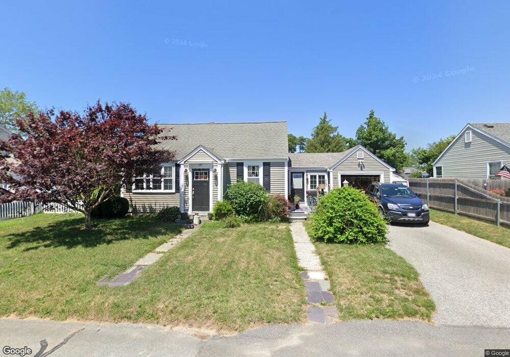
147 Metacomet Ave Swansea, MA 02777
Ocean Grove NeighborhoodEstimated Value: $354,000 - $405,000
3
Beds
1
Bath
1,085
Sq Ft
$355/Sq Ft
Est. Value
About This Home
This home is located at 147 Metacomet Ave, Swansea, MA 02777 and is currently estimated at $385,055, approximately $354 per square foot. 147 Metacomet Ave is a home located in Bristol County with nearby schools including Joseph Case High School, Swansea Wood School, and SCEC Life Academy.
Ownership History
Date
Name
Owned For
Owner Type
Purchase Details
Closed on
Apr 23, 2025
Sold by
Feeney Nancy L
Bought by
Feeney
Current Estimated Value
Purchase Details
Closed on
Nov 9, 1983
Bought by
Lheureux Nancy
Create a Home Valuation Report for This Property
The Home Valuation Report is an in-depth analysis detailing your home's value as well as a comparison with similar homes in the area
Home Values in the Area
Average Home Value in this Area
Purchase History
| Date | Buyer | Sale Price | Title Company |
|---|---|---|---|
| Feeney | -- | None Available | |
| Feeney | -- | None Available | |
| Lheureux Nancy | $48,000 | -- |
Source: Public Records
Mortgage History
| Date | Status | Borrower | Loan Amount |
|---|---|---|---|
| Previous Owner | Lheureux Nancy | $30,000 | |
| Previous Owner | Lheureux Nancy | $14,000 |
Source: Public Records
Tax History Compared to Growth
Tax History
| Year | Tax Paid | Tax Assessment Tax Assessment Total Assessment is a certain percentage of the fair market value that is determined by local assessors to be the total taxable value of land and additions on the property. | Land | Improvement |
|---|---|---|---|---|
| 2025 | $4,184 | $351,000 | $144,000 | $207,000 |
| 2024 | $4,161 | $347,000 | $144,000 | $203,000 |
| 2023 | $3,982 | $303,300 | $107,200 | $196,100 |
| 2022 | $3,789 | $263,300 | $93,200 | $170,100 |
| 2021 | $3,575 | $228,700 | $93,800 | $134,900 |
| 2020 | $3,624 | $232,600 | $97,800 | $134,800 |
| 2019 | $3,349 | $215,900 | $84,200 | $131,700 |
| 2018 | $3,207 | $209,900 | $78,800 | $131,100 |
| 2017 | $2,823 | $212,600 | $75,400 | $137,200 |
| 2016 | $2,585 | $191,200 | $72,900 | $118,300 |
| 2015 | $2,403 | $183,000 | $72,900 | $110,100 |
| 2014 | $2,314 | $180,200 | $72,900 | $107,300 |
Source: Public Records
Map
Nearby Homes
- 42 Anthony Ave
- 143 Metacomet Ave
- 155 Metacomet Ave
- 146 Metacomet Ave
- 23 Massasoit Ave
- 140 Metacomet Ave
- 156 Metacomet Ave
- 131 Metacomet Ave
- 32 Anthony Ave
- 134 Metacomet Ave
- 45 Anthony Ave
- 39 Anthony Ave
- 162 Metacomet Ave
- 15 Massasoit Ave
- 145 Cliff Ave
- 153 Cliff Ave
- 51 Anthony Ave
- 29 Anthony Ave
- 157 Cliff Ave
- 0 Park St Unit 70919108