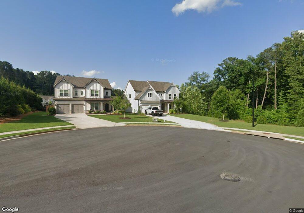
147 Mountainside Dr Unit 1 DRIVE Woodstock, GA 30188
Estimated Value: $648,681 - $713,000
5
Beds
5
Baths
2,919
Sq Ft
$233/Sq Ft
Est. Value
About This Home
This home is located at 147 Mountainside Dr Unit 1 DRIVE, Woodstock, GA 30188 and is currently estimated at $681,420, approximately $233 per square foot. 147 Mountainside Dr Unit 1 DRIVE is a home located in Cherokee County with nearby schools including Arnold Mill Elementary School, Mill Creek Middle School, and River Ridge High School.
Ownership History
Date
Name
Owned For
Owner Type
Purchase Details
Closed on
Oct 15, 2021
Sold by
Holman Edward George
Bought by
Compton Devon P
Current Estimated Value
Home Financials for this Owner
Home Financials are based on the most recent Mortgage that was taken out on this home.
Original Mortgage
$481,500
Outstanding Balance
$438,129
Interest Rate
2.8%
Mortgage Type
New Conventional
Estimated Equity
$243,291
Purchase Details
Closed on
Jun 25, 2020
Sold by
Beazer Gain Llc
Bought by
Holman Edward George and Holman Erika D
Home Financials for this Owner
Home Financials are based on the most recent Mortgage that was taken out on this home.
Original Mortgage
$449,325
Interest Rate
3.1%
Mortgage Type
New Conventional
Create a Home Valuation Report for This Property
The Home Valuation Report is an in-depth analysis detailing your home's value as well as a comparison with similar homes in the area
Home Values in the Area
Average Home Value in this Area
Purchase History
| Date | Buyer | Sale Price | Title Company |
|---|---|---|---|
| Compton Devon P | $535,000 | -- | |
| Holman Edward George | $449,325 | -- |
Source: Public Records
Mortgage History
| Date | Status | Borrower | Loan Amount |
|---|---|---|---|
| Open | Compton Devon P | $481,500 | |
| Previous Owner | Holman Edward George | $449,325 |
Source: Public Records
Tax History Compared to Growth
Tax History
| Year | Tax Paid | Tax Assessment Tax Assessment Total Assessment is a certain percentage of the fair market value that is determined by local assessors to be the total taxable value of land and additions on the property. | Land | Improvement |
|---|---|---|---|---|
| 2025 | $5,795 | $233,960 | $53,600 | $180,360 |
| 2024 | $5,728 | $233,120 | $53,600 | $179,520 |
| 2023 | $4,852 | $212,160 | $50,000 | $162,160 |
| 2022 | $4,842 | $188,360 | $41,600 | $146,760 |
| 2021 | $5,056 | $178,120 | $38,000 | $140,120 |
| 2020 | $909 | $32,000 | $32,000 | $0 |
| 2019 | $909 | $32,000 | $32,000 | $0 |
Source: Public Records
Map
Nearby Homes
- 706 Magnolia Way
- 525 Magnolia Dr
- 789 Cardinal Cove
- 519 Magnolia Dr
- 107 Wiley Bridge Ct
- 12180 Lonsdale Ln
- 5023 Gunners Run NE
- 1003 Wiley Bridge Rd
- 1001 Wiley Bridge Rd
- 989 Wiley Bridge Rd
- 110 Cherry St
- 226 Parc View Ln
- 112 Cherry 0 Cherry St
- 130 W Lake Dr
- 235 Foxley Way
- 123 Ivey Way
- 136 Wiley Parc Cir
- 147 Mountainside Dr Unit 1
- 147 Mountainside Dr Unit 21
- 147 Mountainside Dr
- 147 Mountainside #1 Dr
- 145 Mountainside Dr
- 137 Mountainside Dr Unit 23
- 137 Mountainside Dr
- 133 Mountainside Dr Unit 24
- 133 Mountainside Dr
- 117 Mountainside Dr
- 119 Mountainside Dr Unit 26
- 119 Mountainside Dr
- 115 Mountainside Dr Unit 28
- 115 Mountainside Dr
- 144 Mountainside Dr Unit 18
- 144 Mountainside Dr
- 146 Mountainside Dr Unit 19
- 146 Mountainside Dr Unit 26
- 146 Mountainside Dr
- 142 Mountainside Dr Unit 17