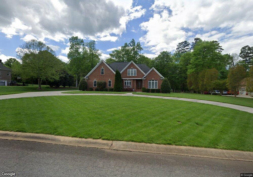
147 Patrick Ln Mount Holly, NC 28120
Estimated Value: $654,000 - $738,951
4
Beds
3
Baths
3,236
Sq Ft
$219/Sq Ft
Est. Value
About This Home
This home is located at 147 Patrick Ln, Mount Holly, NC 28120 and is currently estimated at $708,238, approximately $218 per square foot. 147 Patrick Ln is a home located in Gaston County with nearby schools including Rankin Elementary School, Mount Holly Middle School, and Stuart W. Cramer High School.
Ownership History
Date
Name
Owned For
Owner Type
Purchase Details
Closed on
May 19, 2008
Sold by
Sisk Steve K and Sisk Paige R
Bought by
Neely Billy Thomas and Neely Teresa Deal
Current Estimated Value
Purchase Details
Closed on
Jul 14, 2004
Sold by
Mcgee Charles L and Mcgee Sharon L
Bought by
Sisk Steve K and Sisk Paige R
Home Financials for this Owner
Home Financials are based on the most recent Mortgage that was taken out on this home.
Original Mortgage
$45,000
Interest Rate
6.25%
Mortgage Type
Purchase Money Mortgage
Create a Home Valuation Report for This Property
The Home Valuation Report is an in-depth analysis detailing your home's value as well as a comparison with similar homes in the area
Home Values in the Area
Average Home Value in this Area
Purchase History
| Date | Buyer | Sale Price | Title Company |
|---|---|---|---|
| Neely Billy Thomas | $70,000 | None Available | |
| Sisk Steve K | $50,000 | -- |
Source: Public Records
Mortgage History
| Date | Status | Borrower | Loan Amount |
|---|---|---|---|
| Previous Owner | Sisk Steve K | $45,000 |
Source: Public Records
Tax History Compared to Growth
Tax History
| Year | Tax Paid | Tax Assessment Tax Assessment Total Assessment is a certain percentage of the fair market value that is determined by local assessors to be the total taxable value of land and additions on the property. | Land | Improvement |
|---|---|---|---|---|
| 2025 | $6,973 | $694,530 | $65,000 | $629,530 |
| 2024 | $6,973 | $694,530 | $65,000 | $629,530 |
| 2023 | $7,049 | $694,530 | $65,000 | $629,530 |
| 2022 | $5,703 | $440,400 | $62,000 | $378,400 |
| 2021 | $5,791 | $440,400 | $62,000 | $378,400 |
| 2019 | $5,835 | $440,400 | $62,000 | $378,400 |
| 2018 | $4,160 | $297,150 | $48,400 | $248,750 |
| 2017 | $4,160 | $297,150 | $48,400 | $248,750 |
| 2016 | $2,585 | $297,150 | $0 | $0 |
| 2014 | $2,795 | $321,218 | $60,500 | $260,718 |
Source: Public Records
Map
Nearby Homes
- 101 Madison Dr
- 3631 Azalea Ridge Dr
- 703 Rankin Ave
- 101 Loya St
- 413 W Glendale Ave
- 201 1st St
- 504 N Hawthorne St
- 227 W Glendale Ave
- 221 Deerfield Dr
- 1015 Hoover Ave
- 128 Birchwood Ct
- 1045 Hoover Ave
- 00 Bell St
- 1024 Old Mountain View Rd
- 120 Abernathy St
- 105 S Tanninger Rd
- 5235 Clearwater Lake Rd
- 113 S Mulberry Ct
- 217 Highland St
- 422 Wilson St
- 133 Patrick Ln
- 159 Patrick Ln
- 146 Patrick Ln
- 165 Patrick Ln
- 121 Patrick Ln
- 162 Patrick Ln
- 116 Patrick Ln
- 105 Patrick Ln
- 435 W Central Ave
- 177 Woodhill Dr
- 431 W Central Ave
- 100 Woodhill Dr
- 165 Woodhill Dr
- 606 W Central Ave
- 608 W Central Ave
- 400 W Catawba Ave
- 000 Main Dr Unit 5
- 135 Woodhill Dr
- 135 Woodhill Dr Unit 5
- 143 Woodhill Dr