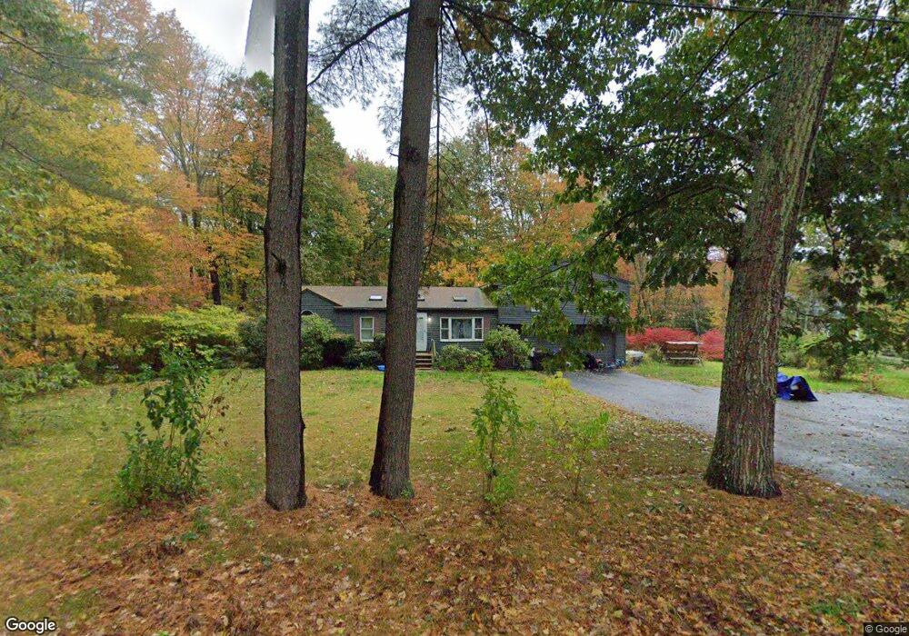
147 Portland Ave Old Orchard Beach, ME 04064
Estimated Value: $522,343 - $635,000
4
Beds
2
Baths
1,768
Sq Ft
$331/Sq Ft
Est. Value
About This Home
This home is located at 147 Portland Ave, Old Orchard Beach, ME 04064 and is currently estimated at $585,336, approximately $331 per square foot. 147 Portland Ave is a home located in York County with nearby schools including Jameson Elementary School, Loranger Memorial School, and Old Orchard Beach High School.
Ownership History
Date
Name
Owned For
Owner Type
Purchase Details
Closed on
Feb 14, 2007
Sold by
Plante Dean and Plante Tracy
Bought by
Oliver John J and Blanchette Bobbi-Jean
Current Estimated Value
Home Financials for this Owner
Home Financials are based on the most recent Mortgage that was taken out on this home.
Original Mortgage
$217,600
Outstanding Balance
$131,463
Interest Rate
6.5%
Mortgage Type
Adjustable Rate Mortgage/ARM
Estimated Equity
$453,873
Create a Home Valuation Report for This Property
The Home Valuation Report is an in-depth analysis detailing your home's value as well as a comparison with similar homes in the area
Home Values in the Area
Average Home Value in this Area
Purchase History
| Date | Buyer | Sale Price | Title Company |
|---|---|---|---|
| Oliver John J | -- | -- |
Source: Public Records
Mortgage History
| Date | Status | Borrower | Loan Amount |
|---|---|---|---|
| Open | Oliver John J | $217,600 | |
| Closed | Oliver John J | $54,400 |
Source: Public Records
Tax History Compared to Growth
Tax History
| Year | Tax Paid | Tax Assessment Tax Assessment Total Assessment is a certain percentage of the fair market value that is determined by local assessors to be the total taxable value of land and additions on the property. | Land | Improvement |
|---|---|---|---|---|
| 2024 | $4,642 | $426,700 | $115,000 | $311,700 |
| 2023 | $4,333 | $380,100 | $102,400 | $277,700 |
| 2022 | $4,297 | $351,100 | $93,200 | $257,900 |
| 2021 | $4,251 | $300,200 | $95,400 | $204,800 |
| 2020 | $4,358 | $282,600 | $86,700 | $195,900 |
| 2019 | $4,380 | $282,600 | $86,700 | $195,900 |
| 2018 | $4,218 | $275,700 | $86,700 | $189,000 |
| 2017 | $4,047 | $257,800 | $76,200 | $181,600 |
| 2016 | $3,953 | $255,700 | $74,100 | $181,600 |
| 2015 | $3,882 | $255,700 | $74,100 | $181,600 |
| 2014 | $3,805 | $255,700 | $74,100 | $181,600 |
| 2013 | $3,587 | $259,900 | $74,100 | $185,800 |
Source: Public Records
Map
Nearby Homes
- 20 Red Oak Dr Unit 2
- 26 Red Oak Dr Unit 5
- 16 Red Oak Dr
- 49 Red Oak Dr
- 21 Red Oak Dr
- 51 Red Oak Dr
- 14 Red Oak Dr
- 13 Red Oak Dr
- 15 Red Oak Dr
- 47 Red Oak Dr
- 12 Red Oak Dr
- 17 Red Oak Dr
- 45 Red Oak Dr
- 19 Red Oak Dr
- 9 or 53 Red Oak Dr
- 35 Red Oak Dr Unit 3
- 8 Sea Oaks Dr Unit 3
- 11 Sea Oaks Dr Unit 2
- 2 Sea Oaks Dr Unit 1
- 4 Sea Oaks Dr Unit 2
- 145 Portland Ave
- 154 Portland Ave
- 149 Portland Ave
- 2 Red Oak Dr
- 1 Red Oak Dr
- 143 Portland Ave
- 151 Portland Ave
- 3 Red Oak Dr
- 150 Portland Ave
- 5 Red Oak Dr
- 148 Portland Ave
- 153 Portland Ave
- 153 Portland Ave
- 153 Portland Ave Unit 2
- 146 Portland Ave
- 144 Portland Ave
- 23 Ross Rd
- 142 Portland Ave
- 155 Portland Ave
- 157 Portland Ave