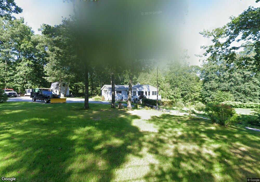
147 Ramshorn Rd Charlton, MA 01507
Estimated Value: $423,495 - $462,000
3
Beds
2
Baths
1,248
Sq Ft
$352/Sq Ft
Est. Value
About This Home
This home is located at 147 Ramshorn Rd, Charlton, MA 01507 and is currently estimated at $439,374, approximately $352 per square foot. 147 Ramshorn Rd is a home located in Worcester County with nearby schools including Shepherd Hill Regional High School.
Ownership History
Date
Name
Owned For
Owner Type
Purchase Details
Closed on
Sep 5, 2008
Sold by
Tri-Community Ymca Sou
Bought by
Alden Cheryl and Alden Daniel E
Current Estimated Value
Purchase Details
Closed on
Mar 31, 2006
Sold by
Alden Cheryl
Bought by
Alden Cheryl and Alden Daniel E
Purchase Details
Closed on
Jul 30, 2004
Sold by
Alden Cheryl and Alden Daniel
Bought by
Alden Cheryl
Home Financials for this Owner
Home Financials are based on the most recent Mortgage that was taken out on this home.
Original Mortgage
$31,000
Interest Rate
6.33%
Mortgage Type
Purchase Money Mortgage
Create a Home Valuation Report for This Property
The Home Valuation Report is an in-depth analysis detailing your home's value as well as a comparison with similar homes in the area
Home Values in the Area
Average Home Value in this Area
Purchase History
| Date | Buyer | Sale Price | Title Company |
|---|---|---|---|
| Alden Cheryl | $6,000 | -- | |
| Alden Cheryl | $6,000 | -- | |
| Alden Cheryl | -- | -- | |
| Alden Cheryl | -- | -- | |
| Alden Cheryl | -- | -- | |
| Alden Cheryl | -- | -- | |
| Alden Cheryl | -- | -- |
Source: Public Records
Mortgage History
| Date | Status | Borrower | Loan Amount |
|---|---|---|---|
| Previous Owner | Alden Cheryl | $31,000 | |
| Previous Owner | Alden Cheryl | $42,500 |
Source: Public Records
Tax History Compared to Growth
Tax History
| Year | Tax Paid | Tax Assessment Tax Assessment Total Assessment is a certain percentage of the fair market value that is determined by local assessors to be the total taxable value of land and additions on the property. | Land | Improvement |
|---|---|---|---|---|
| 2025 | $4,036 | $362,600 | $90,100 | $272,500 |
| 2024 | $3,885 | $342,600 | $90,100 | $252,500 |
| 2023 | $3,813 | $313,300 | $87,100 | $226,200 |
| 2022 | $3,588 | $270,000 | $79,300 | $190,700 |
| 2021 | $3,560 | $237,200 | $75,100 | $162,100 |
| 2020 | $3,499 | $234,200 | $72,100 | $162,100 |
| 2019 | $3,459 | $234,200 | $72,100 | $162,100 |
| 2018 | $3,162 | $234,200 | $72,100 | $162,100 |
| 2017 | $3,029 | $214,800 | $66,100 | $148,700 |
| 2016 | $2,927 | $212,400 | $66,100 | $146,300 |
| 2015 | $2,699 | $201,100 | $66,100 | $135,000 |
| 2014 | $2,600 | $205,400 | $68,700 | $136,700 |
Source: Public Records
Map
Nearby Homes
- 2 Potter Village Rd
- 65 Haggerty Rd
- 2 Lelandville Rd
- 3 Lelandville Rd
- 76 Number 6 Schoolhouse Rd
- 58 Colburn Rd
- 16 Sandersdale Rd
- 0 Partridge Hill Rd
- Lot 1 Mason Road Extension
- 337 Mason Road Extension
- 6 Blackwell Dr
- 60 Saundersdale Rd
- Lots 1+16 Pierpont Rd
- Lot 1A Sandersdale Rd
- Lot 3A Sandersdale Rd
- Lot 2A Sandersdale Rd
- 0 Putnam Rd
- 0 Freeman Rd Unit 73369281
- 20 Brentwood Dr
- 249 Dudley Southbridge Rd
- 149 Ramshorn Rd
- 3 George Woods Cir
- Lot 3 Ramshorn Rd
- Lot 7A Ramshorn Rd
- 135 Ramshorn Rd
- 2 George Woods Cir
- 2 George Woods Cir
- 133 Ramshorn Rd
- 140 Ramshorn Rd
- 144 Ramshorn Rd
- 142 Ramshorn Rd
- 1 George Woods Cir
- 146 Ramshorn Rd
- 129 Ramshorn Rd
- 136 Ramshorn Rd
- 130 Ramshorn Rd
- 148 Ramshorn Rd
- 127 Ramshorn Rd
- 126 Ramshorn Rd
- 123 Ramshorn Rd