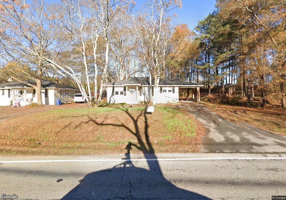
147 S Broad St Winder, GA 30680
Estimated Value: $194,000 - $264,000
2
Beds
1
Bath
1,120
Sq Ft
$213/Sq Ft
Est. Value
About This Home
This home is located at 147 S Broad St, Winder, GA 30680 and is currently estimated at $238,578, approximately $213 per square foot. 147 S Broad St is a home located in Barrow County with nearby schools including Kennedy Elementary School, Westside Middle School, and Apalachee High School.
Ownership History
Date
Name
Owned For
Owner Type
Purchase Details
Closed on
Feb 28, 2018
Sold by
Grant Justin
Bought by
Rac Properties Of Athens Inc
Current Estimated Value
Purchase Details
Closed on
Mar 13, 2015
Sold by
Fowlkes Lisa Fay
Bought by
Grant Justin and Manders Matthew David
Purchase Details
Closed on
Mar 10, 2015
Sold by
Chancey Harold
Bought by
Wright Ruth Chancey
Purchase Details
Closed on
Sep 15, 2014
Sold by
Wright Ruth Chancey
Bought by
Fowlkes Lisa Fay
Create a Home Valuation Report for This Property
The Home Valuation Report is an in-depth analysis detailing your home's value as well as a comparison with similar homes in the area
Home Values in the Area
Average Home Value in this Area
Purchase History
| Date | Buyer | Sale Price | Title Company |
|---|---|---|---|
| Rac Properties Of Athens Inc | $85,000 | -- | |
| Grant Justin | -- | -- | |
| Grant Justin | $70,000 | -- | |
| Wright Ruth Chancey | -- | -- | |
| Fowlkes Lisa Fay | -- | -- |
Source: Public Records
Tax History
| Year | Tax Paid | Tax Assessment Tax Assessment Total Assessment is a certain percentage of the fair market value that is determined by local assessors to be the total taxable value of land and additions on the property. | Land | Improvement |
|---|---|---|---|---|
| 2025 | $2,085 | $74,421 | $16,000 | $58,421 |
| 2024 | $2,071 | $72,600 | $16,000 | $56,600 |
| 2023 | $2,268 | $72,600 | $16,000 | $56,600 |
| 2022 | $1,788 | $51,164 | $16,000 | $35,164 |
| 2021 | $1,896 | $51,164 | $16,000 | $35,164 |
| 2020 | $1,918 | $51,164 | $16,000 | $35,164 |
| 2019 | $1,837 | $47,988 | $16,000 | $31,988 |
| 2018 | $1,630 | $41,835 | $16,536 | $25,299 |
| 2017 | $1,081 | $36,216 | $16,536 | $19,680 |
| 2016 | $975 | $36,216 | $16,536 | $19,680 |
| 2015 | $1,682 | $49,339 | $31,800 | $17,539 |
| 2014 | $1,152 | $33,121 | $15,582 | $17,539 |
| 2013 | -- | $32,256 | $15,582 | $16,674 |
Source: Public Records
Map
Nearby Homes
- 98 Circle Dr
- 155 Horton St
- 0 Horton St Unit 10643908
- 48 Horton St
- 609 Bill Rutledge Rd
- 2036 Massey Ln
- 2061 Massey Ln
- 21 Duke Cir
- 2147 Massey Ln
- 677 Massey St
- 0 Bill Rutledge Rd Unit 7630436
- 0 Bill Rutledge Rd Unit 10591503
- 1993 Township Dr
- 2051 Massey Ln
- 0 W Athens St Unit 10544465
- 34 Wade St
- 0 Georgia Highway 211 Unit 7483562
- 24 Richardson St
- 221 Highway 211 NW
- 175 Melrose St
- 152 S Broad St Unit B
- 152 S Broad St Unit A
- 152 S Broad St
- 152 S Broad St
- 48 Patrick Mill Rd
- 42 Patrick Mill Rd
- 38 Patrick Mill Rd
- Trac2 Patrick Mill Rd
- 47 Patrick Mill Rd
- 41 Patrick Mill Rd
- 53 Patrick Mill Rd
- 57 Patrick Mill Rd
- 70 Patrick Mill Rd
- 59 Bill Rutledge Rd
- 59 Patrick Mill Rd
- 61 Bill Rutledge Rd
- 61 Patrick Mill Rd
- 104 S Broad St
- 121 Sarah St
- 65 Patrick Mill Rd
Your Personal Tour Guide
Ask me questions while you tour the home.