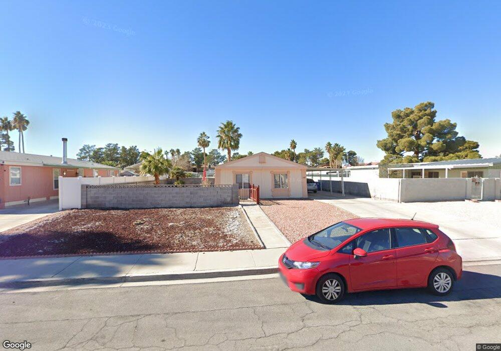
147 Sir Thomas Dr Las Vegas, NV 89110
Estimated Value: $235,000 - $250,000
2
Beds
2
Baths
1,056
Sq Ft
$228/Sq Ft
Est. Value
About This Home
This home is located at 147 Sir Thomas Dr, Las Vegas, NV 89110 and is currently estimated at $240,333, approximately $227 per square foot. 147 Sir Thomas Dr is a home located in Clark County with nearby schools including Richard J. Rundle Elementary School, Charlotte & Jerry Keller Elementary School, and Duane D. Keller Middle School.
Ownership History
Date
Name
Owned For
Owner Type
Purchase Details
Closed on
Jul 25, 1996
Sold by
Colbert Michael D and Colbert Gina M
Bought by
Daggs Charles R and Daggs Margaret A
Current Estimated Value
Home Financials for this Owner
Home Financials are based on the most recent Mortgage that was taken out on this home.
Original Mortgage
$105,564
Outstanding Balance
$8,426
Interest Rate
8.32%
Estimated Equity
$231,907
Purchase Details
Closed on
Jun 20, 1996
Sold by
Gillaspie Leila M
Bought by
Colbert Michael D and Colbert Gina M
Home Financials for this Owner
Home Financials are based on the most recent Mortgage that was taken out on this home.
Original Mortgage
$105,564
Outstanding Balance
$8,426
Interest Rate
8.32%
Estimated Equity
$231,907
Purchase Details
Closed on
Jun 10, 1996
Sold by
Perry Tim and Perry Kay L
Bought by
Gillaspie Leila M
Home Financials for this Owner
Home Financials are based on the most recent Mortgage that was taken out on this home.
Original Mortgage
$105,564
Outstanding Balance
$8,426
Interest Rate
8.32%
Estimated Equity
$231,907
Create a Home Valuation Report for This Property
The Home Valuation Report is an in-depth analysis detailing your home's value as well as a comparison with similar homes in the area
Home Values in the Area
Average Home Value in this Area
Purchase History
| Date | Buyer | Sale Price | Title Company |
|---|---|---|---|
| Daggs Charles R | $50,000 | Land Title | |
| Colbert Michael D | $37,500 | Ati Title | |
| Gillaspie Leila M | -- | Ati Title |
Source: Public Records
Mortgage History
| Date | Status | Borrower | Loan Amount |
|---|---|---|---|
| Open | Daggs Charles R | $105,564 |
Source: Public Records
Tax History Compared to Growth
Tax History
| Year | Tax Paid | Tax Assessment Tax Assessment Total Assessment is a certain percentage of the fair market value that is determined by local assessors to be the total taxable value of land and additions on the property. | Land | Improvement |
|---|---|---|---|---|
| 2025 | $464 | $49,668 | $22,400 | $27,268 |
| 2024 | $451 | $49,668 | $22,400 | $27,268 |
| 2023 | $451 | $44,190 | $18,550 | $25,640 |
| 2022 | $438 | $38,049 | $14,700 | $23,349 |
| 2021 | $425 | $35,872 | $13,650 | $22,222 |
| 2020 | $410 | $34,480 | $12,250 | $22,230 |
| 2019 | $398 | $31,805 | $9,800 | $22,005 |
| 2018 | $386 | $29,729 | $8,400 | $21,329 |
| 2017 | $715 | $23,924 | $6,650 | $17,274 |
| 2016 | $367 | $21,985 | $5,250 | $16,735 |
| 2015 | $365 | $22,300 | $4,900 | $17,400 |
| 2014 | $355 | $13,484 | $4,200 | $9,284 |
Source: Public Records
Map
Nearby Homes
- 153 Sir Thomas Dr
- 136 Sir George Dr
- 130 Bel Port Dr Unit 133
- 179 Sir George Dr
- 140 Sir David Way
- 5330 E Charleston Blvd Unit 2
- 5330 E Charleston Blvd Unit 113
- 111 Sir Arthur Dr
- 0 E Charleston Blvd
- 280 Sir Phillip St
- 147 N Christy Ln
- 1200 Pleasant Brook St
- 332 Sir Jeffery Cir
- 1224 Pleasant Brook St
- 5564 Orchard Ln Unit 133
- 360 Sir Richard Dr E
- 5353 Hollow Brook Ave
- 5600 Orchard Ln
- 4928 Ronan Dr
- 5583 Orchard Ln Unit 152
- 145 Sir Thomas Dr
- 143 Sir Thomas Dr
- 128 Sir George Dr
- 146 Sir Thomas Dr Unit 3
- 130 Sir George Dr
- 144 Sir Thomas Dr
- 139 Sir Thomas Dr
- 150 Sir Thomas Dr
- 150 Sir Thomas Dr Unit None
- 132 Sir George Dr
- 155 Sir Thomas Dr
- 137 Sir Thomas Dr
- 127 Sir George Dr
- 191 Betty Ln
- 123 Sir George Dr
- 193 Betty Ln
- 129 Sir George Dr
- 121 Sir George Dr