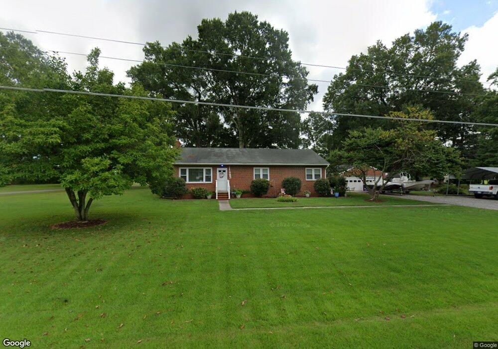
1470 E Euclid Blvd West Point, VA 23181
Estimated Value: $264,000 - $294,000
3
Beds
2
Baths
1,250
Sq Ft
$223/Sq Ft
Est. Value
About This Home
This home is located at 1470 E Euclid Blvd, West Point, VA 23181 and is currently estimated at $279,077, approximately $223 per square foot. 1470 E Euclid Blvd is a home located in King William County with nearby schools including West Point Elementary School, West Point Middle School, and West Point High School.
Ownership History
Date
Name
Owned For
Owner Type
Purchase Details
Closed on
Aug 31, 2005
Sold by
Old Dominion Grain Corp
Bought by
Ronk Johnny R
Current Estimated Value
Home Financials for this Owner
Home Financials are based on the most recent Mortgage that was taken out on this home.
Original Mortgage
$160,000
Outstanding Balance
$85,385
Interest Rate
5.81%
Mortgage Type
New Conventional
Estimated Equity
$193,692
Create a Home Valuation Report for This Property
The Home Valuation Report is an in-depth analysis detailing your home's value as well as a comparison with similar homes in the area
Home Values in the Area
Average Home Value in this Area
Purchase History
| Date | Buyer | Sale Price | Title Company |
|---|---|---|---|
| Ronk Johnny R | $20,000 | -- |
Source: Public Records
Mortgage History
| Date | Status | Borrower | Loan Amount |
|---|---|---|---|
| Open | Ronk Johnny R | $160,000 |
Source: Public Records
Tax History Compared to Growth
Tax History
| Year | Tax Paid | Tax Assessment Tax Assessment Total Assessment is a certain percentage of the fair market value that is determined by local assessors to be the total taxable value of land and additions on the property. | Land | Improvement |
|---|---|---|---|---|
| 2025 | $627 | $205,500 | $47,300 | $158,200 |
| 2024 | $555 | $205,500 | $47,300 | $158,200 |
| 2023 | $555 | $205,500 | $47,300 | $158,200 |
| 2022 | $591 | $157,500 | $47,300 | $110,200 |
| 2021 | $599 | $157,500 | $47,300 | $110,200 |
| 2020 | $599 | $195,700 | $29,800 | $165,900 |
| 2019 | $599 | $149,900 | $47,300 | $102,600 |
| 2018 | $614 | $157,500 | $47,300 | $110,200 |
| 2017 | $638 | $157,500 | $47,300 | $110,200 |
| 2016 | $646 | $157,500 | $47,300 | $110,200 |
| 2015 | $677 | $157,500 | $47,300 | $110,200 |
| 2014 | $777 | $0 | $0 | $0 |
Source: Public Records
Map
Nearby Homes
- LOT 16 Newman Dr
- LOT 16 B Newman Dr
- 4204 Mattaponi Ave
- 321 Pointers Dr
- 311 Pointers Dr
- 330 Pointers Dr
- 3559 Odi St
- 3557 Odi St
- 2660 N Oak Ln
- Lot 14 Goose Creek Rd
- 342 Ogden St
- .21ac King William Ave
- Lot 24 King William Ave
- Lot 25 King William Ave
- 332 Ogden St
- 322 Ogden St
- 314 Ogden St
- 605 Rivergate Terrace
- 3050 King William Ave
- Lot 23 Glen St
- 1480 E Euclid Blvd
- 1405-E E Euclid Blvd
- 1520 E Euclid Blvd
- 1400 E Euclid Blvd
- 3680 Blue Heron Ln
- 3570 Shoreline Dr
- 1390 E Euclid Blvd
- 3550 Shoreline Dr
- 3720 Blue Heron Ln
- 3710 Blue Heron Ln
- 1380 E Euclid Blvd
- 3560 Shoreline Dr
- 1420 Riverview Dr
- 1350 E Euclid Blvd
- 3680 Newman Dr
- 1520 E East Euclid Blvd
- 3680 Briarwood Ln
- 1380 Riverview Dr
- 3750 Blue Heron Ln
- 3740 Blue Heron Ln