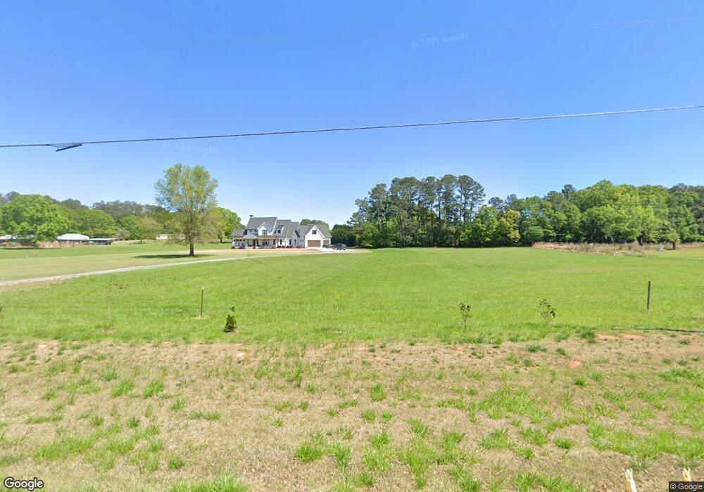
1470 Malcom Bridge Rd Bogart, GA 30622
Estimated Value: $69,000 - $704,000
3
Beds
2
Baths
1,713
Sq Ft
$225/Sq Ft
Est. Value
About This Home
This home is located at 1470 Malcom Bridge Rd, Bogart, GA 30622 and is currently estimated at $384,997, approximately $224 per square foot. 1470 Malcom Bridge Rd is a home located in Oconee County with nearby schools including Rocky Branch Elementary School, Malcom Bridge Middle School, and North Oconee High School.
Ownership History
Date
Name
Owned For
Owner Type
Purchase Details
Closed on
Jun 26, 2023
Sold by
Hamlett Leyman H Estate
Bought by
Hamlett Judith W
Current Estimated Value
Purchase Details
Closed on
Apr 14, 2014
Sold by
Hamlett Leyman H
Bought by
Wc Land Holdings Llc
Purchase Details
Closed on
Oct 8, 2013
Sold by
Hamlett Leyman H
Bought by
Hodges Scott and Hodges Allison
Purchase Details
Closed on
Jul 8, 2013
Sold by
Hamlett Leyman H
Bought by
Hamlett Leyman H and Hamlett Donna L
Create a Home Valuation Report for This Property
The Home Valuation Report is an in-depth analysis detailing your home's value as well as a comparison with similar homes in the area
Home Values in the Area
Average Home Value in this Area
Purchase History
| Date | Buyer | Sale Price | Title Company |
|---|---|---|---|
| Hamlett Judith W | -- | -- | |
| Wc Land Holdings Llc | $190,000 | -- | |
| Hodges Scott | $20,000 | -- | |
| Hamlett Leyman H | -- | -- |
Source: Public Records
Tax History Compared to Growth
Tax History
| Year | Tax Paid | Tax Assessment Tax Assessment Total Assessment is a certain percentage of the fair market value that is determined by local assessors to be the total taxable value of land and additions on the property. | Land | Improvement |
|---|---|---|---|---|
| 2024 | $580 | $190,556 | $100,105 | $90,451 |
| 2023 | $605 | $177,017 | $92,691 | $84,326 |
| 2022 | $501 | $146,285 | $74,153 | $72,132 |
| 2021 | $512 | $132,729 | $67,412 | $65,317 |
| 2020 | $496 | $121,056 | $61,284 | $59,772 |
| 2019 | $392 | $109,105 | $53,290 | $55,815 |
| 2018 | $351 | $96,345 | $48,445 | $47,900 |
| 2017 | $324 | $84,316 | $40,371 | $43,945 |
| 2016 | $1,881 | $79,426 | $36,702 | $42,724 |
| 2015 | -- | $77,014 | $36,702 | $40,313 |
| 2014 | -- | $109,983 | $70,676 | $39,307 |
| 2013 | -- | $0 | $0 | $0 |
Source: Public Records
Map
Nearby Homes
- 2632 Morningside Way
- 1381 Mayfair Way
- 3065 Brookhaven Dr
- 0 Us 53 Hwy Unit 10376334
- 1895 Vintage Place
- 1710 Whistling Creek
- 1381 Malcom Estates
- 2141 Malcom Estates
- 1190 Wareview Ct
- 2165 Harperfield Dr
- 1010 Long Creek Dr
- 1105 Harperfield Dr
- 1141 Field Ln
- 0 Clotfelter Rd Unit 1025303
- 1479 Mcfall Ct
- 1336 Prince Place
- 1071 Oaklake Cir
- 1120 Lancaster Ct
- 1061 Bent Creek Rd
- 1452 Malcom Bridge Rd
- 1101 Timarron Trail
- 1091 Timarron Trail
- 1011 Rocky Branch Farm Dr
- 1111 Timarron Trail
- 1081 Timarron Trail
- 1510 Malcom Bridge Rd
- 1071 Timarron Trail Unit Lot 5A
- 1071 Timarron Trail
- 1081 Timarron Trail
- 0 Timarron Trail Unit 3167420
- 0 Timarron Trail Unit 3133750
- 0 Timarron Trail
- 1091 Timarron Trail
- 1471 Malcom Bridge Rd
- 1101 Timarron Trail
- 1676 Malcom Bridge Rd
- 1070 Regency Walk Unit 61
- 1193 Brookhaven Dr Unit Lot 68
- 2289 Brookhaven Dr Unit Lot 5