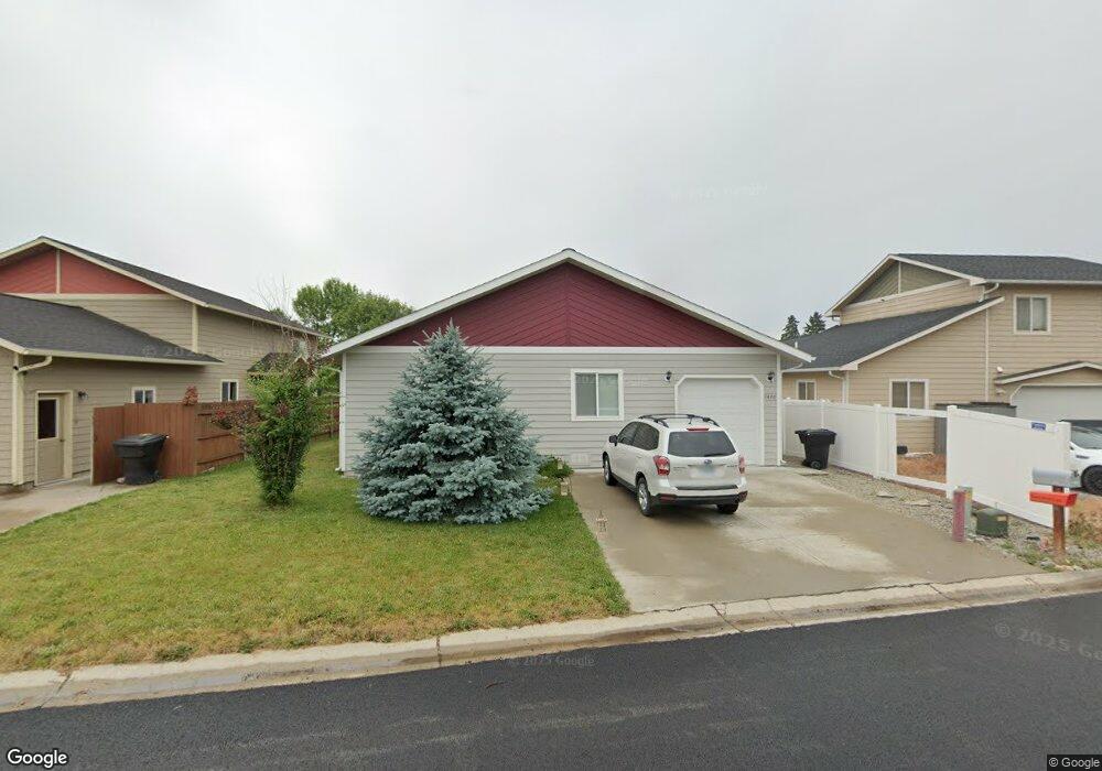
1470 Memory Ln Kalispell, MT 59901
Estimated Value: $429,025 - $464,000
3
Beds
2
Baths
1,300
Sq Ft
$341/Sq Ft
Est. Value
About This Home
This home is located at 1470 Memory Ln, Kalispell, MT 59901 and is currently estimated at $443,506, approximately $341 per square foot. 1470 Memory Ln is a home located in Flathead County with nearby schools including Cornelius Hedges School, Kalispell Middle School, and Flathead High School.
Ownership History
Date
Name
Owned For
Owner Type
Purchase Details
Closed on
Apr 17, 2013
Sold by
Johnson Gilchrist Paula M and Gilchrist Scott R
Bought by
Bb Development Company Llc
Current Estimated Value
Home Financials for this Owner
Home Financials are based on the most recent Mortgage that was taken out on this home.
Original Mortgage
$129,500
Outstanding Balance
$93,570
Interest Rate
4%
Mortgage Type
Adjustable Rate Mortgage/ARM
Estimated Equity
$349,936
Purchase Details
Closed on
Jul 14, 2006
Sold by
Inline Construction Inc
Bought by
Lundgren Gerald A and Ford Alice H
Create a Home Valuation Report for This Property
The Home Valuation Report is an in-depth analysis detailing your home's value as well as a comparison with similar homes in the area
Purchase History
| Date | Buyer | Sale Price | Title Company |
|---|---|---|---|
| Bb Development Company Llc | -- | First American Title Company | |
| Johnson Gilchrist Paula M | -- | First American Title Company | |
| Lundgren Gerald A | -- | Flathead County Title Compan |
Source: Public Records
Mortgage History
| Date | Status | Borrower | Loan Amount |
|---|---|---|---|
| Open | Johnson Gilchrist Paula M | $129,500 |
Source: Public Records
Tax History
| Year | Tax Paid | Tax Assessment Tax Assessment Total Assessment is a certain percentage of the fair market value that is determined by local assessors to be the total taxable value of land and additions on the property. | Land | Improvement |
|---|---|---|---|---|
| 2025 | $2,222 | $444,700 | $0 | $0 |
| 2024 | $3,056 | $392,300 | $0 | $0 |
| 2023 | $3,928 | $392,300 | $0 | $0 |
| 2022 | $2,537 | $252,500 | $0 | $0 |
| 2021 | $3,101 | $252,500 | $0 | $0 |
| 2020 | $2,772 | $36,453 | $0 | $0 |
| 2019 | $821 | $36,453 | $0 | $0 |
| 2018 | $860 | $38,959 | $0 | $0 |
| 2017 | $856 | $38,959 | $0 | $0 |
| 2016 | $698 | $33,025 | $0 | $0 |
| 2015 | $689 | $33,025 | $0 | $0 |
| 2014 | $926 | $34,597 | $0 | $0 |
Source: Public Records
Map
Nearby Homes
- 826 11th St E
- 1519 Woodland Ave
- 446 Valley Dr
- 1545 Lehi Ln
- 51 Selders Ln
- 1705 8th Ave E
- 1681 Bull Run
- 1683 Bull Run
- 1690 Bull Run
- 386 Willow Glen Dr
- 1305 4th Ave E
- 715 8th St E
- 270 Caroline Rd
- 1312 2nd Ave E
- 3953 US Highway 93 S
- 305 Kelly Rd Unit F-22
- 305 Kelly Rd Unit F21
- 184 Lawrence Ln
- 442 4th Ave E
- 141 Beargrass Ln
- 1468 Memory Ln
- 1472 Memory Ln
- 1474 Memory Ln
- 1466 Memory Ln
- 1418 Woodland Ave
- 1476 Memory Ln
- 1420 Woodland Ave
- 1416 Woodland Ave
- 1478 Memory Ln
- 1422 Woodland Ave
- 1422 Woodland Ave
- NHN Memory Ln
- 1480 Memory Ln
- LOT 11 Memory Ln
- LOT 14 Memory Ln
- LOT 13 Memory Ln
- LOT 15 Memory Ln
- Lot 16 Memory Ln
- 0 Memory Ln
- 1484 Memory Ln
Your Personal Tour Guide
Ask me questions while you tour the home.