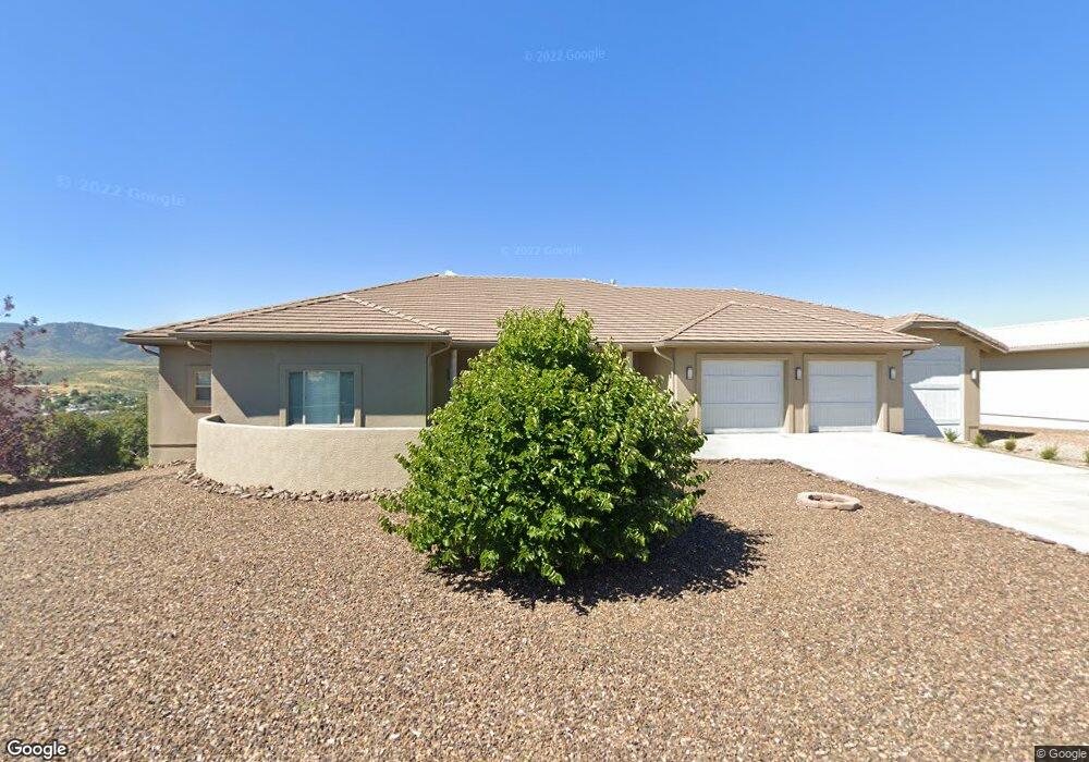
1470 N Overlook Dr Unit 6 Dewey, AZ 86327
Prescott Golf & Country Club NeighborhoodEstimated Value: $888,675 - $941,000
3
Beds
3
Baths
3,120
Sq Ft
$292/Sq Ft
Est. Value
About This Home
This home is located at 1470 N Overlook Dr Unit 6, Dewey, AZ 86327 and is currently estimated at $910,169, approximately $291 per square foot. 1470 N Overlook Dr Unit 6 is a home located in Yavapai County with nearby schools including Lake Valley Elementary School, Glassford Hill Middle School, and Bradshaw Mountain High School.
Ownership History
Date
Name
Owned For
Owner Type
Purchase Details
Closed on
Jul 28, 2023
Sold by
Bair Ryan Robert and Bair Marta Christine
Bought by
John B Haggenmiller Revocable Trust and Haggenmiller
Current Estimated Value
Purchase Details
Closed on
Nov 15, 2012
Sold by
Federal Home Loan Mortgage Corporation
Bought by
Bair Ryan Robet and Samuelson Marta Christine
Purchase Details
Closed on
Oct 26, 2012
Sold by
Wells Fargo Bank Na
Bought by
Federal Home Loan Mortgage Corp
Purchase Details
Closed on
Oct 3, 2012
Sold by
Branch Cliff and Branch Sharon
Bought by
Wells Fargo Bank Na
Purchase Details
Closed on
Dec 1, 2009
Sold by
Branch Cliff and Branch Sharon
Bought by
Branch Clifford W and Branch Sharon A
Purchase Details
Closed on
Mar 29, 2007
Sold by
Shull Frank T and Shull Mary Anne
Bought by
Branch Cliff and Branch Sharon
Home Financials for this Owner
Home Financials are based on the most recent Mortgage that was taken out on this home.
Original Mortgage
$338,400
Interest Rate
6.25%
Mortgage Type
Purchase Money Mortgage
Purchase Details
Closed on
May 2, 2006
Sold by
Royal West Investments Inc
Bought by
Shull Frank T and Shull Mary Anne
Purchase Details
Closed on
Sep 28, 1999
Sold by
Gohlich Edward J and Gohlich Marjorie F
Bought by
Royal West Investments Inc
Home Financials for this Owner
Home Financials are based on the most recent Mortgage that was taken out on this home.
Original Mortgage
$44,500
Interest Rate
7.76%
Mortgage Type
Seller Take Back
Purchase Details
Closed on
Jan 22, 1996
Sold by
Pcc6 Llc
Bought by
Gohlich Ii Edward J and Gohlich Marjorie F
Purchase Details
Closed on
May 18, 1995
Sold by
Normandin Michael B and Normandin Barbara J
Bought by
Pcc6 Llc
Purchase Details
Closed on
May 22, 1994
Sold by
Pcc6 L L C
Bought by
Normandin Michael B and Trank Barbara J
Home Financials for this Owner
Home Financials are based on the most recent Mortgage that was taken out on this home.
Original Mortgage
$38,400
Interest Rate
8.83%
Mortgage Type
Purchase Money Mortgage
Create a Home Valuation Report for This Property
The Home Valuation Report is an in-depth analysis detailing your home's value as well as a comparison with similar homes in the area
Home Values in the Area
Average Home Value in this Area
Purchase History
| Date | Buyer | Sale Price | Title Company |
|---|---|---|---|
| John B Haggenmiller Revocable Trust | $905,000 | Driggs Title Agency | |
| Bair Ryan Robet | -- | None Available | |
| Federal Home Loan Mortgage Corp | -- | Accommodation | |
| Wells Fargo Bank Na | $282,115 | Accommodation | |
| Branch Clifford W | -- | None Available | |
| Branch Cliff | $168,188 | Chicago Title Insurance Comp | |
| Shull Frank T | $147,000 | Yavapai Title Agency Inc | |
| Royal West Investments Inc | $63,500 | Capital Title Agency | |
| Gohlich Ii Edward J | $42,000 | Capital Title Agency | |
| Pcc6 Llc | $48,000 | Capital Title Agency | |
| Normandin Michael B | $48,000 | Capital Title Agency |
Source: Public Records
Mortgage History
| Date | Status | Borrower | Loan Amount |
|---|---|---|---|
| Previous Owner | Branch Cliff | $338,400 | |
| Previous Owner | Royal West Investments Inc | $44,500 | |
| Previous Owner | Normandin Michael B | $38,400 |
Source: Public Records
Tax History Compared to Growth
Tax History
| Year | Tax Paid | Tax Assessment Tax Assessment Total Assessment is a certain percentage of the fair market value that is determined by local assessors to be the total taxable value of land and additions on the property. | Land | Improvement |
|---|---|---|---|---|
| 2026 | $4,301 | $78,834 | -- | -- |
| 2024 | $3,945 | $85,658 | -- | -- |
| 2023 | $3,945 | $71,951 | $6,424 | $65,527 |
| 2022 | $3,872 | $51,722 | $5,908 | $45,814 |
| 2021 | $3,991 | $6,215 | $6,215 | $0 |
| 2020 | $3,831 | $0 | $0 | $0 |
| 2019 | $3,772 | $0 | $0 | $0 |
| 2018 | $3,581 | $0 | $0 | $0 |
| 2017 | $3,499 | $0 | $0 | $0 |
| 2016 | $3,370 | $0 | $0 | $0 |
| 2015 | -- | $0 | $0 | $0 |
| 2014 | -- | $0 | $0 | $0 |
Source: Public Records
Map
Nearby Homes
- 10550 E Cumberland Ct
- 1345 Sorrel Trail
- 10614 E High Point Dr
- 10676 E Singletree Trail
- 1424 N Rustlers Roost
- 1428 N Rustlers Roost
- 1426 N Rustlers Roost
- 10658 E High Point Dr
- 1550 N Neoga Cir
- 1395 N Rustlers Roost
- 10452 Buckskin Dr
- 1269 N Oxbow Dr
- 10735 E High Point Dr
- 1246 N Barzona Ave Unit F
- 1246 N Barzona Ave Unit G
- 10784 E Oxbow Dr
- 10559 E Manzanita Trail
- 1328 N Pinto Trail
- 10219 E Manzanita Trail
- 1049 N Arrowhead Ln
- 1470 N Overlook Dr
- 0 N Overlook Dr
- 90 N Overlook Dr
- 1492 N Overlook Dr Unit 6
- 94 E Cumberland Ct
- 1489 N Overlook Dr
- 1459 N Overlook Dr
- 1428 N Overlook Dr
- 10497 E Old Black Canyon Hwy
- 10497 E Old Black Canyon Hwy Unit 6
- 10491 E Old Black Canyon Hwy
- 10550 E Cumberland Ct
- 1501 N Overlook Dr
- 1431 N Overlook Dr
- 10511 E Old Black Canyon Hwy Unit 6
- 10479 E Old Black Canyon Hwy
- 10555 E Cumberland Ct
- 1400 N Overlook Dr Unit 83
- 1400 N Overlook Dr
- 10565 E Old Black Canyon Hwy