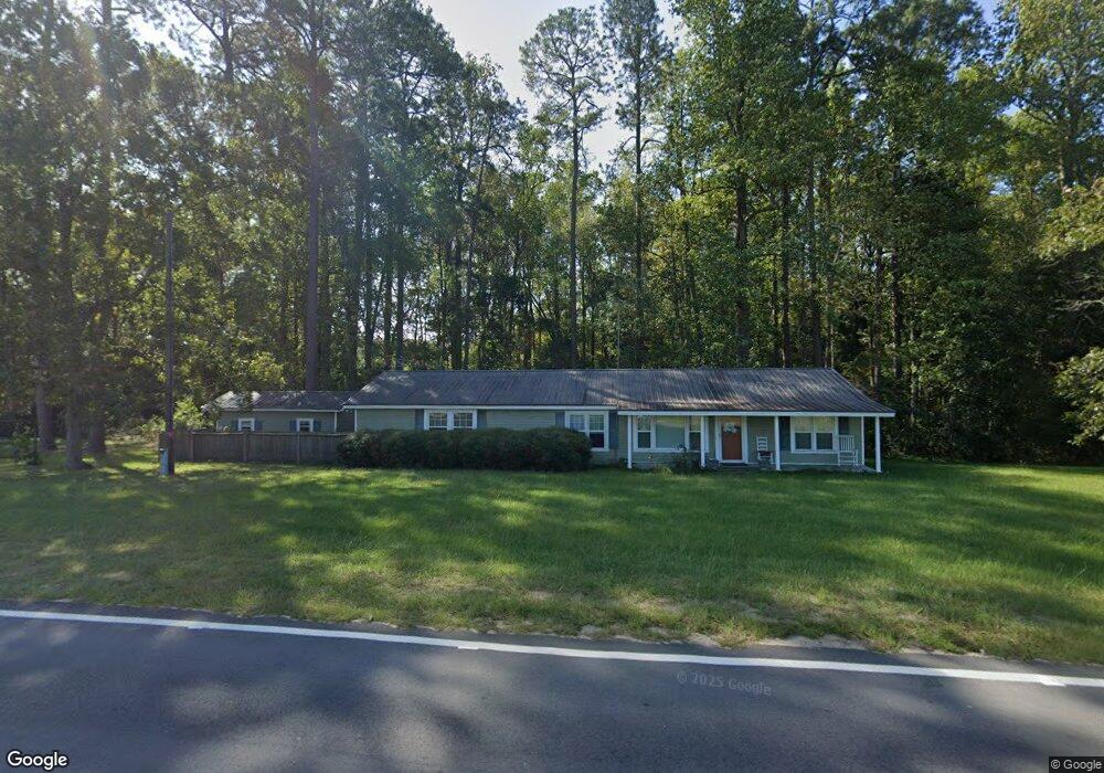
1470 Post Rd Hazlehurst, GA 31539
Estimated Value: $215,751 - $287,000
Studio
1
Bath
1,536
Sq Ft
$153/Sq Ft
Est. Value
About This Home
This home is located at 1470 Post Rd, Hazlehurst, GA 31539 and is currently estimated at $234,438, approximately $152 per square foot. 1470 Post Rd is a home located in Jeff Davis County with nearby schools including Jeff Davis Primary School, Jeff Davis Elementary School, and Jeff Davis Middle School.
Ownership History
Date
Name
Owned For
Owner Type
Purchase Details
Closed on
Dec 25, 2014
Sold by
White Ashley Nicole Hand
Bought by
Davis Kimberly Ann
Current Estimated Value
Purchase Details
Closed on
Mar 10, 2011
Sold by
Faulk John W
Bought by
White Brent M and White Ashley
Purchase Details
Closed on
Apr 20, 1993
Bought by
Faulk J W
Purchase Details
Closed on
Mar 2, 1990
Bought by
Faulk J W
Purchase Details
Closed on
Jan 1, 1962
Bought by
Faulk J W
Create a Home Valuation Report for This Property
The Home Valuation Report is an in-depth analysis detailing your home's value as well as a comparison with similar homes in the area
Home Values in the Area
Average Home Value in this Area
Purchase History
| Date | Buyer | Sale Price | Title Company |
|---|---|---|---|
| Davis Kimberly Ann | -- | -- | |
| Davis Kimberly Ann | -- | -- | |
| Hand Davis Kimberly Ann | -- | -- | |
| White Brent M | -- | -- | |
| Faulk J W | $6,200 | -- | |
| Faulk J W | -- | -- | |
| Faulk J W | -- | -- |
Source: Public Records
Tax History
| Year | Tax Paid | Tax Assessment Tax Assessment Total Assessment is a certain percentage of the fair market value that is determined by local assessors to be the total taxable value of land and additions on the property. | Land | Improvement |
|---|---|---|---|---|
| 2025 | $1,050 | $70,996 | $45,480 | $25,516 |
| 2024 | $1,152 | $69,532 | $44,280 | $25,252 |
| 2023 | $967 | $52,183 | $33,058 | $19,125 |
| 2022 | $956 | $52,183 | $33,058 | $19,125 |
| 2021 | $951 | $52,347 | $33,058 | $19,289 |
| 2020 | $941 | $52,347 | $33,058 | $19,289 |
| 2019 | $932 | $52,347 | $33,058 | $19,289 |
| 2018 | $922 | $52,347 | $33,058 | $19,289 |
| 2017 | $884 | $51,852 | $33,058 | $18,794 |
| 2016 | $1,356 | $47,776 | $28,982 | $18,794 |
| 2015 | -- | $42,944 | $26,636 | $16,308 |
| 2014 | -- | $38,410 | $22,007 | $16,403 |
Source: Public Records
Map
Nearby Homes
- 00 Henry Mims Rd
- 0 Henry-Mimbs Rd Unit 10701612
- 2110 Post Rd
- 0088 003A Pine Level Church Rd
- 1881 Bell Telephone Rd
- TRACT 1 - 112 Seahorse Rd
- TRACT 4 - 112 Seahorse Rd
- TRACT 3 - 112 Seahorse Rd
- TRACT 2 - 112 Seahorse Rd
- 60 Fred Hutchinson Rd
- Stewart Cemetery Rd
- 0 Stewart Cemetery Rd Unit 10650398
- TRACT 3 Rhonda Coleman Rd
- TRACT 2 Rhonda Coleman Rd
- 824 Old Dixie School Rd
- 00 Herrington Rd
- 0 Herrington Rd
- W 4th St
- 0 (35.01 Acres) Bacon School Rd
- 469 Dyal Rd
Your Personal Tour Guide
Ask me questions while you tour the home.