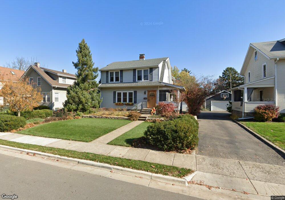
1470 Wyandotte Rd Columbus, OH 43212
Estimated Value: $636,324 - $912,000
4
Beds
3
Baths
2,352
Sq Ft
$308/Sq Ft
Est. Value
About This Home
This home is located at 1470 Wyandotte Rd, Columbus, OH 43212 and is currently estimated at $724,831, approximately $308 per square foot. 1470 Wyandotte Rd is a home located in Franklin County with nearby schools including Robert Louis Stevenson Elementary School, Larson Middle School, and Grandview Heights High School.
Ownership History
Date
Name
Owned For
Owner Type
Purchase Details
Closed on
Sep 13, 2016
Sold by
Todd Andrew P and Todd Denise
Bought by
Todd Andrew P and Todd Denise
Current Estimated Value
Purchase Details
Closed on
Mar 7, 1980
Bought by
Todd Andrew P and Todd Denise
Create a Home Valuation Report for This Property
The Home Valuation Report is an in-depth analysis detailing your home's value as well as a comparison with similar homes in the area
Home Values in the Area
Average Home Value in this Area
Purchase History
| Date | Buyer | Sale Price | Title Company |
|---|---|---|---|
| Todd Andrew P | -- | None Available | |
| Todd Andrew P | $42,700 | -- |
Source: Public Records
Tax History Compared to Growth
Tax History
| Year | Tax Paid | Tax Assessment Tax Assessment Total Assessment is a certain percentage of the fair market value that is determined by local assessors to be the total taxable value of land and additions on the property. | Land | Improvement |
|---|---|---|---|---|
| 2024 | $10,732 | $184,000 | $77,560 | $106,440 |
| 2023 | $9,401 | $183,995 | $77,560 | $106,435 |
| 2022 | $11,163 | $186,060 | $67,270 | $118,790 |
| 2021 | $10,451 | $186,060 | $67,270 | $118,790 |
| 2020 | $10,408 | $186,060 | $67,270 | $118,790 |
| 2019 | $10,546 | $166,850 | $67,270 | $99,580 |
| 2018 | $9,584 | $166,850 | $67,270 | $99,580 |
| 2017 | $9,250 | $166,850 | $67,270 | $99,580 |
| 2016 | $8,667 | $125,900 | $47,600 | $78,300 |
| 2015 | $8,667 | $125,900 | $47,600 | $78,300 |
| 2014 | $8,694 | $125,900 | $47,600 | $78,300 |
| 2013 | $3,819 | $114,450 | $43,260 | $71,190 |
Source: Public Records
Map
Nearby Homes
- 1561 Glenn Ave
- 1459 Elmwood Ave Unit 1459
- 1313 Lincoln Rd
- 2015 W 5th Ave Unit 211
- 2015 W 5th Ave Unit 102
- 2015 W 5th Ave Unit 108
- 1655-1657 Ashland Ave
- 1661 Ashland Ave Unit 663
- 1263 Oakland Ave
- 1631 Roxbury Rd Unit A1
- 1631 Roxbury Rd Unit F3
- 1631 Roxbury Rd Unit B6
- 1733 Elmwood Ave
- 1782 Wyandotte Rd
- 1475 W 3rd Ave Unit 204
- 1364 W 7th Ave
- 1000 Urlin Ave Unit 1822
- 1000 Urlin Ave Unit 2007
- 1000 Urlin Ave Unit 520
- 1000 Urlin Ave Unit 605
- 1482 Wyandotte Rd
- 1462 Wyandotte Rd
- 1486 Wyandotte Rd Unit 490
- 1486-1490 Wyandotte Rd
- 1452 Wyandotte Rd
- 1465 Glenn Ave
- 1459 Glenn Ave
- 1469 Glenn Ave
- 1455 Glenn Ave
- 1475 Glenn Ave
- 1471 Wyandotte Rd
- 1496 Wyandotte Rd
- 1477 Wyandotte Rd
- 1461 Wyandotte Rd
- 1445 Glenn Ave
- 1442 Wyandotte Rd
- 1481 Glenn Ave
- 1485 Wyandotte Rd
- 1440 Wyandotte Rd
- 1443 Glenn Ave