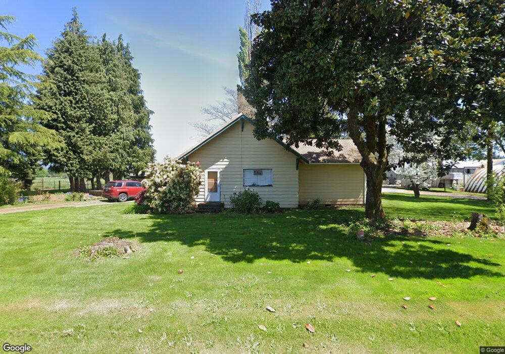
14707 NE 137th Ave Brush Prairie, WA 98606
Estimated Value: $1,024,000 - $1,592,226
6
Beds
4
Baths
2,346
Sq Ft
$563/Sq Ft
Est. Value
About This Home
This home is located at 14707 NE 137th Ave, Brush Prairie, WA 98606 and is currently estimated at $1,321,075, approximately $563 per square foot. 14707 NE 137th Ave is a home located in Clark County with nearby schools including Glenwood Heights Primary School, Laurin Middle School, and Prairie High School.
Ownership History
Date
Name
Owned For
Owner Type
Purchase Details
Closed on
Mar 7, 2025
Sold by
Kytola Larry S and Kytola Sandra L
Bought by
Kytola Sandra L
Current Estimated Value
Purchase Details
Closed on
Feb 9, 2004
Sold by
Kytola Larry S and Kytola Sandra L
Bought by
4 U Developments Llc
Home Financials for this Owner
Home Financials are based on the most recent Mortgage that was taken out on this home.
Original Mortgage
$334,000
Interest Rate
5.82%
Mortgage Type
Purchase Money Mortgage
Purchase Details
Closed on
Oct 12, 2000
Sold by
Kytola Sandra L and Kytola Larry S
Bought by
Kytola David W and Kytola Pamela J
Create a Home Valuation Report for This Property
The Home Valuation Report is an in-depth analysis detailing your home's value as well as a comparison with similar homes in the area
Home Values in the Area
Average Home Value in this Area
Purchase History
| Date | Buyer | Sale Price | Title Company |
|---|---|---|---|
| Kytola Sandra L | $313 | None Listed On Document | |
| 4 U Developments Llc | -- | Stewart Title | |
| Kytola David W | -- | -- |
Source: Public Records
Mortgage History
| Date | Status | Borrower | Loan Amount |
|---|---|---|---|
| Previous Owner | 4 U Developments Llc | $334,000 | |
| Closed | 4 U Developments Llc | $134,000 |
Source: Public Records
Tax History Compared to Growth
Tax History
| Year | Tax Paid | Tax Assessment Tax Assessment Total Assessment is a certain percentage of the fair market value that is determined by local assessors to be the total taxable value of land and additions on the property. | Land | Improvement |
|---|---|---|---|---|
| 2025 | $5,977 | $1,263,202 | $662,801 | $600,401 |
| 2024 | $5,083 | $1,273,898 | $662,801 | $611,097 |
| 2023 | $5,124 | $1,216,392 | $633,639 | $582,753 |
| 2022 | $5,017 | $1,187,228 | $659,240 | $527,988 |
| 2021 | $5,083 | $999,592 | $555,852 | $443,740 |
| 2020 | $4,960 | $918,374 | $510,834 | $407,540 |
| 2019 | $4,329 | $855,183 | $469,394 | $385,789 |
| 2018 | $5,151 | $475,660 | $0 | $0 |
| 2017 | $4,496 | $432,417 | $0 | $0 |
| 2016 | $4,341 | $410,788 | $0 | $0 |
| 2015 | $4,291 | $363,494 | $0 | $0 |
| 2014 | -- | $340,537 | $0 | $0 |
| 2013 | -- | $304,443 | $0 | $0 |
Source: Public Records
Map
Nearby Homes
- 0 NE 144th St Unit 2 23069373
- 15619 NE Caples Rd Unit 7
- 15619 NE Caples Rd Unit 95
- 15105 NE 152nd Ave
- 15014 NE Caples Rd
- 16010 NE 152nd Ave
- 16518 NE 142nd Ave
- 11606 NE 133rd Ave
- 13705 NE 118th Way
- 11613 NE 136th Ave
- 1610 SE 44th Cir
- 11703 NE 128th Place
- 11620 NE 131st Ave
- 13712 NE 116th Cir
- 4200 SE 17th Ave
- 4119 SE 17th Ave
- 11501 NE 131st Place
- 16316 NE 167th Ave
- 15403 NE 119th St
- 3838 SE 7th Ave
- 14816 NE 137th Ave
- 13508 NE 144th St
- 2513 Nee 144th St
- 13725 NE 144th St
- 13815 NE 151st St
- 14300 NE 144th St
- 24637 NE 151st St
- 13337 NE 151st St
- 14207 NE 144th St
- 14306 NE 144th St
- 0 151st St NE Unit 714613
- 0 151st St NE Unit 19322250
- 0 151st St NE Unit 18362136
- 13610 NE 151st St
- 13202 NE 144th St
- 14311 NE 132nd Ave
- 13416 NE 151st St
- 14101 NE 144th St
- 13018 NE 144th St
- 13206 NE 151st St