Estimated Value: $262,000 - $292,000
3
Beds
2
Baths
1,182
Sq Ft
$232/Sq Ft
Est. Value
About This Home
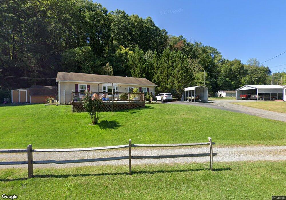
This home is located at 1471 Rock Ln, Salem, VA 24153 and is currently estimated at $274,408, approximately $232 per square foot. 1471 Rock Ln is a home located in Salem City with nearby schools including G.W. Carver Elementary School, Andrew Lewis Middle School, and Salem High School.
Ownership History
Date
Name
Owned For
Owner Type
Purchase Details
Closed on
Sep 27, 2006
Sold by
Vitro Lawrence V
Bought by
Thompson Maynard L
Current Estimated Value
Home Financials for this Owner
Home Financials are based on the most recent Mortgage that was taken out on this home.
Original Mortgage
$121,600
Outstanding Balance
$72,681
Interest Rate
6.49%
Mortgage Type
New Conventional
Estimated Equity
$201,727
Create a Home Valuation Report for This Property
The Home Valuation Report is an in-depth analysis detailing your home's value as well as a comparison with similar homes in the area
Home Values in the Area
Average Home Value in this Area
Purchase History
| Date | Buyer | Sale Price | Title Company |
|---|---|---|---|
| Thompson Maynard L | -- | None Available |
Source: Public Records
Mortgage History
| Date | Status | Borrower | Loan Amount |
|---|---|---|---|
| Open | Thompson Maynard L | $121,600 |
Source: Public Records
Tax History
| Year | Tax Paid | Tax Assessment Tax Assessment Total Assessment is a certain percentage of the fair market value that is determined by local assessors to be the total taxable value of land and additions on the property. | Land | Improvement |
|---|---|---|---|---|
| 2025 | $1,290 | $218,700 | $36,500 | $182,200 |
| 2024 | $1,204 | $200,600 | $34,900 | $165,700 |
| 2023 | $2,099 | $174,900 | $32,200 | $142,700 |
| 2022 | $1,924 | $160,300 | $29,500 | $130,800 |
| 2021 | $1,787 | $148,900 | $25,700 | $123,200 |
| 2020 | $1,742 | $145,200 | $25,700 | $119,500 |
| 2019 | $1,690 | $140,800 | $25,700 | $115,100 |
| 2018 | $1,631 | $138,200 | $25,700 | $112,500 |
| 2017 | $1,613 | $136,700 | $25,700 | $111,000 |
| 2016 | $1,613 | $136,700 | $25,700 | $111,000 |
| 2015 | $1,545 | $130,900 | $26,000 | $104,900 |
| 2014 | $1,545 | $130,900 | $26,000 | $104,900 |
Source: Public Records
Map
Nearby Homes
- 1000 BLK Polar Ln
- 332 Woodside Dr
- 328 Woodside Dr
- 324 Woodside Dr
- 2955 Emissary Dr
- 205 Northern Trail
- 316 Polar Ln
- 5618 Plain View Ave
- 5813 Wayburn Dr
- 512 Parkdale Dr
- 1718 Laurel Mountain Dr
- 0 Barnett Cir NW Unit B
- 0 Barnett Cir NW Unit A
- 1639 Sunset Ave
- 1766 Laurel Mountain Dr
- 2844 Tully Dr
- TBD Laurel Mountain Rd
- 1685 Sigmon Rd NW
- 1720 Millbrook St
- 5141 Youngwood Dr NW
- 1059 Kessler Mill Rd
- 1474 Rock Ln
- 1061 Kessler Mill Rd
- 1050 Kessler Mill Rd
- 1450 Rock Ln
- 1400 Polar Ln
- 1031 Kessler Mill Rd
- 1079 Kessler Mill Rd
- 1400 Rock Ln
- 1032 Kessler Mill Rd
- 1032 Kessler Mill Rd
- 1080 Kessler Mill Rd
- 1036 Kessler Mill Rd
- 1070 Kessler Mill Rd
- 1200 Polar Ln
- 1016 Kessler Mill Rd
- 1028 Kessler Mill Rd
- 1102 Kessler Mill Rd
- 1106 Kessler Mill Rd
- 1104 Kessler Mill Rd
Your Personal Tour Guide
Ask me questions while you tour the home.