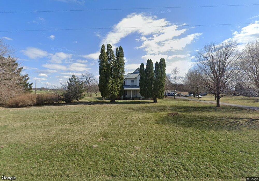
1471 State Route 613 Mc Comb, OH 45858
McComb NeighborhoodEstimated Value: $165,000 - $228,000
4
Beds
2
Baths
2,536
Sq Ft
$75/Sq Ft
Est. Value
About This Home
This home is located at 1471 State Route 613, Mc Comb, OH 45858 and is currently estimated at $190,557, approximately $75 per square foot. 1471 State Route 613 is a home located in Hancock County with nearby schools including McComb Elementary School, McComb Middle School, and Mccomb Local High School.
Ownership History
Date
Name
Owned For
Owner Type
Purchase Details
Closed on
Jul 23, 2024
Sold by
Billingsley John C
Bought by
Bbnrr Dreams Irrevocable Trust and Ippolito
Current Estimated Value
Purchase Details
Closed on
Mar 1, 2024
Sold by
Nicholas-Taylor Bonnie L
Bought by
Taylor Robert
Purchase Details
Closed on
Jan 24, 1994
Bought by
Taylor Bradley and Nicholas-Taylor Bo
Create a Home Valuation Report for This Property
The Home Valuation Report is an in-depth analysis detailing your home's value as well as a comparison with similar homes in the area
Home Values in the Area
Average Home Value in this Area
Purchase History
| Date | Buyer | Sale Price | Title Company |
|---|---|---|---|
| Bbnrr Dreams Irrevocable Trust | -- | None Listed On Document | |
| Taylor Robert | $150,000 | None Listed On Document | |
| Taylor Bradley | $60,000 | -- |
Source: Public Records
Tax History Compared to Growth
Tax History
| Year | Tax Paid | Tax Assessment Tax Assessment Total Assessment is a certain percentage of the fair market value that is determined by local assessors to be the total taxable value of land and additions on the property. | Land | Improvement |
|---|---|---|---|---|
| 2024 | $1,672 | $50,490 | $10,170 | $40,320 |
| 2023 | $1,668 | $50,690 | $10,170 | $40,520 |
| 2022 | $1,710 | $50,690 | $10,170 | $40,520 |
| 2021 | $1,341 | $35,200 | $10,080 | $25,120 |
| 2020 | $1,341 | $35,200 | $10,080 | $25,120 |
| 2019 | $1,279 | $35,200 | $10,080 | $25,120 |
| 2018 | $1,089 | $31,630 | $8,760 | $22,870 |
| 2017 | $1,096 | $31,630 | $8,760 | $22,870 |
| 2016 | $1,017 | $31,630 | $8,760 | $22,870 |
| 2015 | $1,031 | $31,720 | $8,760 | $22,960 |
| 2014 | $1,068 | $32,820 | $8,760 | $24,060 |
| 2012 | $1,145 | $32,820 | $8,760 | $24,060 |
Source: Public Records
Map
Nearby Homes
- 358 State Route 613
- 3699 State Route 613
- 223 N Church St
- 223 Cherry St
- 0 Joshua Rd Unit 6126475
- 102 Meadowshire Dr
- 5330 State Route 186
- 4134 County Road 203
- 3019 Ohio 235
- 1381 County Road 5
- D273 Co Rd 1
- 687 State Route 235
- 9984 State Route 235
- 60 Rush St
- 4629 State Route 65
- 132 Main St
- 634 Ohio St
- 504 E Main St
- 111 E Sugar St
- 13 E Liberty St
- 1518 State Route 613
- 1679 State Route 613
- 1679 Ohio 613
- 1235 Ohio 613
- 1235 State Route 613
- 1235 St Route
- 5082 Township Road 117
- 0 County Road 53
- 5320 County Road 53
- 5091 C R 53
- 5091 County Road 53
- 5374 County Road 53
- 5406 Township Road 117
- 5349 C R 53
- 2023 State Route 613
- 5428 County Road 53
- 5349 County Road 53
- 2148 Ohio 613
- 2148 State Route 613
- 5645 Township Rd 117