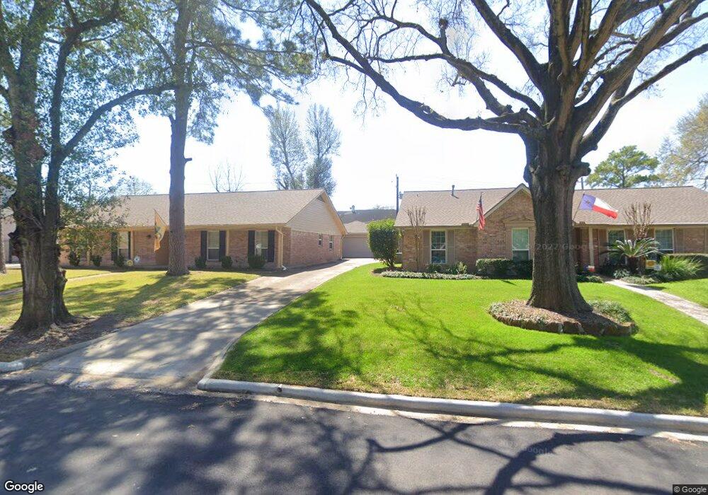
14710 Perthshire Rd Unit 25 Houston, TX 77079
Energy Corridor NeighborhoodEstimated Value: $216,762 - $239,000
3
Beds
3
Baths
1,978
Sq Ft
$116/Sq Ft
Est. Value
About This Home
This home is located at 14710 Perthshire Rd Unit 25, Houston, TX 77079 and is currently estimated at $228,941, approximately $115 per square foot. 14710 Perthshire Rd Unit 25 is a home located in Harris County with nearby schools including Nottingham Elementary School, Spring Forest Middle School, and Stratford High School.
Ownership History
Date
Name
Owned For
Owner Type
Purchase Details
Closed on
Apr 9, 2004
Sold by
Traina Charles A and Traina Ronald A
Bought by
Ford Douglas C
Current Estimated Value
Home Financials for this Owner
Home Financials are based on the most recent Mortgage that was taken out on this home.
Original Mortgage
$88,000
Outstanding Balance
$41,267
Interest Rate
5.61%
Mortgage Type
Purchase Money Mortgage
Estimated Equity
$187,674
Create a Home Valuation Report for This Property
The Home Valuation Report is an in-depth analysis detailing your home's value as well as a comparison with similar homes in the area
Home Values in the Area
Average Home Value in this Area
Purchase History
| Date | Buyer | Sale Price | Title Company |
|---|---|---|---|
| Ford Douglas C | -- | First American Title |
Source: Public Records
Mortgage History
| Date | Status | Borrower | Loan Amount |
|---|---|---|---|
| Open | Ford Douglas C | $88,000 |
Source: Public Records
Tax History Compared to Growth
Tax History
| Year | Tax Paid | Tax Assessment Tax Assessment Total Assessment is a certain percentage of the fair market value that is determined by local assessors to be the total taxable value of land and additions on the property. | Land | Improvement |
|---|---|---|---|---|
| 2025 | $4,863 | $207,072 | $65,105 | $141,967 |
| 2024 | $4,863 | $220,600 | $65,105 | $155,495 |
| 2023 | $4,863 | $208,484 | $65,105 | $143,379 |
| 2022 | $392 | $172,000 | $65,105 | $106,895 |
| 2021 | $3,842 | $155,320 | $65,105 | $90,215 |
| 2020 | $4,026 | $160,697 | $65,105 | $95,592 |
| 2019 | $4,105 | $156,791 | $52,084 | $104,707 |
| 2018 | $0 | $160,622 | $52,084 | $108,538 |
| 2017 | $392 | $171,867 | $52,084 | $119,783 |
| 2016 | $3,705 | $159,078 | $52,084 | $106,994 |
| 2015 | $531 | $157,908 | $52,084 | $105,824 |
| 2014 | $531 | $128,247 | $26,042 | $102,205 |
Source: Public Records
Map
Nearby Homes
- 14708 Perthshire Rd Unit F
- 14690 Perthshire Rd Unit C
- 14688 Perthshire Rd Unit C
- 14662 Perthshire Rd Unit D
- 14721 Perthshire Rd
- 14707 Perthshire Rd
- 738 Thicket Ln
- 818 Thornvine Ln
- 14919 Woodthorpe Ln
- 14711 Barryknoll Ln Unit 35
- 14703 Barryknoll Ln Unit 26
- 14719 Barryknoll Ln Unit 52
- 840 Threadneedle St Unit 220
- 840 Threadneedle St Unit 181
- 840 Threadneedle St Unit 208
- 840 Threadneedle St Unit 184
- 820 Threadneedle St Unit 249
- 14715 Barryknoll Ln Unit 128
- 850 Threadneedle St Unit 71
- 880 Tully Rd Unit 40
- 14710 Perthshire Rd Unit D
- 14710 Perthshire Rd Unit 25
- 14710 Perthshire Rd Unit 25
- 14710 Perthshire Rd Unit 25
- 14710 Perthshire Rd Unit C
- 14712 Perthshire Rd Unit C
- 14712 Perthshire Rd Unit 24
- 14712 Perthshire Rd Unit 24
- 14712 Perthshire Rd Unit 24
- 14712 Perthshire Rd Unit 24
- 14712 Perthshire Rd Unit A
- 14708 Perthshire Rd Unit 26
- 14708 Perthshire Rd Unit 26
- 14708 Perthshire Rd Unit 26
- 14708 Perthshire Rd Unit 26
- 14708 Perthshire Rd Unit 26
- 14708 Perthshire Rd Unit 26
- 14708 Perthshire Rd Unit 26
- 14708 Perthshire Rd Unit G
- 14708 Perthshire Rd Unit B