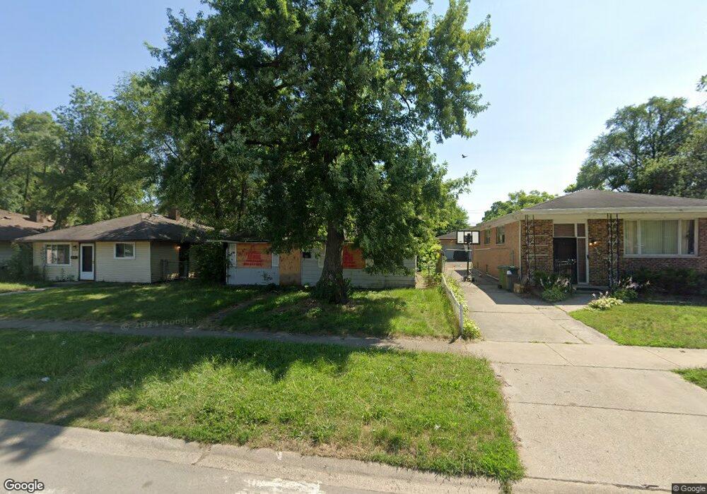
14716 Shepard Dr Dolton, IL 60419
Estimated Value: $115,776 - $150,000
2
Beds
1
Bath
925
Sq Ft
$143/Sq Ft
Est. Value
About This Home
This home is located at 14716 Shepard Dr, Dolton, IL 60419 and is currently estimated at $131,944, approximately $142 per square foot. 14716 Shepard Dr is a home located in Cook County with nearby schools including Berger-Vandenberg Elementary School, Creative Communications Academy, and School Of Fine Arts Academy.
Ownership History
Date
Name
Owned For
Owner Type
Purchase Details
Closed on
Dec 21, 2006
Sold by
Gibson Margaret
Bought by
Robinson Ricky
Current Estimated Value
Home Financials for this Owner
Home Financials are based on the most recent Mortgage that was taken out on this home.
Original Mortgage
$132,000
Outstanding Balance
$104,832
Interest Rate
6.24%
Mortgage Type
Unknown
Estimated Equity
$27,112
Purchase Details
Closed on
Sep 30, 2002
Sold by
Hud
Bought by
Gibson Margaret
Home Financials for this Owner
Home Financials are based on the most recent Mortgage that was taken out on this home.
Original Mortgage
$67,100
Interest Rate
6.24%
Purchase Details
Closed on
Apr 4, 2002
Sold by
Gurnia
Bought by
Hud
Create a Home Valuation Report for This Property
The Home Valuation Report is an in-depth analysis detailing your home's value as well as a comparison with similar homes in the area
Home Values in the Area
Average Home Value in this Area
Purchase History
| Date | Buyer | Sale Price | Title Company |
|---|---|---|---|
| Robinson Ricky | $132,000 | Law Title | |
| Gibson Margaret | -- | Stewart Title | |
| Hud | -- | -- |
Source: Public Records
Mortgage History
| Date | Status | Borrower | Loan Amount |
|---|---|---|---|
| Open | Robinson Ricky | $132,000 | |
| Previous Owner | Gibson Margaret | $67,100 |
Source: Public Records
Tax History
| Year | Tax Paid | Tax Assessment Tax Assessment Total Assessment is a certain percentage of the fair market value that is determined by local assessors to be the total taxable value of land and additions on the property. | Land | Improvement |
|---|---|---|---|---|
| 2025 | $3,207 | $9,000 | $2,125 | $6,875 |
| 2024 | $3,207 | $9,000 | $2,125 | $6,875 |
| 2023 | $973 | $9,000 | $2,125 | $6,875 |
| 2022 | $973 | $4,765 | $1,875 | $2,890 |
| 2021 | $988 | $4,765 | $1,875 | $2,890 |
| 2020 | $1,070 | $4,765 | $1,875 | $2,890 |
| 2019 | $1,586 | $5,604 | $1,750 | $3,854 |
| 2018 | $1,575 | $5,604 | $1,750 | $3,854 |
| 2017 | $1,531 | $5,604 | $1,750 | $3,854 |
| 2016 | $2,162 | $5,889 | $1,625 | $4,264 |
| 2015 | $2,011 | $5,889 | $1,625 | $4,264 |
| 2014 | $2,019 | $5,889 | $1,625 | $4,264 |
| 2013 | $2,122 | $6,350 | $1,625 | $4,725 |
Source: Public Records
Map
Nearby Homes
- 14708 Shepard Dr
- 14720 Shepard Dr
- 14761 Lincoln Ave
- 14635 Woodlawn Ave
- 14846 Woodlawn Ave
- 14631 Lincoln Ave
- 14731 Kimbark Ave
- 14737 Kimbark Ave
- 14525 Dobson Ave
- 14637 Kenwood Ave
- 1107 E 145th St
- 14738 Dante Ave
- 14521 Kenwood Ave
- 15020 Woodlawn Ave
- 14405 Woodlawn Ave
- 1138 E 151st St
- 14738 Blackstone Ave
- 1212 E 151st St
- 1425 Kasten Dr
- 14610 Blackstone Ave
- 14718 Shepard Dr
- 14712 Shepard Dr
- 14722 Shepard Dr
- 14704 Shepard Dr
- 14741 Lincoln Ave
- 14741 Lincoln Ave
- 14745 Lincoln Ave
- 14745 Lincoln Ave
- 14737 Lincoln Ave
- 14737 Lincoln Ave
- 14702 Shepard Dr
- 14733 Lincoln Ave
- 14733 Lincoln Ave
- 14711 Shepard Dr
- 14679 Shepard Dr
- 14728 Shepard Dr
- 14749 Lincoln Ave
- 14749 Lincoln Ave
- 14700 Shepard Dr
- 14729 Lincoln Ave
Your Personal Tour Guide
Ask me questions while you tour the home.