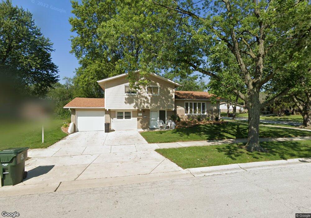
14718 Massasoit Ave Oak Forest, IL 60452
Oak Forest AreaEstimated Value: $303,000 - $331,000
About This Home
This home is located at 14718 Massasoit Ave, Oak Forest, IL 60452 and is currently estimated at $314,270, approximately $272 per square foot. 14718 Massasoit Ave is a home located in Cook County with nearby schools including Kerkstra Elementary School, Jack Hille Middle School, and Oak Forest High School.
Ownership History
We collect this data history from publicly available records. To have your information removed, we recommend requesting removal directly through your county’s website.
Purchase Details
Home Financials for this Owner
Home Financials are based on the most recent Mortgage that was taken out on this home.Purchase Details
Home Values in the Area
Average Home Value in this Area
Purchase History
We collect this data history from publicly available records. To have your information removed, we recommend requesting removal directly through your county’s website.
| Date | Buyer | Sale Price | Title Company |
|---|---|---|---|
| $230,000 | Fidelity National Title | ||
| -- | -- |
Mortgage History
We collect this data history from publicly available records. To have your information removed, we recommend requesting removal directly through your county’s website.
| Date | Status | Borrower | Loan Amount |
|---|---|---|---|
| Open | $35,031 | ||
| Previous Owner | $225,834 |
Tax History
We collect this data history from publicly available records. To have your information removed, we recommend requesting removal directly through your county’s website.
| Year | Tax Paid | Tax Assessment Tax Assessment Total Assessment is a certain percentage of the fair market value that is determined by local assessors to be the total taxable value of land and additions on the property. | Land | Improvement |
|---|---|---|---|---|
| 2025 | $7,196 | $23,001 | $3,713 | $19,288 |
| 2024 | $7,196 | $23,001 | $3,713 | $19,288 |
| 2023 | $6,904 | $23,001 | $3,713 | $19,288 |
| 2022 | $6,904 | $16,444 | $3,300 | $13,144 |
| 2021 | $6,733 | $16,443 | $3,300 | $13,143 |
| 2020 | $5,252 | $16,443 | $3,300 | $13,143 |
| 2019 | $5,838 | $17,922 | $3,093 | $14,829 |
| 2018 | $5,737 | $17,922 | $3,093 | $14,829 |
| 2017 | $5,780 | $17,922 | $3,093 | $14,829 |
| 2016 | $5,493 | $15,866 | $2,887 | $12,979 |
| 2015 | $5,311 | $15,866 | $2,887 | $12,979 |
| 2014 | $4,464 | $15,866 | $2,887 | $12,979 |
| 2013 | $4,666 | $15,997 | $2,887 | $13,110 |
Map
- 14825 Parkside Ave
- 14525 Walden Ct Unit PH4
- 5539 La Palm Dr
- 14517 Sussex Ct Unit PH3
- 14849 Park Ave
- 14504 Linder Ct Unit G4
- 15017 Sunset Ave
- 14500 Linder Ct Unit PH1
- 15200 Oxford Dr
- 5700 Victoria Dr
- 14814 Landings Ln
- 6301 147th St
- 15317 Boca Rio Dr
- 14804 Le Claire Ave
- 15405 James Dr
- 14820 Anne Ct
- 5239 Laramie Ct
- 14913 Sheila Ct
- 14843 Anne Ct
- 5595 155th St
- 14730 Massasoit Ave
- 14724 Massasoit Ave
- 14736 Massasoit Ave
- 14729 Menard Ave
- 14723 Menard Ave
- 14735 Menard Ave
- 14742 Massasoit Ave
- 14729 Massasoit Ave
- 5751 Grange Ave
- 14735 Massasoit Ave
- 14723 Massasoit Ave
- 14741 Menard Ave
- 14717 Menard Ave
- 14741 Massasoit Ave
- 14717 Massasoit Ave
- 14748 Massasoit Ave
- 14747 Menard Ave
- 14747 Massasoit Ave
- 5713 Grange Ave
- 14730 Major Ave
Ask me questions while you tour the home.