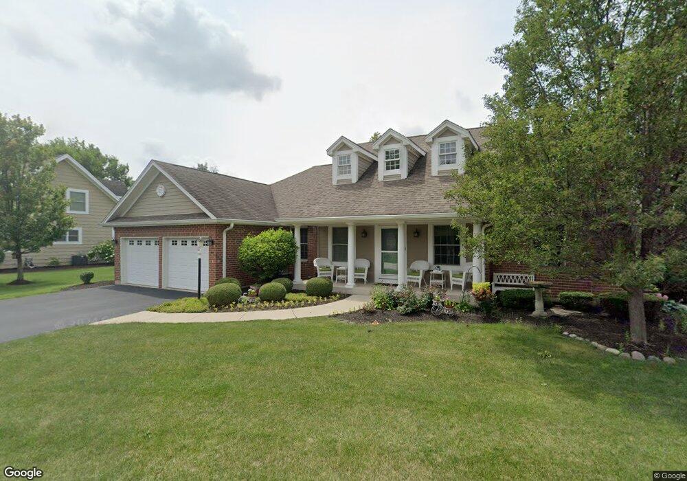
14720 Lorel Ave Oak Forest, IL 60452
Estimated Value: $313,000 - $378,000
3
Beds
2
Baths
1,959
Sq Ft
$178/Sq Ft
Est. Value
About This Home
This home is located at 14720 Lorel Ave, Oak Forest, IL 60452 and is currently estimated at $349,497, approximately $178 per square foot. 14720 Lorel Ave is a home located in Cook County with nearby schools including Kerkstra Elementary School, Jack Hille Middle School, and Oak Forest High School.
Ownership History
Date
Name
Owned For
Owner Type
Purchase Details
Closed on
Jan 19, 2007
Sold by
Schultz Leonard and Schultz Colleen
Bought by
Walsh Patricia
Current Estimated Value
Home Financials for this Owner
Home Financials are based on the most recent Mortgage that was taken out on this home.
Original Mortgage
$95,000
Outstanding Balance
$62,077
Interest Rate
8.25%
Mortgage Type
Credit Line Revolving
Estimated Equity
$287,420
Create a Home Valuation Report for This Property
The Home Valuation Report is an in-depth analysis detailing your home's value as well as a comparison with similar homes in the area
Home Values in the Area
Average Home Value in this Area
Purchase History
| Date | Buyer | Sale Price | Title Company |
|---|---|---|---|
| Walsh Patricia | -- | Git |
Source: Public Records
Mortgage History
| Date | Status | Borrower | Loan Amount |
|---|---|---|---|
| Open | Walsh Patricia | $95,000 |
Source: Public Records
Tax History
| Year | Tax Paid | Tax Assessment Tax Assessment Total Assessment is a certain percentage of the fair market value that is determined by local assessors to be the total taxable value of land and additions on the property. | Land | Improvement |
|---|---|---|---|---|
| 2025 | $7,206 | $29,000 | $5,541 | $23,459 |
| 2024 | $7,206 | $29,000 | $5,541 | $23,459 |
| 2023 | $8,168 | $29,000 | $5,541 | $23,459 |
| 2022 | $8,168 | $25,612 | $4,926 | $20,686 |
| 2021 | $8,032 | $25,611 | $4,925 | $20,686 |
| 2020 | $8,862 | $25,611 | $4,925 | $20,686 |
| 2019 | $9,499 | $27,012 | $4,617 | $22,395 |
| 2018 | $9,336 | $27,012 | $4,617 | $22,395 |
| 2017 | $9,391 | $27,012 | $4,617 | $22,395 |
| 2016 | $8,311 | $22,723 | $4,309 | $18,414 |
| 2015 | $8,061 | $22,723 | $4,309 | $18,414 |
| 2014 | $7,848 | $22,723 | $4,309 | $18,414 |
| 2013 | $7,965 | $25,447 | $4,309 | $21,138 |
Source: Public Records
Map
Nearby Homes
- 14756 Lorel Ave
- 14739 Park Ave
- 14708 El Vista Ave
- 14533 Walden Ct Unit G2
- 14852 Park Ave
- 14517 Sussex Ct Unit PH-1
- 14529 Walden Ct Unit M3
- 14501 Central Ct Unit PH3
- 14511 Central Ct Unit M2
- 15020 Park Ave
- 15017 Sunset Ave
- 14913 Sheila Ct
- 14641 Lavergne Ave
- 15134 Laramie Ave
- 4948 145th St
- 14655 Lamon Ave Unit 2N
- 5332 Crescent Ln Unit C
- 16207 Long Ave
- 5341 Crescent Ln Unit D
- 5235 141st St
- 14730 Lorel Ave
- 14713 Long Ave
- 14700 Lorel Ave
- 14721 Long Ave
- 14735 Lorel Ave
- 14705 Lorel Ave
- 14727 Long Ave
- 14740 Lorel Ave
- 5333 147th St
- 14731 Long Ave
- 14701 Lorel Ave
- 14739 Long Ave
- 14745 Lorel Ave
- 14743 Long Ave
- 14715 Mission Ave
- 14723 Mission Ave
- 14731 Mission Ave
- 5400 Grange Ave
- 5251 147th St Unit 1
- 5251 147th St Unit 6A
Your Personal Tour Guide
Ask me questions while you tour the home.