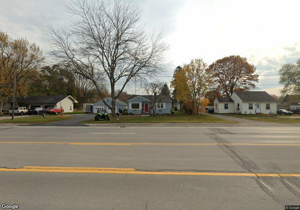
1473 W Us Highway 10 31 Unit 31 Scottville, MI 49454
Estimated Value: $188,570 - $273,000
--
Bed
1
Bath
1,240
Sq Ft
$189/Sq Ft
Est. Value
About This Home
This home is located at 1473 W Us Highway 10 31 Unit 31, Scottville, MI 49454 and is currently estimated at $234,393, approximately $189 per square foot. 1473 W Us Highway 10 31 Unit 31 is a home located in Mason County with nearby schools including Mason County Central Upper Elementary School, Scottville Elementary School, and Mason County Central Middle School.
Ownership History
Date
Name
Owned For
Owner Type
Purchase Details
Closed on
Aug 13, 2024
Sold by
Bourgette David
Bought by
Bourgette David and David A And Dawn M Bourgette Trust
Current Estimated Value
Purchase Details
Closed on
Jul 10, 2017
Sold by
Bourgette Lillian M and Bourgette Lillian
Bought by
Bourgette Lillian M and Bourgette David
Purchase Details
Closed on
May 20, 2004
Sold by
Wagner James and Wagner Aldis G
Bought by
Bourgette Walter and Bourgette Lillian
Purchase Details
Closed on
Dec 2, 2003
Sold by
Wagner Aldis G and Wagner James
Bought by
Wagner Aldis G and Wagner James
Create a Home Valuation Report for This Property
The Home Valuation Report is an in-depth analysis detailing your home's value as well as a comparison with similar homes in the area
Home Values in the Area
Average Home Value in this Area
Purchase History
| Date | Buyer | Sale Price | Title Company |
|---|---|---|---|
| Bourgette David | -- | None Listed On Document | |
| Bourgette Lillian M | -- | None Available | |
| Bourgette Walter | $87,000 | Lakeshore Land & Title | |
| Wagner Aldis G | -- | -- |
Source: Public Records
Tax History Compared to Growth
Tax History
| Year | Tax Paid | Tax Assessment Tax Assessment Total Assessment is a certain percentage of the fair market value that is determined by local assessors to be the total taxable value of land and additions on the property. | Land | Improvement |
|---|---|---|---|---|
| 2025 | $1,890 | $93,900 | $93,900 | $0 |
| 2024 | -- | $76,800 | $76,800 | $0 |
| 2023 | -- | $63,800 | $63,800 | $0 |
| 2022 | -- | $53,100 | $0 | $0 |
| 2021 | $899 | $49,100 | $0 | $0 |
| 2020 | $899 | $43,700 | $0 | $0 |
| 2019 | -- | -- | $0 | $0 |
| 2018 | -- | -- | $0 | $0 |
| 2017 | -- | -- | $0 | $0 |
| 2016 | -- | -- | $0 | $0 |
| 2015 | -- | -- | $0 | $0 |
| 2013 | -- | -- | $0 | $0 |
Source: Public Records
Map
Nearby Homes
- 313 S Amber Rd
- 982 W 1st St
- 1903 W 1st St
- VL W First St Parcel C
- VL W First Street -Parcel A
- VL W First St-Parcel D
- 1821 W Hansen Rd
- 1266 N Cedar Lane Rd
- 111 W Broadway Ave
- 1662 W Chilberg Rd
- 203 Crowley St
- 1479 N Cedar Lane Rd
- 301 Crowley St
- 124 W Beryl St
- 309 N Main St
- 5.26 Acres Highway 10 NW
- 508 N Main St
- 511 Thomas St
- 0 S Columbia Ave
- 1100 N Gordon Rd
- 1473 U S 10
- 1485 W Us Highway 10 31 Unit 31
- 1455 W Us Highway 10 31 Unit 31
- 1503 W Us Highway 10 31 Unit 31
- 1441 W Us Highway 10 31 Unit 31
- 1503 U S 10
- 1519 W Us Highway 10 31 Unit 31
- 1519 U S 10
- 1508 W Us Highway 10 31 Unit 31
- 1417 W Us Highway 10 31 Unit 31
- 1417 U S 10
- 1535 W Us Highway 10 31 Unit 31
- 1549 W Us Highway 10 31 Unit 31
- 1549 U S 10
- 1561 W Us Highway 10 31 Unit 31
- 1556 W Us 10 (Parcel 3)
- 1556 W Us 10 (Parcel 1)
- 1556 U S 10
- 1378 W Us Highway 10 31 Unit 31
- 1364 W Us Highway 10 31 Unit 31