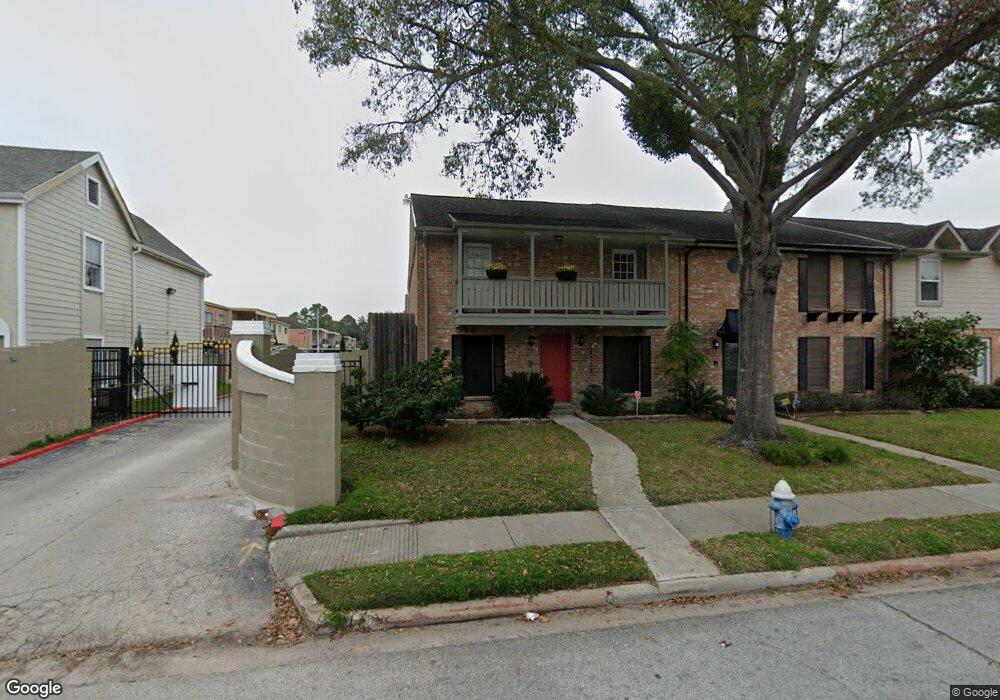
14730 Perthshire Rd Unit 35 Houston, TX 77079
Energy Corridor NeighborhoodEstimated Value: $245,568 - $261,000
4
Beds
3
Baths
2,464
Sq Ft
$103/Sq Ft
Est. Value
About This Home
This home is located at 14730 Perthshire Rd Unit 35, Houston, TX 77079 and is currently estimated at $253,142, approximately $102 per square foot. 14730 Perthshire Rd Unit 35 is a home located in Harris County with nearby schools including Nottingham Elementary School, Spring Forest Middle School, and Stratford High School.
Ownership History
Date
Name
Owned For
Owner Type
Purchase Details
Closed on
Oct 27, 2009
Sold by
Saxenian Thomas
Bought by
Dauleh Mazen Issa
Current Estimated Value
Purchase Details
Closed on
Jun 13, 2003
Sold by
Chin Victor J
Bought by
Han Humphrey C and Han Nancy C
Purchase Details
Closed on
Jan 24, 2003
Sold by
Deblanc Helen Faye
Bought by
Nik Ahd Karim and Salami Nasrin
Home Financials for this Owner
Home Financials are based on the most recent Mortgage that was taken out on this home.
Original Mortgage
$94,000
Interest Rate
5.96%
Create a Home Valuation Report for This Property
The Home Valuation Report is an in-depth analysis detailing your home's value as well as a comparison with similar homes in the area
Home Values in the Area
Average Home Value in this Area
Purchase History
| Date | Buyer | Sale Price | Title Company |
|---|---|---|---|
| Dauleh Mazen Issa | -- | Startex 03 | |
| Han Humphrey C | -- | -- | |
| Nik Ahd Karim | -- | Fidelity National Title |
Source: Public Records
Mortgage History
| Date | Status | Borrower | Loan Amount |
|---|---|---|---|
| Previous Owner | Nik Ahd Karim | $94,000 |
Source: Public Records
Tax History Compared to Growth
Tax History
| Year | Tax Paid | Tax Assessment Tax Assessment Total Assessment is a certain percentage of the fair market value that is determined by local assessors to be the total taxable value of land and additions on the property. | Land | Improvement |
|---|---|---|---|---|
| 2025 | $5,595 | $253,830 | $68,195 | $185,635 |
| 2024 | $5,595 | $253,830 | $68,195 | $185,635 |
| 2023 | $5,595 | $253,830 | $68,195 | $185,635 |
| 2022 | $4,766 | $203,859 | $68,195 | $135,664 |
| 2021 | $4,591 | $188,031 | $68,195 | $119,836 |
| 2020 | $4,711 | $188,031 | $68,195 | $119,836 |
| 2019 | $4,882 | $186,464 | $54,556 | $131,908 |
| 2018 | $2,226 | $181,974 | $54,556 | $127,418 |
| 2017 | $4,869 | $186,113 | $54,556 | $131,557 |
| 2016 | $4,778 | $182,642 | $54,556 | $128,086 |
| 2015 | $3,984 | $181,223 | $54,556 | $126,667 |
| 2014 | $3,984 | $149,678 | $27,278 | $122,400 |
Source: Public Records
Map
Nearby Homes
- 14708 Perthshire Rd Unit F
- 14690 Perthshire Rd Unit C
- 738 Thicket Ln
- 14721 Perthshire Rd
- 14688 Perthshire Rd Unit C
- 14707 Perthshire Rd
- 14662 Perthshire Rd Unit D
- 14919 Woodthorpe Ln
- 818 Thornvine Ln
- 840 Threadneedle St Unit 181
- 840 Threadneedle St Unit 208
- 840 Threadneedle St Unit 184
- 820 Threadneedle St Unit 249
- 14719 Barryknoll Ln Unit 52
- 14711 Barryknoll Ln Unit 35
- 14703 Barryknoll Ln Unit 26
- 15066 Kimberley Ct
- 14715 Barryknoll Ln Unit 128
- 14715 Barryknoll Ln Unit 152
- 850 Threadneedle St Unit 71
- 14730 Perthshire Rd Unit 35
- 14730 Perthshire Rd Unit 35
- 14730 Perthshire Rd Unit 35
- 14730 Perthshire Rd Unit 35
- 14730 Perthshire Rd Unit 35
- 14730 Perthshire Rd
- 14730 Perthshire Rd Unit C
- 14730 Perthshire Rd Unit F
- 14730 Perthshire Rd Unit A
- 14732 Perthshire Rd Unit 34
- 14732 Perthshire Rd Unit 34
- 14732 Perthshire Rd Unit 34
- 14732 Perthshire Rd Unit 34
- 14732 Perthshire Rd Unit 34
- 14732 Perthshire Rd Unit 34
- 14732 Perthshire Rd Unit F
- 14732 Perthshire Rd Unit D
- 14732 Perthshire Rd Unit A
- 14734 Perthshire Rd Unit 29
- 14734 Perthshire Rd Unit 29