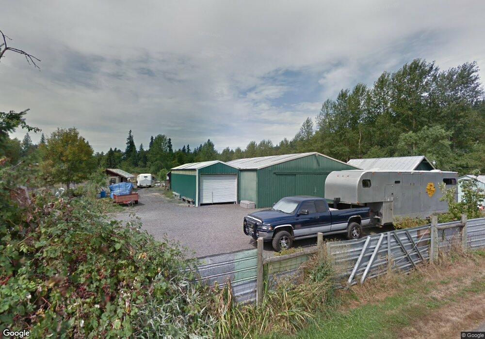
14733 S Graves Rd Mulino, OR 97042
Estimated Value: $574,000 - $672,445
--
Bed
--
Bath
--
Sq Ft
8.01
Acres
About This Home
This home is located at 14733 S Graves Rd, Mulino, OR 97042 and is currently estimated at $626,148. 14733 S Graves Rd is a home.
Ownership History
Date
Name
Owned For
Owner Type
Purchase Details
Closed on
Apr 25, 2013
Sold by
Ritchey Teresa K and Akimseu Terry
Bought by
Akimseu Terry K and Ritchey Teresa K
Current Estimated Value
Home Financials for this Owner
Home Financials are based on the most recent Mortgage that was taken out on this home.
Original Mortgage
$300,912
Outstanding Balance
$212,922
Interest Rate
3.6%
Mortgage Type
FHA
Estimated Equity
$413,226
Purchase Details
Closed on
Mar 2, 2005
Sold by
Ritchey Teresa Kay
Bought by
Ritchey Teresa Kay and Akimseu Terry
Home Financials for this Owner
Home Financials are based on the most recent Mortgage that was taken out on this home.
Original Mortgage
$272,000
Interest Rate
5.66%
Mortgage Type
Stand Alone Refi Refinance Of Original Loan
Purchase Details
Closed on
Jan 14, 1997
Sold by
Cox Virginia L
Bought by
Ritchey Teresa Kay
Create a Home Valuation Report for This Property
The Home Valuation Report is an in-depth analysis detailing your home's value as well as a comparison with similar homes in the area
Home Values in the Area
Average Home Value in this Area
Purchase History
| Date | Buyer | Sale Price | Title Company |
|---|---|---|---|
| Akimseu Terry K | -- | Stewart Title | |
| Ritchey Teresa Kay | -- | First American Title Insuran | |
| Ritchey Teresa Kay | $77,000 | Chicago Title |
Source: Public Records
Mortgage History
| Date | Status | Borrower | Loan Amount |
|---|---|---|---|
| Open | Akimseu Terry K | $300,912 | |
| Closed | Ritchey Teresa Kay | $272,000 |
Source: Public Records
Tax History Compared to Growth
Tax History
| Year | Tax Paid | Tax Assessment Tax Assessment Total Assessment is a certain percentage of the fair market value that is determined by local assessors to be the total taxable value of land and additions on the property. | Land | Improvement |
|---|---|---|---|---|
| 2025 | $3,481 | $231,952 | -- | -- |
| 2024 | $3,371 | $225,198 | -- | -- |
| 2023 | $3,371 | $218,642 | $0 | $0 |
| 2022 | $2,850 | $212,278 | $0 | $0 |
| 2021 | $2,725 | $206,096 | $0 | $0 |
| 2020 | $2,650 | $200,096 | $0 | $0 |
| 2019 | $2,573 | $194,273 | $0 | $0 |
| 2018 | $2,502 | $188,614 | $0 | $0 |
| 2017 | $2,370 | $183,123 | $0 | $0 |
| 2016 | $2,229 | $177,795 | $0 | $0 |
| 2015 | $2,099 | $172,617 | $0 | $0 |
| 2014 | $1,935 | $159,645 | $0 | $0 |
Source: Public Records
Map
Nearby Homes
- 26250 S Milk Creek Cir
- 14980 S Buckner Creek Rd
- 15693 S Hidden Rd
- 13920 S Lucia Ln
- 13511 S Freeman Rd
- 16428 S Buckner Creek Rd
- 26684 S Fish Rd
- 26740 S Fish Rd
- 0000 S Buckner Creek Rd
- 14001 S Union Mills Rd
- 24450 S Highway 213
- 15678 S Spangler Rd
- 12192 S Mulino Rd
- 28381 S Salo Rd
- 23501 S Beatie Rd
- 15032 S Carus Rd
- 12051 S Riggs Damm Rd
- 23942 S Powder Rd
- 22876 S Highway 213
- 11600 S Emerson Rd
- 14723 S Graves Rd
- 14773 S Graves Rd
- 14713 S Graves Rd
- 14693 S Graves Rd
- 0 S Graves Rd Unit 8012417
- 0 S Graves Rd Unit 8080445
- 0 S Graves Rd Unit 10028532
- 0 S Graves Rd Unit 700 11129979
- 0 S Graves Rd
- 14653 S Graves Rd
- 14765 S Graves Rd
- 14720 S Howards Mill Rd
- 14883 S Graves Rd
- 0 Howard Mill-Relisted
- 14664 S Graves Rd
- 14963 S Graves Rd
- 14734 S Howards Mill Rd
- 14600 S Alder Creek Ln
- 26159 S Milk Creek Cir
- 26180 S Milk Creek Cir